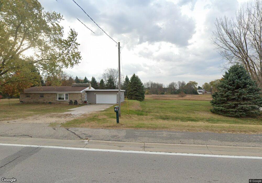
1923 W Us Highway 10 31 Unit 31 Scottville, MI 49454
Estimated Value: $227,685 - $275,000
--
Bed
--
Bath
1,380
Sq Ft
$179/Sq Ft
Est. Value
About This Home
This home is located at 1923 W Us Highway 10 31 Unit 31, Scottville, MI 49454 and is currently estimated at $247,171, approximately $179 per square foot. 1923 W Us Highway 10 31 Unit 31 is a home located in Mason County with nearby schools including Mason County Central Upper Elementary School, Scottville Elementary School, and Mason County Central Middle School.
Ownership History
Date
Name
Owned For
Owner Type
Purchase Details
Closed on
Jan 14, 2021
Sold by
Johnson Robert E
Bought by
Deyoung Karl
Current Estimated Value
Home Financials for this Owner
Home Financials are based on the most recent Mortgage that was taken out on this home.
Original Mortgage
$150,000
Outstanding Balance
$133,876
Interest Rate
2.71%
Mortgage Type
VA
Estimated Equity
$113,295
Purchase Details
Closed on
Aug 1, 1987
Create a Home Valuation Report for This Property
The Home Valuation Report is an in-depth analysis detailing your home's value as well as a comparison with similar homes in the area
Home Values in the Area
Average Home Value in this Area
Purchase History
| Date | Buyer | Sale Price | Title Company |
|---|---|---|---|
| Deyoung Karl | $150,000 | None Available | |
| -- | $46,000 | -- |
Source: Public Records
Mortgage History
| Date | Status | Borrower | Loan Amount |
|---|---|---|---|
| Open | Deyoung Karl | $150,000 |
Source: Public Records
Tax History Compared to Growth
Tax History
| Year | Tax Paid | Tax Assessment Tax Assessment Total Assessment is a certain percentage of the fair market value that is determined by local assessors to be the total taxable value of land and additions on the property. | Land | Improvement |
|---|---|---|---|---|
| 2025 | -- | $108,900 | $108,900 | $0 |
| 2024 | -- | $88,100 | $88,100 | $0 |
| 2023 | -- | $0 | $0 | $0 |
| 2022 | -- | $0 | $0 | $0 |
| 2021 | $0 | $61,400 | $0 | $0 |
| 2020 | -- | -- | $0 | $0 |
| 2019 | -- | -- | $0 | $0 |
| 2018 | -- | -- | $0 | $0 |
| 2017 | -- | -- | $0 | $0 |
| 2016 | -- | -- | $0 | $0 |
| 2015 | -- | -- | $0 | $0 |
| 2013 | -- | -- | $0 | $0 |
Source: Public Records
Map
Nearby Homes
- 1903 W 1st St
- 313 S Amber Rd
- VL W First St Parcel C
- VL W First Street -Parcel A
- VL W First St-Parcel D
- 982 W 1st St
- 1821 W Hansen Rd
- 1662 W Chilberg Rd
- 1266 N Cedar Lane Rd
- 1479 N Cedar Lane Rd
- 1100 N Gordon Rd
- Lot 36 N Pine Ridge Dr
- Lot 35 N Pine Ridge Dr
- 111 W Broadway Ave
- 203 Crowley St
- 301 Crowley St
- 124 W Beryl St
- 309 N Main St
- 5.26 Acres Highway 10 NW
- 0 N Dennis Rd
- 1923 U S 10
- 1959 U S 10
- 1893 W Us Highway 10 31 Unit 31
- 1892 W Us Highway 10 Hwy
- 1944 U S 10
- 1944 W Us Highway 10 31
- 1875 U S 10
- 1868 U S 10
- 56 S Quarterline Rd
- 72 S Quarterline Rd
- 1868 W Us Highway 10 31
- 2031 U S 31
- 2016 U S 31 Unit 12
- 2016 U S 31 Unit 10
- 2016 U S 31 Unit 7
- 2016 U S 31 Unit 11
- 2016 U S 31 Unit 8
- 2024 W Us Highway 10
- 2047 U S 10
- 2026 U S 31 Unit 8