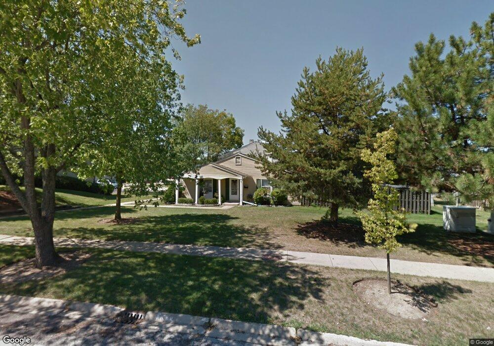
1924 Farnham Ct Unit 4 Schaumburg, IL 60194
West Schaumburg NeighborhoodEstimated Value: $254,000 - $284,000
2
Beds
2
Baths
975
Sq Ft
$274/Sq Ft
Est. Value
About This Home
This home is located at 1924 Farnham Ct Unit 4, Schaumburg, IL 60194 and is currently estimated at $266,980, approximately $273 per square foot. 1924 Farnham Ct Unit 4 is a home located in Cook County with nearby schools including Neil Armstrong Elementary School, Dwight D Eisenhower Junior High School, and Hoffman Estates High School.
Ownership History
Date
Name
Owned For
Owner Type
Purchase Details
Closed on
Jul 18, 2003
Sold by
Jager Theresa J
Bought by
Lada Malgorzata
Current Estimated Value
Home Financials for this Owner
Home Financials are based on the most recent Mortgage that was taken out on this home.
Original Mortgage
$122,550
Outstanding Balance
$64,697
Interest Rate
8.55%
Mortgage Type
Unknown
Estimated Equity
$202,283
Create a Home Valuation Report for This Property
The Home Valuation Report is an in-depth analysis detailing your home's value as well as a comparison with similar homes in the area
Home Values in the Area
Average Home Value in this Area
Purchase History
| Date | Buyer | Sale Price | Title Company |
|---|---|---|---|
| Lada Malgorzata | $129,000 | Pntn |
Source: Public Records
Mortgage History
| Date | Status | Borrower | Loan Amount |
|---|---|---|---|
| Open | Lada Malgorzata | $122,550 |
Source: Public Records
Tax History Compared to Growth
Tax History
| Year | Tax Paid | Tax Assessment Tax Assessment Total Assessment is a certain percentage of the fair market value that is determined by local assessors to be the total taxable value of land and additions on the property. | Land | Improvement |
|---|---|---|---|---|
| 2024 | $4,380 | $19,000 | $3,500 | $15,500 |
| 2023 | $4,210 | $19,000 | $3,500 | $15,500 |
| 2022 | $4,210 | $19,000 | $3,500 | $15,500 |
| 2021 | $3,082 | $13,524 | $5,236 | $8,288 |
| 2020 | $3,102 | $13,524 | $5,236 | $8,288 |
| 2019 | $3,103 | $15,027 | $5,236 | $9,791 |
| 2018 | $3,541 | $15,250 | $4,571 | $10,679 |
| 2017 | $3,503 | $15,250 | $4,571 | $10,679 |
| 2016 | $3,515 | $15,250 | $4,571 | $10,679 |
| 2015 | $2,962 | $12,548 | $3,990 | $8,558 |
| 2014 | $2,944 | $12,548 | $3,990 | $8,558 |
| 2013 | $2,851 | $12,548 | $3,990 | $8,558 |
Source: Public Records
Map
Nearby Homes
- 923 Banbury Ct Unit 4
- 1912 Finchley Ct Unit 3
- 1929 Hastings Ct Unit 3
- 2216 Andover Ct
- 752 N Brookdale Dr
- 845 Harmon Blvd
- 775 Harmon Blvd
- 730 Hamilton Cir
- 2342 Hamilton Place
- 1975 Leiter Way Unit 12002
- 1988 Leiter Way Unit 13001
- 1981 Leiter Way Unit 12005
- 1977 Leiter Way Unit 12003
- 1986 Leiter Way Unit 13002
- 1711 Pebble Beach Ct
- 1585 W Oakmont Rd
- 1375 Rebecca Dr Unit 213
- 323 Green Knoll Ln Unit 1818
- 1941 Quaker Hollow Ln Unit 11
- 1968 Quaker Hollow Ln Unit 12
- 1932 Farnham Ct Unit 4
- 1934 Farnham Ct Unit 4
- 1930 Farnham Ct Unit 4
- 1930 Farnham Ct Unit 1930
- 1936 Farnham Ct Unit 4
- 1928 Farnham Ct Unit 4
- 1938 Farnham Ct Unit 4
- 1926 Farnham Ct Unit 4
- 1933 Oxford Ct
- 1931 Oxford Ct Unit 4
- 1929 Oxford Ct
- 2000 Farnham Ct
- 1927 Oxford Ct Unit 4
- 1935 Oxford Ct
- 1923 Oxford Ct
- 1925 Oxford Ct
- 1927 Farnham Ct Unit 4
- 1937 Oxford Ct Unit 4
- 2002 Farnham Ct Unit 4
- 1929 Farnham Ct