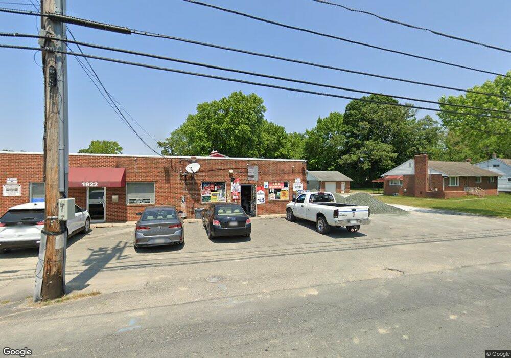
1924 Middleborough Rd Baltimore, MD 21221
Estimated Value: $540,565
--
Bed
--
Bath
4,500
Sq Ft
$120/Sq Ft
Est. Value
About This Home
This home is located at 1924 Middleborough Rd, Baltimore, MD 21221 and is currently estimated at $540,565, approximately $120 per square foot. 1924 Middleborough Rd is a home located in Baltimore County with nearby schools including Middleborough Elementary School, Deep Creek Middle, and Chesapeake High School.
Ownership History
Date
Name
Owned For
Owner Type
Purchase Details
Closed on
Sep 23, 2022
Sold by
Horney Harry E
Bought by
Kc Brothers Llc
Current Estimated Value
Home Financials for this Owner
Home Financials are based on the most recent Mortgage that was taken out on this home.
Original Mortgage
$360,000
Interest Rate
5.55%
Mortgage Type
New Conventional
Purchase Details
Closed on
May 2, 2022
Sold by
Horney Jr Harry E
Bought by
Horney Rodney Allan and Horney Patricia L
Purchase Details
Closed on
Nov 19, 1979
Sold by
Romeo Samuel T
Bought by
Horney Harry E and Horney Mary E
Create a Home Valuation Report for This Property
The Home Valuation Report is an in-depth analysis detailing your home's value as well as a comparison with similar homes in the area
Home Values in the Area
Average Home Value in this Area
Purchase History
| Date | Buyer | Sale Price | Title Company |
|---|---|---|---|
| Kc Brothers Llc | $450,000 | Fidelity National Title | |
| Horney Rodney Allan | -- | Brennan James C | |
| Horney Harry E | $100,000 | -- |
Source: Public Records
Mortgage History
| Date | Status | Borrower | Loan Amount |
|---|---|---|---|
| Previous Owner | Kc Brothers Llc | $360,000 |
Source: Public Records
Tax History Compared to Growth
Tax History
| Year | Tax Paid | Tax Assessment Tax Assessment Total Assessment is a certain percentage of the fair market value that is determined by local assessors to be the total taxable value of land and additions on the property. | Land | Improvement |
|---|---|---|---|---|
| 2025 | $4,394 | $371,300 | -- | -- |
| 2024 | $4,394 | $317,300 | $0 | $0 |
| 2023 | $1,834 | $263,300 | $142,600 | $120,700 |
| 2022 | $3,620 | $263,300 | $142,600 | $120,700 |
| 2021 | $3,640 | $263,300 | $142,600 | $120,700 |
| 2020 | $3,285 | $271,000 | $142,600 | $128,400 |
| 2019 | $3,285 | $271,000 | $142,600 | $128,400 |
| 2018 | $3,735 | $271,000 | $142,600 | $128,400 |
| 2017 | $3,812 | $273,900 | $0 | $0 |
| 2016 | $4,265 | $272,333 | $0 | $0 |
| 2015 | $4,265 | $270,767 | $0 | $0 |
| 2014 | $4,265 | $269,200 | $0 | $0 |
Source: Public Records
Map
Nearby Homes
- 203 Oak Ave
- 319 Sassafras Rd
- 316 Wye Rd
- 2023 Middleborough Rd
- 200 West Rd
- 1811 Hilltop Ave
- Parcel 943 Browns Rd
- 528 Waters Landing Dr
- 608 Hopkins Landing Dr
- 1698 Poles Rd
- 2 Sidewell Ct
- 84 Kingston Park Ln
- 1643 Riverwood Rd
- 1534 Hudson View Rd
- 116 Kingston Park Ln
- 1618 Riverwood Rd
- 356 Delano Way
- 78 W Kingston Park Ln
- 60 Helmsman Ct
- 1634 Cape May Rd
- 221 Oak Ave
- 1926 Middleborough Rd
- 1912 Middleborough Rd
- 1923 Middleborough Rd
- 217 Oak Ave
- 1928 Middleborough Rd
- 218 Oak Ave
- 1925 Middleborough Rd
- 216 Oak Ave
- 1913 Middleborough Rd
- 1930 Middleborough Rd
- 1927 Middleborough Rd
- 214 Oak Ave
- 213 Oak Ave
- 1908 Middleborough Rd
- 212 Oak Ave
- 302A Worton Rd
- 1932 Middleborough Rd
- 2000 Middleborough Rd
- 211 Oak Ave
