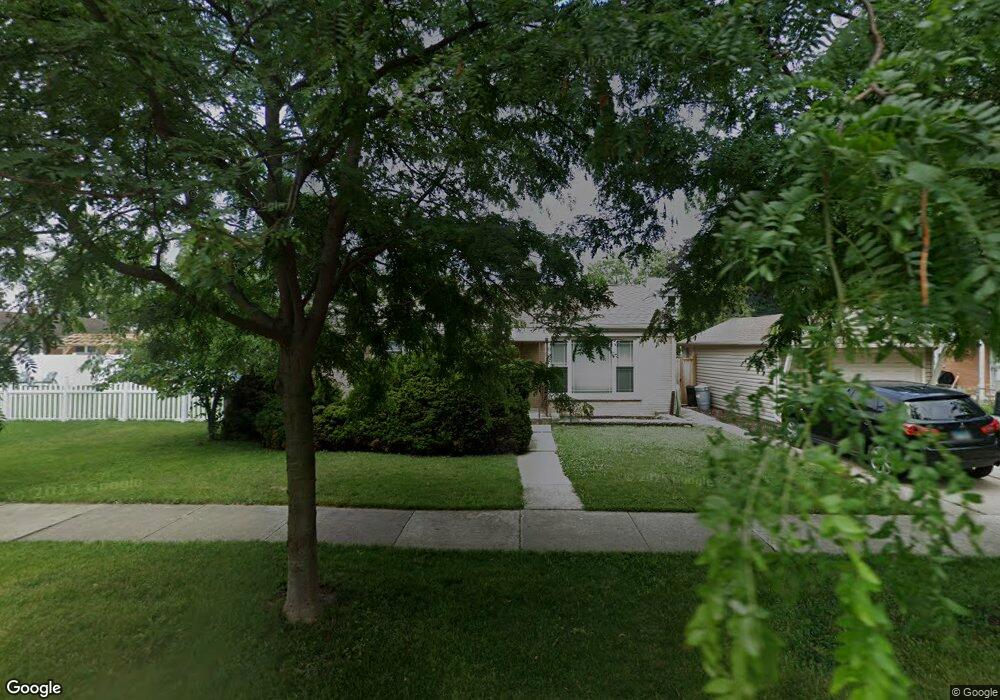
1924 Orchard St Des Plaines, IL 60018
Estimated Value: $340,000 - $385,000
3
Beds
1
Bath
1,051
Sq Ft
$339/Sq Ft
Est. Value
About This Home
This home is located at 1924 Orchard St, Des Plaines, IL 60018 and is currently estimated at $356,442, approximately $339 per square foot. 1924 Orchard St is a home located in Cook County with nearby schools including South Elementary School, Algonquin Middle School, and Maine West High School.
Ownership History
Date
Name
Owned For
Owner Type
Purchase Details
Closed on
Mar 10, 2008
Sold by
Kopp Mary A
Bought by
Upstrom James and Upstrom Linda C
Current Estimated Value
Home Financials for this Owner
Home Financials are based on the most recent Mortgage that was taken out on this home.
Original Mortgage
$150,000
Outstanding Balance
$93,908
Interest Rate
6.09%
Mortgage Type
Unknown
Estimated Equity
$262,534
Purchase Details
Closed on
Aug 18, 2007
Sold by
Kopp Mary A
Bought by
Kopp Mary A and Mary A Kopp Trust
Purchase Details
Closed on
Aug 14, 2007
Sold by
Kopp Mary A
Bought by
Kopp Mary A
Create a Home Valuation Report for This Property
The Home Valuation Report is an in-depth analysis detailing your home's value as well as a comparison with similar homes in the area
Home Values in the Area
Average Home Value in this Area
Purchase History
| Date | Buyer | Sale Price | Title Company |
|---|---|---|---|
| Upstrom James | $252,000 | None Available | |
| Kopp Mary A | -- | None Available | |
| Kopp Mary A | -- | None Available |
Source: Public Records
Mortgage History
| Date | Status | Borrower | Loan Amount |
|---|---|---|---|
| Open | Upstrom James | $150,000 |
Source: Public Records
Tax History
| Year | Tax Paid | Tax Assessment Tax Assessment Total Assessment is a certain percentage of the fair market value that is determined by local assessors to be the total taxable value of land and additions on the property. | Land | Improvement |
|---|---|---|---|---|
| 2025 | $5,544 | $29,000 | $5,427 | $23,573 |
| 2024 | $5,544 | $24,346 | $4,523 | $19,823 |
| 2023 | $5,384 | $24,346 | $4,523 | $19,823 |
| 2022 | $5,384 | $24,346 | $4,523 | $19,823 |
| 2021 | $4,362 | $17,521 | $3,768 | $13,753 |
| 2020 | $4,357 | $17,521 | $3,768 | $13,753 |
| 2019 | $4,375 | $19,687 | $3,768 | $15,919 |
| 2018 | $4,402 | $18,156 | $3,316 | $14,840 |
| 2017 | $4,342 | $18,156 | $3,316 | $14,840 |
| 2016 | $4,351 | $18,156 | $3,316 | $14,840 |
| 2015 | $3,250 | $13,374 | $2,864 | $10,510 |
| 2014 | $3,829 | $15,507 | $2,864 | $12,643 |
| 2013 | $3,657 | $17,181 | $2,864 | $14,317 |
Source: Public Records
Map
Nearby Homes
- 1721 Prospect Ave
- 1845 Everett Ave
- 1445 Everett Ave
- 1689 S Elm St
- 1645 Illinois St
- 1696 S Elm St
- 1640 S River Rd
- 1370 Fargo Ave Unit E
- 1754 E Lincoln Ave
- 2220 S Chestnut St
- 1673 Spruce Ave
- 1641 E Touhy Ave
- 1629 E Touhy Ave
- 1939 E Touhy Ave
- 1700 E Forest Ave
- 1990 Berry Ln
- 38 E Touhy Ave
- 2600 S Scott St
- 1080 Bogart St
- 2646 Maple St
- 1693 Prospect Ave
- 1679 Prospect Ave
- 1679 Prospect Ave
- 1679 Prospect Ave
- 1936 Orchard St
- 1686 Stockton Ave
- 1666 Stockton Ave
- 1704 Stockton Ave
- 1665 Prospect Ave
- 1665 Prospect Ave
- 1706 Stockton Ave
- 1890 Orchard St Unit 1
- 1890 Orchard St
- 1703 Prospect Ave
- 1703 Prospect Ave
- 1660 Stockton Ave
- 1714 Stockton Ave
- 1888 Orchard St
- 1659 Prospect Ave
- 1654 Stockton Ave
Your Personal Tour Guide
Ask me questions while you tour the home.