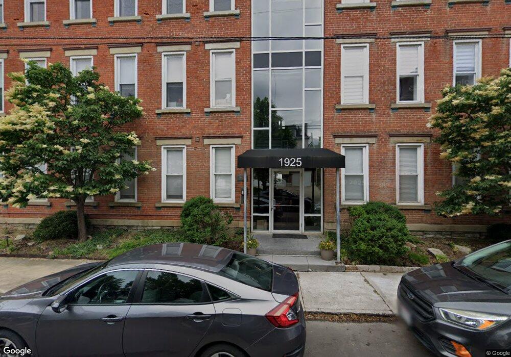
1925 Auburn Ave Unit 7 Cincinnati, OH 45219
Mount Auburn NeighborhoodEstimated Value: $324,204 - $364,000
About This Home
Furnished 2BR/2BA Top-Floor Condo with City Views | Walk to Christ Hospital
Quiet, spacious, and fully furnished 2-bedroom, 2-bath condo on the top (3rd) floor of a historic building in Mt. Auburn. Ideal for traveling nurses, medical professionals, and corporate renters seeking a comfortable, turnkey home close to work.
Enjoy an open, airy layout with hardwood floors, abundant natural light, and lots of storage. Step out onto the large private balcony overlooking Over-the-Rhine, perfect for relaxing after a long shift. The fully equipped kitchen, Smart TV, and high-speed internet make everyday living easy.
Key Features
2 bedrooms, 2 full bathrooms
In-unit laundry
Second bedroom doubles as a dedicated workspace with desk and office chair
Blackout / room-darkening shades in primary bedroom
Smart TV, streaming-ready
Fully equipped kitchen
Gas grill on balcony
High-speed internet included
Secure building with intercom system (app, key fob, or smartphone NFC)
One dedicated parking space included + additional street parking
Quiet building with respected quiet hours
Location
Walking distance to Christ Hospital and downtown Cincinnati
Short drive to University of Cincinnati, Cincinnati Children's Hospital, and UC Medical Center
Quiet residential street with easy access to highways and city amenities
Lease & Pricing
Minimum 3-month lease, preference given to 6+ month stays
Rent: $3,200/month
$3,000/month for 6+ month leases
Internet included
Utilities included up to $150/month (tenant pays overage)
$250 one-time cleaning fee
One month security deposit
Approved pets subject to a one-time non-refundable $400 pet fee and $60/month pet rent.
Ownership History
Purchase Details
Purchase Details
Purchase Details
Home Financials for this Owner
Home Financials are based on the most recent Mortgage that was taken out on this home.Purchase Details
Home Financials for this Owner
Home Financials are based on the most recent Mortgage that was taken out on this home.Purchase Details
Home Values in the Area
Average Home Value in this Area
Purchase History
| Date | Buyer | Sale Price | Title Company |
|---|---|---|---|
| Auburn Seven Llc | $335,000 | Chicago Title | |
| Dobbs Brandon | $250,000 | Comprehensive Title | |
| Harpold Charles M | -- | Classic Title Agency Llc | |
| Castillo Al | -- | None Available | |
| Keys Hill Development Llc | $1,088,400 | None Available |
Mortgage History
| Date | Status | Borrower | Loan Amount |
|---|---|---|---|
| Previous Owner | Harpold Charles M | $217,520 | |
| Previous Owner | Castillo Al | $194,000 |
Property History
| Date | Event | Price | List to Sale | Price per Sq Ft |
|---|---|---|---|---|
| 03/02/2026 03/02/26 | Off Market | $3,200 | -- | -- |
| 01/29/2026 01/29/26 | For Rent | $3,200 | -- | -- |
Tax History
| Year | Tax Paid | Tax Assessment Tax Assessment Total Assessment is a certain percentage of the fair market value that is determined by local assessors to be the total taxable value of land and additions on the property. | Land | Improvement |
|---|---|---|---|---|
| 2025 | $5,404 | $87,777 | $11,375 | $76,402 |
| 2024 | $5,240 | $87,777 | $11,375 | $76,402 |
| 2023 | $5,358 | $87,777 | $11,375 | $76,402 |
| 2022 | $6,786 | $99,750 | $9,975 | $89,775 |
| 2021 | $6,532 | $99,750 | $9,975 | $89,775 |
| 2020 | $6,724 | $99,750 | $9,975 | $89,775 |
| 2019 | $6,447 | $87,500 | $8,750 | $78,750 |
| 2018 | $6,449 | $87,500 | $8,750 | $78,750 |
| 2017 | $6,128 | $87,500 | $8,750 | $78,750 |
| 2016 | $6,421 | $90,409 | $8,750 | $81,659 |
| 2015 | $1,449 | $90,409 | $8,750 | $81,659 |
| 2014 | $1,459 | $90,409 | $8,750 | $81,659 |
| 2013 | $1,485 | $90,409 | $8,750 | $81,659 |
Map
- 1863 Walker St
- 1883 Walker St
- 1938 Bigelow St
- 1940 Bigelow St
- 1942 Bigelow St
- 1946 Bigelow St
- 1944 Bigelow St
- 1948 Bigelow St
- 1825 Walker St
- 164 Dorchester Ave
- 224 Dorchester Ave
- 152 Dorchester Ave
- 318 Seitz St
- 136 Dorchester Ave
- 320 Mulberry St
- 330 Boal St
- 305 Seitz St
- 138 Dorsey St
- 0 Goethe St Unit 1848287
- 203 Seitz St
- 1925 Auburn Ave Unit 4
- 1925 Auburn Ave Unit 3
- 1925 Auburn Ave Unit 8
- 1925 Auburn Ave Unit 18
- 1925 Auburn Ave Unit 18
- 1925 Auburn Ave Unit 18
- 1925 Auburn Ave Unit 18
- 1925 Auburn Ave Unit 2
- 1925 Auburn Ave
- 1925 Auburn Ave Unit 1
- 1925 Auburn Ave Unit 5
- 1925 Auburn Ave Unit 6
- 1933 Auburn Ave
- 1 Park Place
- 1935 Auburn Ave
- 2 Park Place
- 1924 Auburn Ave
- 1924 Auburn Ave
- 1924 Auburn Ave
- 1924 Auburn Ave
Ask me questions while you tour the home.