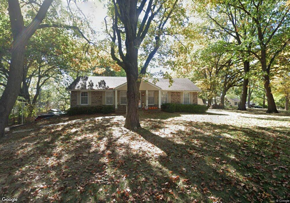
1925 Barford Rd Liberty, MO 64068
Estimated Value: $294,000 - $375,000
3
Beds
2
Baths
1,605
Sq Ft
$214/Sq Ft
Est. Value
About This Home
This home is located at 1925 Barford Rd, Liberty, MO 64068 and is currently estimated at $343,083, approximately $213 per square foot. 1925 Barford Rd is a home located in Clay County with nearby schools including Alexander Doniphan Elementary School, Discovery Middle School, and Liberty High School.
Ownership History
Date
Name
Owned For
Owner Type
Purchase Details
Closed on
Mar 29, 2021
Sold by
Kasten John Todd and Miles Shanna
Bought by
Kasten John Todd
Current Estimated Value
Home Financials for this Owner
Home Financials are based on the most recent Mortgage that was taken out on this home.
Original Mortgage
$190,000
Interest Rate
2.73%
Mortgage Type
New Conventional
Purchase Details
Closed on
Apr 30, 2019
Sold by
Kasten Debra and Kasten John
Bought by
Kasten John Todd and Miles Shanna
Home Financials for this Owner
Home Financials are based on the most recent Mortgage that was taken out on this home.
Original Mortgage
$189,255
Interest Rate
5.5%
Mortgage Type
FHA
Create a Home Valuation Report for This Property
The Home Valuation Report is an in-depth analysis detailing your home's value as well as a comparison with similar homes in the area
Home Values in the Area
Average Home Value in this Area
Purchase History
| Date | Buyer | Sale Price | Title Company |
|---|---|---|---|
| Kasten John Todd | -- | Alliance Title | |
| Kasten John Todd | -- | Alpha Title Guaranty Inc |
Source: Public Records
Mortgage History
| Date | Status | Borrower | Loan Amount |
|---|---|---|---|
| Closed | Kasten John Todd | $190,000 | |
| Closed | Kasten John Todd | $189,255 |
Source: Public Records
Tax History Compared to Growth
Tax History
| Year | Tax Paid | Tax Assessment Tax Assessment Total Assessment is a certain percentage of the fair market value that is determined by local assessors to be the total taxable value of land and additions on the property. | Land | Improvement |
|---|---|---|---|---|
| 2025 | $3,738 | $54,640 | -- | -- |
| 2024 | $3,738 | $48,600 | -- | -- |
| 2023 | $3,801 | $48,600 | $0 | $0 |
| 2022 | $3,500 | $44,180 | $0 | $0 |
| 2021 | $3,472 | $44,175 | $9,120 | $35,055 |
| 2020 | $2,694 | $32,190 | $0 | $0 |
| 2019 | $2,694 | $32,186 | $5,700 | $26,486 |
| 2018 | $2,600 | $30,500 | $0 | $0 |
| 2017 | $2,575 | $30,500 | $5,320 | $25,180 |
| 2016 | $2,575 | $30,500 | $5,320 | $25,180 |
| 2015 | $2,576 | $30,500 | $5,320 | $25,180 |
| 2014 | $2,428 | $28,520 | $5,320 | $23,200 |
Source: Public Records
Map
Nearby Homes
- 1124 Amesbury Ave
- 1323 Amesbury Ave
- 1218 Canterbury Ln
- 918 Amesbury Ave
- 862 Amesbury Ave
- 415 Monterey Ave
- 509 Belmont St
- 1507 Amesbury Ave
- 420 Belmont St
- 716 Bristol Ct
- 1733 Welleslay Ln
- 1537 Canterbury Ln
- 1331 Park Ln
- 1317 Park Ln
- 1304 Wellington Way
- 1327 Easton Ct
- 1209 Liberty Drive Terrace
- 253 S Stewart Rd
- 1205 Blackberry Dr
- 1030 Maple Woods Dr
- 1204 S Liberty Dr
- 1214 S Liberty Dr
- 1926 Barford Rd
- 1929 Barford Rd
- 1930 Barford Rd
- 1136 S Liberty Dr
- 1933 Barford Rd
- 1934 Barford Rd
- 1904 High Dr
- 1900 High Dr
- 1908 High Dr
- 1121 Manchester Rd
- 1116 S Liberty Dr
- 1201 S Liberty Dr
- 1912 High Dr
- 1131 S Liberty Dr
- 1140 Manchester Rd
- 1920 High Dr
- 1112 S Liberty Dr
- 1136 Amesbury Ave