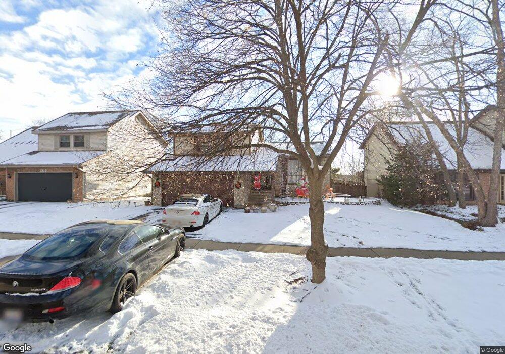
1925 Crescent Ln Hoffman Estates, IL 60169
South Hoffman Estates NeighborhoodEstimated Value: $382,000 - $465,000
4
Beds
2
Baths
1,916
Sq Ft
$218/Sq Ft
Est. Value
About This Home
This home is located at 1925 Crescent Ln, Hoffman Estates, IL 60169 and is currently estimated at $418,481, approximately $218 per square foot. 1925 Crescent Ln is a home located in Cook County with nearby schools including Neil Armstrong Elementary School, Dwight D Eisenhower Junior High School, and Hoffman Estates High School.
Ownership History
Date
Name
Owned For
Owner Type
Purchase Details
Closed on
May 16, 2002
Sold by
Starr Kenneth B and Starr Marsha J
Bought by
Chang Paul Po Shun and Huang Bina Pi Yun
Current Estimated Value
Home Financials for this Owner
Home Financials are based on the most recent Mortgage that was taken out on this home.
Original Mortgage
$167,600
Interest Rate
6.7%
Create a Home Valuation Report for This Property
The Home Valuation Report is an in-depth analysis detailing your home's value as well as a comparison with similar homes in the area
Home Values in the Area
Average Home Value in this Area
Purchase History
| Date | Buyer | Sale Price | Title Company |
|---|---|---|---|
| Chang Paul Po Shun | $210,000 | Chicago Title Insurance Co |
Source: Public Records
Mortgage History
| Date | Status | Borrower | Loan Amount |
|---|---|---|---|
| Previous Owner | Chang Paul Po Shun | $167,600 |
Source: Public Records
Tax History
| Year | Tax Paid | Tax Assessment Tax Assessment Total Assessment is a certain percentage of the fair market value that is determined by local assessors to be the total taxable value of land and additions on the property. | Land | Improvement |
|---|---|---|---|---|
| 2025 | $8,593 | $37,000 | $5,662 | $31,338 |
| 2024 | $8,593 | $28,000 | $5,147 | $22,853 |
| 2023 | $7,300 | $28,000 | $5,147 | $22,853 |
| 2022 | $7,300 | $28,000 | $5,147 | $22,853 |
| 2021 | $6,600 | $23,029 | $8,106 | $14,923 |
| 2020 | $6,520 | $23,029 | $8,106 | $14,923 |
| 2019 | $6,487 | $25,588 | $8,106 | $17,482 |
| 2018 | $6,879 | $24,531 | $7,077 | $17,454 |
| 2017 | $6,775 | $24,531 | $7,077 | $17,454 |
| 2016 | $6,564 | $24,531 | $7,077 | $17,454 |
| 2015 | $6,146 | $21,758 | $6,176 | $15,582 |
| 2014 | $6,054 | $21,758 | $6,176 | $15,582 |
| 2013 | $5,881 | $21,758 | $6,176 | $15,582 |
Source: Public Records
Map
Nearby Homes
- 1800 Monterey Ct
- 1475 Rebecca Dr Unit 213
- 1880 Bonnie Ln Unit 116
- 1880 Bonnie Ln Unit 112
- 1500 Robin Cir Unit 314
- 1975 Windsong Dr Unit 333E1
- 2222 Seaver Ln
- 1729 Pebble Beach Ct
- 1776 Bristol Walk Unit 1776
- 1809 Lancashire Ct
- 1103 Southbridge Ln
- 1797 Queensbury Cir Unit 5764
- 1987 Leiter Way Unit 11003
- 1988 Leiter Way Unit 13001
- 1994 Leiter Way Unit 14003
- 1991 Leiter Way Unit 10001
- 1986 Leiter Way Unit 13002
- 1989 Leiter Way Unit 11004
- 1722 Fayette Walk Unit E
- 1576 Poplar Creek Dr
- 1915 Crescent Ln
- 1935 Crescent Ln
- 1941 Crescent Ln
- 1905 Crescent Ln
- 1920 Crescent Ln
- 1910 Crescent Ln
- 1930 Crescent Ct
- 1945 Crescent Ln
- 1901 Crescent Ln
- 1900 Crescent Ln
- 1932 Crescent Ct
- 1951 Crescent Ln
- 1891 Crescent Ln
- 1948 Crescent Ct
- 1890 Crescent Ln
- 1934 Crescent Ct
- 1955 Crescent Ln
- 1946 Crescent Ct
- 1885 Crescent Ln
- 1950 Crescent Ln
Your Personal Tour Guide
Ask me questions while you tour the home.