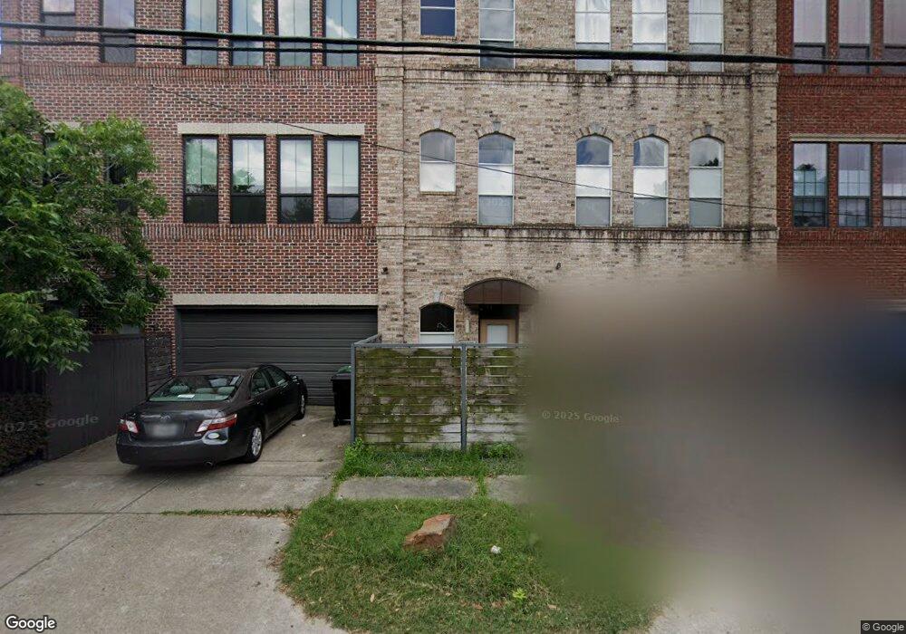
1925 Fairview St Unit A Houston, TX 77019
Montrose NeighborhoodEstimated Value: $465,022 - $639,000
3
Beds
3
Baths
2,000
Sq Ft
$277/Sq Ft
Est. Value
About This Home
This home is located at 1925 Fairview St Unit A, Houston, TX 77019 and is currently estimated at $553,506, approximately $276 per square foot. 1925 Fairview St Unit A is a home located in Harris County with nearby schools including Baker Montessori, Lanier Middle School, and Lamar High School.
Ownership History
Date
Name
Owned For
Owner Type
Purchase Details
Closed on
Apr 8, 1999
Sold by
Inner Loop Properties Inc
Bought by
Adams Richard Spencer
Current Estimated Value
Home Financials for this Owner
Home Financials are based on the most recent Mortgage that was taken out on this home.
Original Mortgage
$200,800
Outstanding Balance
$51,354
Interest Rate
7.16%
Estimated Equity
$502,152
Create a Home Valuation Report for This Property
The Home Valuation Report is an in-depth analysis detailing your home's value as well as a comparison with similar homes in the area
Home Values in the Area
Average Home Value in this Area
Purchase History
| Date | Buyer | Sale Price | Title Company |
|---|---|---|---|
| Adams Richard Spencer | -- | Chicago Title |
Source: Public Records
Mortgage History
| Date | Status | Borrower | Loan Amount |
|---|---|---|---|
| Open | Adams Richard Spencer | $200,800 | |
| Closed | Adams Richard Spencer | $25,100 |
Source: Public Records
Tax History Compared to Growth
Tax History
| Year | Tax Paid | Tax Assessment Tax Assessment Total Assessment is a certain percentage of the fair market value that is determined by local assessors to be the total taxable value of land and additions on the property. | Land | Improvement |
|---|---|---|---|---|
| 2025 | $2,427 | $448,419 | $165,000 | $283,419 |
| 2024 | $2,427 | $426,622 | $165,000 | $261,622 |
| 2023 | $2,427 | $429,893 | $165,000 | $264,893 |
| 2022 | $3,477 | $389,967 | $165,000 | $224,967 |
| 2021 | $8,877 | $369,971 | $157,500 | $212,471 |
| 2020 | $8,446 | $348,773 | $157,500 | $191,273 |
| 2019 | $9,250 | $365,549 | $110,000 | $255,549 |
| 2018 | $7,480 | $382,504 | $110,000 | $272,504 |
| 2017 | $7,467 | $382,504 | $110,000 | $272,504 |
| 2016 | $9,944 | $382,504 | $110,000 | $272,504 |
| 2015 | $6,223 | $382,504 | $110,000 | $272,504 |
| 2014 | $6,223 | $347,859 | $96,250 | $251,609 |
Source: Public Records
Map
Nearby Homes
- 2314 Park St
- 2415 Elmen St
- 2025 Park St
- 2309 Driscoll St
- 2011 Woodhead St
- 2026 Morse St
- 1728 Michigan St Unit A
- 1728 Michigan St Unit C
- 2003 Morse St
- 2413 Ralph St Unit 2
- 2506 Mandell St Unit 3
- 2103 Hazard St
- 1705 Michigan St
- 1660 Hawthorne St
- 1902 Elmen St
- 1906 Woodhead St
- 1718 Welch St Unit C
- 1701 Hawthorne St
- 1709 Haver St
- 2505 Mcduffie St Unit B
- 1925 Fairview St
- 1925 Fairview St Unit B
- 1925 Fairview St Unit C
- 2409 Woodhead St
- 2411 Woodhead St
- 2402 Elmen St
- 2413 Woodhead St Unit C
- 2413 Woodhead St Unit A
- 2413 Woodhead St Unit B
- 2404 Elmen St
- 2323 Woodhead St Unit ID1019542P
- 2323 Woodhead St
- 1924 Fairview St
- 1924 Fairview St Unit ID1019542P
- 1924 Fairview Ave
- 2406 Elmen St
- 2406 Elmen St Unit 1
- 2406 Elmen St Unit 2
- 2404 Woodhead St
- 2322 Elmen St