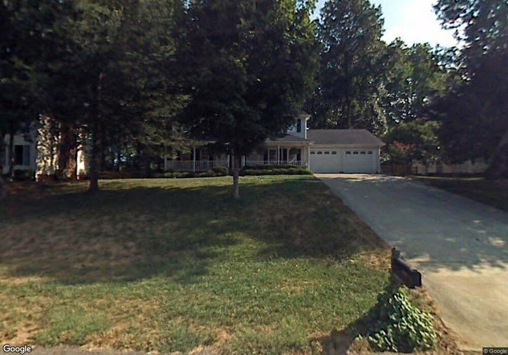
1925 Glenridge Dr Kernersville, NC 27284
Piney Grove NeighborhoodEstimated Value: $364,808 - $412,000
3
Beds
3
Baths
2,224
Sq Ft
$176/Sq Ft
Est. Value
About This Home
This home is located at 1925 Glenridge Dr, Kernersville, NC 27284 and is currently estimated at $391,452, approximately $176 per square foot. 1925 Glenridge Dr is a home located in Forsyth County with nearby schools including Piney Grove Elementary, Kernersville Middle, and East Forsyth High School.
Ownership History
Date
Name
Owned For
Owner Type
Purchase Details
Closed on
Mar 22, 2022
Sold by
Payne Peter J and Payne Dorothy J
Bought by
Grubb Michael David
Current Estimated Value
Home Financials for this Owner
Home Financials are based on the most recent Mortgage that was taken out on this home.
Original Mortgage
$327,000
Outstanding Balance
$302,751
Interest Rate
3.15%
Mortgage Type
New Conventional
Estimated Equity
$88,701
Purchase Details
Closed on
Jun 21, 2010
Sold by
Reaves Thomas L and Reaves Ashlie T
Bought by
Payne Peter J and Payne Dorothy J
Home Financials for this Owner
Home Financials are based on the most recent Mortgage that was taken out on this home.
Original Mortgage
$167,200
Interest Rate
4.97%
Mortgage Type
New Conventional
Create a Home Valuation Report for This Property
The Home Valuation Report is an in-depth analysis detailing your home's value as well as a comparison with similar homes in the area
Home Values in the Area
Average Home Value in this Area
Purchase History
| Date | Buyer | Sale Price | Title Company |
|---|---|---|---|
| Grubb Michael David | $325,000 | Delinquent Joseph D | |
| Payne Peter J | $209,000 | Chicago Title Insurance Co |
Source: Public Records
Mortgage History
| Date | Status | Borrower | Loan Amount |
|---|---|---|---|
| Open | Grubb Michael David | $327,000 | |
| Previous Owner | Payne Peter J | $167,200 |
Source: Public Records
Tax History Compared to Growth
Tax History
| Year | Tax Paid | Tax Assessment Tax Assessment Total Assessment is a certain percentage of the fair market value that is determined by local assessors to be the total taxable value of land and additions on the property. | Land | Improvement |
|---|---|---|---|---|
| 2024 | $1,988 | $241,900 | $50,000 | $191,900 |
| 2023 | $1,988 | $241,900 | $50,000 | $191,900 |
| 2022 | $1,988 | $241,900 | $50,000 | $191,900 |
| 2021 | $1,988 | $241,900 | $50,000 | $191,900 |
| 2020 | $1,806 | $202,700 | $42,000 | $160,700 |
| 2019 | $1,826 | $202,700 | $42,000 | $160,700 |
| 2018 | $1,758 | $202,700 | $42,000 | $160,700 |
| 2016 | $1,669 | $193,790 | $42,000 | $151,790 |
| 2015 | $1,669 | $193,790 | $42,000 | $151,790 |
| 2014 | $1,612 | $193,790 | $42,000 | $151,790 |
Source: Public Records
Map
Nearby Homes
- 1721 Abbottsford Dr
- 1700 Abbottsford Dr
- 6031 Glenacre Dr
- 1705 Braemore Ct
- 2120 Eagle Valley Ct
- 7106 Smokerise Ln
- 6165 Habersham Dr
- 6025 Fording Creek Ln
- 1470 Old Coach Rd
- 7186 Shagbark Dr
- 2725 Valleyspring Rd
- 1800 Kerner Rd
- 2162 Summerlyn Park Dr
- 2480 Dean Rd
- 1466 Dappledown St Unit 1
- 1462 Dappledown St Unit 2
- 1457 Dappledown St Unit 65
- 1461 Dappledown St Unit 64
- 1582 Dappledown St Unit 59
- 1586 Dappledown St Unit 58
- 1915 Glenridge Dr
- 1935 Glenridge Dr
- 1905 Glenridge Dr
- 1945 Glenridge Dr
- 1920 Glenridge Dr
- 1930 Glenridge Dr
- 1732 Abbottsford Dr
- 1910 Glenridge Dr
- 6004 Glenacre Dr
- 1728 Abbottsford Dr
- 1736 Abbottsford Dr
- 1940 Glenridge Dr
- 1955 Glenridge Dr
- 1740 Abbottsford Dr
- 1724 Abbottsford Dr
- 6008 Glenacre Dr
- 1950 Glenridge Dr
- 1744 Abbottsford Dr
- 6012 Glenacre Dr
- 1965 Glenridge Dr