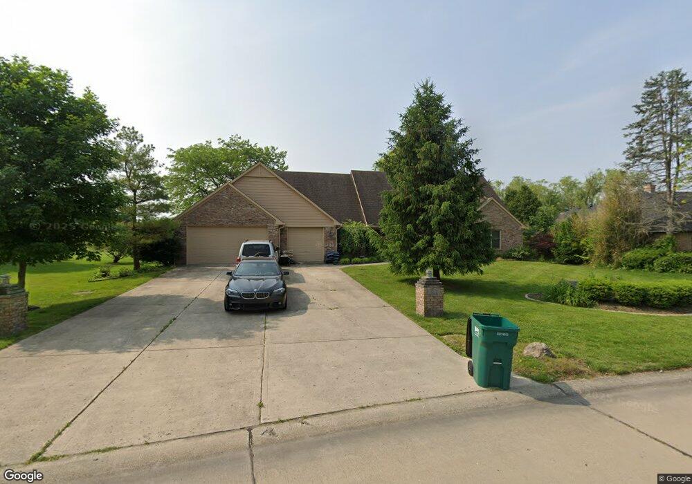
1925 Hillside Dr Franklin, IN 46131
Estimated Value: $471,079 - $570,000
3
Beds
4
Baths
3,139
Sq Ft
$165/Sq Ft
Est. Value
About This Home
This home is located at 1925 Hillside Dr, Franklin, IN 46131 and is currently estimated at $518,770, approximately $165 per square foot. 1925 Hillside Dr is a home located in Johnson County with nearby schools including Needham Elementary School, Franklin Community Middle School, and Custer Baker Intermediate School.
Ownership History
Date
Name
Owned For
Owner Type
Purchase Details
Closed on
Sep 11, 2020
Sold by
Hagn Mare A and Hagn Wendy J
Bought by
Hagn Mare A
Current Estimated Value
Purchase Details
Closed on
Jun 28, 2012
Sold by
Meyer James B and Meyer Phyllis D
Bought by
Hagn Marc A and Hagn Wendy J
Home Financials for this Owner
Home Financials are based on the most recent Mortgage that was taken out on this home.
Original Mortgage
$225,600
Interest Rate
3.77%
Mortgage Type
New Conventional
Create a Home Valuation Report for This Property
The Home Valuation Report is an in-depth analysis detailing your home's value as well as a comparison with similar homes in the area
Home Values in the Area
Average Home Value in this Area
Purchase History
| Date | Buyer | Sale Price | Title Company |
|---|---|---|---|
| Hagn Mare A | -- | None Available | |
| Hagn Marc A | -- | None Available |
Source: Public Records
Mortgage History
| Date | Status | Borrower | Loan Amount |
|---|---|---|---|
| Previous Owner | Hagn Marc A | $225,600 |
Source: Public Records
Tax History
| Year | Tax Paid | Tax Assessment Tax Assessment Total Assessment is a certain percentage of the fair market value that is determined by local assessors to be the total taxable value of land and additions on the property. | Land | Improvement |
|---|---|---|---|---|
| 2025 | $4,417 | $401,200 | $56,400 | $344,800 |
| 2024 | $4,417 | $395,600 | $56,400 | $339,200 |
| 2023 | $4,326 | $386,800 | $56,400 | $330,400 |
| 2022 | $4,082 | $361,600 | $53,100 | $308,500 |
| 2021 | $3,419 | $303,900 | $53,100 | $250,800 |
| 2020 | $3,396 | $301,900 | $53,100 | $248,800 |
| 2019 | $3,473 | $308,600 | $53,100 | $255,500 |
| 2018 | $4,512 | $304,500 | $53,100 | $251,400 |
| 2017 | $2,848 | $283,800 | $53,100 | $230,700 |
| 2016 | $2,685 | $269,500 | $53,100 | $216,400 |
| 2014 | $2,523 | $252,300 | $67,600 | $184,700 |
| 2013 | $2,523 | $252,300 | $67,600 | $184,700 |
Source: Public Records
Map
Nearby Homes
- 2080 Fairway Lakes Dr
- 409 Paris Dr
- 1083 Beechtree Ln
- 1185 Beechtree Ln
- 1682 Millpond Ln
- 1636 Millpond Ln
- 1679 Millpond Ln
- 1663 Millpond Ln
- 1640 Millpond Ln
- 1650 Millpond Ln
- 1660 Millpond Ln
- 1653 Millpond Ln
- 1686 Millpond Ln
- 1630 Millpond Ln
- 1658 Millpond Ln
- 1627 Millpond Ln
- 1634 Millpond Ln
- 1668 Millpond Ln
- 1672 Millpond Ln
- 1680 Millpond Ln
- 1935 Hillside Dr
- 1915 Hillside Dr
- 1905 Hillside Dr
- 1945 Hillside Dr
- 1914 Hillside Dr
- 1944 Hillside Dr
- 1260 Paris Dr
- 1895 Hillside Dr
- 1904 Hillside Dr
- 1320 Paris Dr
- 1230 Paris Dr
- 1894 Hillside Dr
- 1885 Hillside Dr
- 1340 Paris Dr
- 1305 Paris Dr
- 1309 Paris Dr
- 1299 Paris Dr
- 1884 Hillside Dr
- 1265 Paris Dr
- 1319 Paris Dr
Your Personal Tour Guide
Ask me questions while you tour the home.