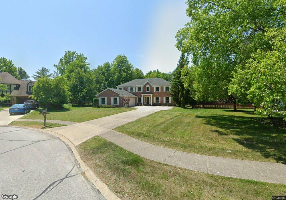
1925 Holdens Arbor Cir Westlake, OH 44145
Estimated Value: $532,000 - $622,000
4
Beds
3
Baths
3,300
Sq Ft
$176/Sq Ft
Est. Value
About This Home
This home is located at 1925 Holdens Arbor Cir, Westlake, OH 44145 and is currently estimated at $579,991, approximately $175 per square foot. 1925 Holdens Arbor Cir is a home located in Cuyahoga County with nearby schools including Dover Intermediate School, Lee Burneson Middle School, and Westlake High School.
Ownership History
Date
Name
Owned For
Owner Type
Purchase Details
Closed on
Jul 21, 2017
Sold by
Anstead John R and Anstead Carole C
Bought by
Anstead John R and Anstead Carole C
Current Estimated Value
Purchase Details
Closed on
Nov 10, 1988
Sold by
Mccain Leonard H
Bought by
Anstead John R
Purchase Details
Closed on
Feb 12, 1988
Bought by
Mccain Leonard H
Purchase Details
Closed on
Sep 20, 1984
Bought by
Hennie Homes Inc
Purchase Details
Closed on
Jan 1, 1982
Bought by
Rockport Dev Corp
Create a Home Valuation Report for This Property
The Home Valuation Report is an in-depth analysis detailing your home's value as well as a comparison with similar homes in the area
Home Values in the Area
Average Home Value in this Area
Purchase History
| Date | Buyer | Sale Price | Title Company |
|---|---|---|---|
| Anstead John R | -- | None Available | |
| Anstead John R | $240,000 | -- | |
| Mccain Leonard H | $226,000 | -- | |
| Hennie Homes Inc | -- | -- | |
| Rockport Dev Corp | -- | -- |
Source: Public Records
Tax History Compared to Growth
Tax History
| Year | Tax Paid | Tax Assessment Tax Assessment Total Assessment is a certain percentage of the fair market value that is determined by local assessors to be the total taxable value of land and additions on the property. | Land | Improvement |
|---|---|---|---|---|
| 2024 | $7,917 | $167,125 | $35,490 | $131,635 |
| 2023 | $7,331 | $132,310 | $28,180 | $104,130 |
| 2022 | $7,214 | $132,300 | $28,180 | $104,130 |
| 2021 | $7,223 | $132,300 | $28,180 | $104,130 |
| 2020 | $7,291 | $122,500 | $26,080 | $96,430 |
| 2019 | $7,069 | $350,000 | $74,500 | $275,500 |
| 2018 | $7,101 | $122,500 | $26,080 | $96,430 |
| 2017 | $6,881 | $111,650 | $25,830 | $85,820 |
| 2016 | $6,844 | $111,650 | $25,830 | $85,820 |
| 2015 | $6,485 | $111,650 | $25,830 | $85,820 |
| 2014 | $6,485 | $103,850 | $23,070 | $80,780 |
Source: Public Records
Map
Nearby Homes
- 2075 Bassett Rd
- 29379 Detroit Rd
- 29363 Detroit Rd Unit 5
- 1476 Bobby Ln Unit 7
- 2647 Piedmont Ct Unit 56
- 28167 Zinfandel Ct
- 28163 Zinfandel Ct
- Ashton Plan at Hope Pointe Place
- Bowman Plan at Hope Pointe Place
- 1721 Merlot Ln
- 27923 Hilliard Blvd
- 28180 Detroit Rd Unit A2
- 1625 Cedarwood Dr Unit 218
- 1670 Cedarwood Dr Unit 148
- 1510 Alder Ln Unit 7C
- 1480 Cedarwood Dr Unit 21F
- 1316 Cedarwood Dr Unit D3
- 26814 Center Ridge Rd
- 28080 Center Ridge Rd
- 0 Hilliard Blvd Unit 5128276
- 1919 Holdens Arbor Cir
- 1921 Holdens Arbor Run
- 1929 Holdens Arbor Cir
- 1917 Holdens Arbor Cir
- 2105 Bassett Rd
- 2085 Bassett Rd
- 1865 Holden's Arbor Cir
- 1907 Holdens Arbor Cir
- 1912 Holdens Arbor Run
- 2165 Bassett Rd
- 1913 Holdens Arbor Cir
- 1913 Holdens Arbor Cir
- 1905 Holdens Arbor Cir
- 1909 Holdens Arbor Cir
- 2175 Bassett Rd
- 1897 Holdens Arbor Run
- 1920 Holdens Arbor Run
- 1904 Holdens Arbor Cir
- 2104 Bassett Rd
- 29226 Farmington Turn