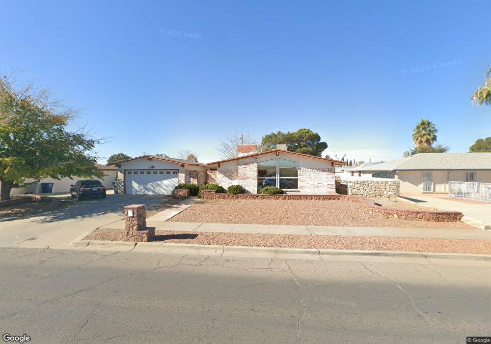
1925 Lee Elder Dr El Paso, TX 79936
Glen Cove NeighborhoodEstimated Value: $231,514 - $253,000
3
Beds
2
Baths
1,607
Sq Ft
$151/Sq Ft
Est. Value
About This Home
This home is located at 1925 Lee Elder Dr, El Paso, TX 79936 and is currently estimated at $243,379, approximately $151 per square foot. 1925 Lee Elder Dr is a home located in El Paso County with nearby schools including Tierra Del Sol Elementary School, J M Hanks High School, and EL PASO LEADERSHIP ACADEMY - MIDDLE EAST.
Ownership History
Date
Name
Owned For
Owner Type
Purchase Details
Closed on
Nov 7, 2016
Sold by
Mendivil Bernadette and Ramos Bernadette
Bought by
Ramos Gilberto R and Mendivil Bernadette
Current Estimated Value
Home Financials for this Owner
Home Financials are based on the most recent Mortgage that was taken out on this home.
Original Mortgage
$105,600
Outstanding Balance
$14,293
Interest Rate
3.48%
Mortgage Type
New Conventional
Estimated Equity
$229,086
Purchase Details
Closed on
Mar 25, 1998
Sold by
Cendant Mobility Services Corp
Bought by
Mendivil Bernadette
Home Financials for this Owner
Home Financials are based on the most recent Mortgage that was taken out on this home.
Original Mortgage
$68,000
Interest Rate
7.13%
Create a Home Valuation Report for This Property
The Home Valuation Report is an in-depth analysis detailing your home's value as well as a comparison with similar homes in the area
Home Values in the Area
Average Home Value in this Area
Purchase History
| Date | Buyer | Sale Price | Title Company |
|---|---|---|---|
| Ramos Gilberto R | -- | None Available | |
| Mendivil Bernadette | -- | Alamo Title Company |
Source: Public Records
Mortgage History
| Date | Status | Borrower | Loan Amount |
|---|---|---|---|
| Open | Ramos Gilberto R | $105,600 | |
| Previous Owner | Mendivil Bernadette | $68,000 |
Source: Public Records
Tax History Compared to Growth
Tax History
| Year | Tax Paid | Tax Assessment Tax Assessment Total Assessment is a certain percentage of the fair market value that is determined by local assessors to be the total taxable value of land and additions on the property. | Land | Improvement |
|---|---|---|---|---|
| 2025 | $5,438 | $230,832 | $43,702 | $187,130 |
| 2024 | $5,438 | $198,000 | $27,985 | $170,015 |
| 2023 | $5,438 | $205,759 | $27,985 | $177,774 |
| 2022 | $5,972 | $192,320 | $27,985 | $164,335 |
| 2021 | $5,033 | $154,847 | $27,985 | $126,862 |
| 2020 | $4,619 | $146,237 | $20,763 | $125,474 |
| 2018 | $4,405 | $141,648 | $20,763 | $120,885 |
| 2017 | $4,059 | $132,791 | $20,763 | $112,028 |
| 2016 | $4,059 | $132,791 | $20,763 | $112,028 |
| 2015 | $3,813 | $132,791 | $20,763 | $112,028 |
| 2014 | $3,813 | $133,262 | $20,763 | $112,499 |
Source: Public Records
Map
Nearby Homes
- 1868 Tom Bolt Dr
- 1817 Hugh Royer Place
- 1901 Bobby Jones Dr
- 2001 Bobby Jones Dr Unit A
- 2009 Bobby Jones Dr Unit B
- 1913 Seagull Dr
- 11016 Bob Stone Dr
- 11012 Bob Stone Dr
- 11013 Bob Stone Dr
- 2604 Anise Dr
- 2308 Tom Watson Ct
- 11008 Johnny Miller Dr
- 1844 Jack Nicklaus Dr Unit 1846
- 2348 Sea Side Dr
- 1804 Jerry Abbott St
- 1739 Jerry Abbott St
- 2101 E Glen Dr
- 2325 Ken Venturi Ln
- 11204 Bob Mitchell Dr
- 2313 Frank Beard Dr
- 1919 Lee Elder Dr Unit A
- 1929 Lee Elder Dr
- 11066 Tom Weiskopf Dr
- 11066 Tom Weiskopf Dr Unit 1
- 1969 Ratner Cir
- 1965 Ratner Cir
- 1924 Lee Elder Dr
- 1928 Lee Elder Dr
- 1913 Lee Elder Dr Unit 1915
- 1913 Lee Elder Dr Unit 1
- 1920 Lee Elder Dr
- 1915 Lee Elder Dr Unit 1
- 1915 Lee Elder Dr
- 1973 Ratner Cir
- 11062 Tom Weiskopf Dr
- 11062 Tom Weiskopf Dr Unit 1
- 1932 Lee Elder Dr
- 1916 Lee Elder Dr
- 1916 Lee Elder Dr Unit D
- 1916 Lee Elder Dr Unit A