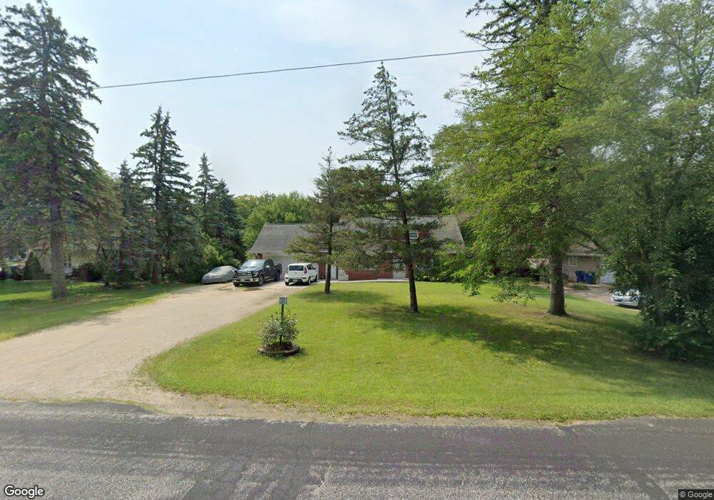
1925 Maple Dale Rd Unit 1927 West Bend, WI 53090
Estimated Value: $336,322 - $350,000
--
Bed
--
Bath
--
Sq Ft
0.26
Acres
About This Home
This home is located at 1925 Maple Dale Rd Unit 1927, West Bend, WI 53090 and is currently estimated at $342,831. 1925 Maple Dale Rd Unit 1927 is a home located in Washington County with nearby schools including Fair Park Elementary School, Badger Middle School, and East High School.
Ownership History
Date
Name
Owned For
Owner Type
Purchase Details
Closed on
Jul 1, 2021
Sold by
Cull Aaron and Cull Jacquelyn M
Bought by
Cull Aaron A and Cull Jacquelyn M
Current Estimated Value
Purchase Details
Closed on
Aug 25, 2020
Sold by
Mapledale Rentals Llc
Bought by
Cull Jacquelyn M and Cull Aaron
Home Financials for this Owner
Home Financials are based on the most recent Mortgage that was taken out on this home.
Original Mortgage
$156,000
Outstanding Balance
$138,694
Interest Rate
3%
Mortgage Type
Commercial
Estimated Equity
$204,137
Purchase Details
Closed on
Jan 19, 2012
Sold by
Stockhausen Vincent and Stockhausen Janet
Bought by
Mapledale Rentals Llc
Purchase Details
Closed on
Dec 1, 2006
Sold by
Chevalier Michael T and Chevalier Kathleen M
Bought by
Chevalier Michael T and Chevalier Kathleen M
Create a Home Valuation Report for This Property
The Home Valuation Report is an in-depth analysis detailing your home's value as well as a comparison with similar homes in the area
Home Values in the Area
Average Home Value in this Area
Purchase History
| Date | Buyer | Sale Price | Title Company |
|---|---|---|---|
| Cull Aaron A | -- | None Available | |
| Cull Jacquelyn M | $208,000 | Abstract & Title Company | |
| Mapledale Rentals Llc | -- | None Available | |
| Stockhausen Vincent | -- | None Available | |
| Chevalier Michael T | -- | None Available |
Source: Public Records
Mortgage History
| Date | Status | Borrower | Loan Amount |
|---|---|---|---|
| Open | Cull Jacquelyn M | $156,000 |
Source: Public Records
Tax History Compared to Growth
Tax History
| Year | Tax Paid | Tax Assessment Tax Assessment Total Assessment is a certain percentage of the fair market value that is determined by local assessors to be the total taxable value of land and additions on the property. | Land | Improvement |
|---|---|---|---|---|
| 2024 | $2,608 | $259,200 | $50,800 | $208,400 |
| 2023 | $2,264 | $201,600 | $42,300 | $159,300 |
| 2022 | $2,316 | $201,600 | $42,300 | $159,300 |
| 2021 | $2,367 | $201,600 | $42,300 | $159,300 |
| 2020 | $2,278 | $161,500 | $40,500 | $121,000 |
| 2019 | $2,058 | $161,500 | $40,500 | $121,000 |
| 2018 | $2,119 | $161,500 | $40,500 | $121,000 |
| 2017 | $2,092 | $161,500 | $40,500 | $121,000 |
| 2016 | $2,154 | $158,300 | $40,500 | $117,800 |
| 2015 | $2,133 | $158,300 | $40,500 | $117,800 |
| 2014 | $2,124 | $158,300 | $40,500 | $117,800 |
| 2013 | $2,379 | $187,200 | $50,400 | $136,800 |
Source: Public Records
Map
Nearby Homes
- Lt4 Wallace Lake Rd
- 1650 Vivian Ct
- 1606 Vivian Ct
- 2161 Wallace Lake Rd
- 2350 E Sandy Acre Rd
- 2112 Deerfield Dr
- 2008 Lenora Dr
- 1311 Daisy Dr
- 1123 Marcia Ave Unit 206
- 628 Victoria St
- Lt2 N River Rd
- Lt1 N River Rd
- Lt3 N River Rd
- 1363 Legion Cir
- 511 Robin St
- LT4 River Rd
- 2705 E Washington St
- 1519 E Washington St
- 1401 Lee Ave
- 829 Royal Dr
- 1935 Maple Dale Rd
- 1919 Maple Dale Rd
- 1928 Birch Terrace
- 1944 Birch Terrace
- 1943 Maple Dale Rd
- 1926 Maple Dale Rd
- 1907 Maple Dale Rd Unit 1909
- 1939 Birch Terrace
- 1932 Maple Dale Rd
- 1918 Maple Dale Rd
- 1925 Birch Terrace
- 1952 Birch Terrace
- 1944 Maple Dale Rd
- 1951 Maple Dale Rd
- 6815 Eastwood Trail
- 1917 Beck Ln S
- 1923 Beck Ln S
- 1911 Beck Ln S
- 1947 Birch Terrace
- 1950 Maple Dale Rd