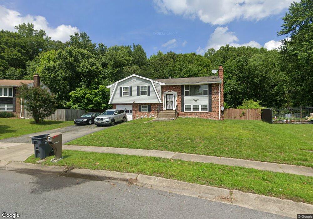
1925 Michael Rd Waldorf, MD 20601
Estimated Value: $405,000 - $426,238
Studio
3
Baths
1,248
Sq Ft
$335/Sq Ft
Est. Value
About This Home
This home is located at 1925 Michael Rd, Waldorf, MD 20601 and is currently estimated at $418,560, approximately $335 per square foot. 1925 Michael Rd is a home located in Charles County with nearby schools including J.P. Ryon Elementary School, John Hanson Middle School, and Thomas Stone High School.
Ownership History
Date
Name
Owned For
Owner Type
Purchase Details
Closed on
Aug 24, 2005
Sold by
Boston Iris Harry Sowers
Bought by
Boston Iris
Current Estimated Value
Home Financials for this Owner
Home Financials are based on the most recent Mortgage that was taken out on this home.
Original Mortgage
$260,000
Outstanding Balance
$136,318
Interest Rate
5.63%
Mortgage Type
New Conventional
Estimated Equity
$282,242
Purchase Details
Closed on
Oct 2, 2003
Sold by
Timlick Collis V
Bought by
Boston Iris Harry Sowers
Purchase Details
Closed on
Jul 19, 2000
Sold by
Davis Joseph R and Davis Linda M
Bought by
Timlick Collis
Create a Home Valuation Report for This Property
The Home Valuation Report is an in-depth analysis detailing your home's value as well as a comparison with similar homes in the area
Home Values in the Area
Average Home Value in this Area
Purchase History
| Date | Buyer | Sale Price | Title Company |
|---|---|---|---|
| Boston Iris | -- | -- | |
| Boston Iris Harry Sowers | $219,000 | -- | |
| Timlick Collis | $161,000 | -- |
Source: Public Records
Mortgage History
| Date | Status | Borrower | Loan Amount |
|---|---|---|---|
| Open | Boston Iris | $260,000 | |
| Closed | Timlick Collis | -- |
Source: Public Records
Tax History
| Year | Tax Paid | Tax Assessment Tax Assessment Total Assessment is a certain percentage of the fair market value that is determined by local assessors to be the total taxable value of land and additions on the property. | Land | Improvement |
|---|---|---|---|---|
| 2025 | $10,114 | $342,233 | -- | -- |
| 2024 | $4,379 | $314,767 | $0 | $0 |
| 2023 | $4,106 | $287,300 | $88,300 | $199,000 |
| 2022 | $3,878 | $274,133 | $0 | $0 |
| 2021 | $3,487 | $260,967 | $0 | $0 |
| 2020 | $3,487 | $247,800 | $88,300 | $159,500 |
| 2019 | $3,400 | $242,400 | $0 | $0 |
| 2018 | $3,288 | $237,000 | $0 | $0 |
| 2017 | $3,210 | $231,600 | $0 | $0 |
| 2016 | -- | $227,900 | $0 | $0 |
| 2015 | $3,257 | $224,200 | $0 | $0 |
| 2014 | $3,257 | $220,500 | $0 | $0 |
Source: Public Records
Map
Nearby Homes
- 2730 Pinewood Dr
- 0 Pinewood Dr
- 5800 Betsy Cir
- 13159 Partridge Berry Ct
- 2709 Pinewood Dr
- 2703 Pinewood Dr
- 1616 Debra Dr
- 5932 Michael Rd
- 5014 Nicholas Rd
- 2769 Pinewood Dr
- 1712 Temi Dr
- 3109 Tudor Rd
- 3448 Williamsburg Dr
- 8021 Holly Ave
- 3203 Pinefield Cir
- 919 Truro Ln
- 2650 Pinewood Dr
- 3502 Lisa Ln
- 2217 Pinefield Way
- 8311 Cedarville Rd
- 1927 Michael Rd
- 1923 Michael Rd
- 2731 Pinewood Dr
- 1920 Michael Rd
- 1921 Michael Rd
- 1929 Michael Rd
- 1922 Michael Rd
- 2733 Pinewood Dr
- 1919 Michael Rd
- 2137 Cedar Tree Ln
- 2141 Cedar Tree Ln
- 2133 Cedar Tree Ln
- 2727 Pinewood Dr
- 2735 Pinewood Dr
- 2145 Cedar Tree Ln
- 2129 Cedar Tree Ln
- 1916 Michael Rd
- 2737 Pinewood Dr
- 1917 Michael Rd
- 2149 Cedar Tree Ln
Your Personal Tour Guide
Ask me questions while you tour the home.