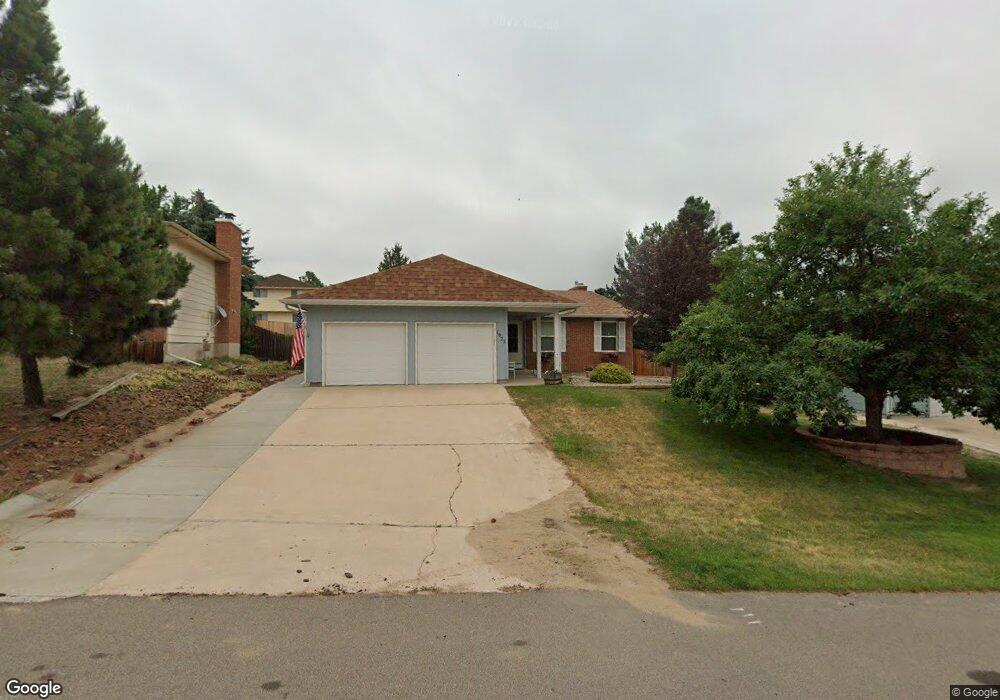
1925 Rusty Hinge Dr Colorado Springs, CO 80920
Briargate NeighborhoodEstimated Value: $436,000 - $501,000
4
Beds
4
Baths
1,568
Sq Ft
$295/Sq Ft
Est. Value
About This Home
This home is located at 1925 Rusty Hinge Dr, Colorado Springs, CO 80920 and is currently estimated at $462,546, approximately $294 per square foot. 1925 Rusty Hinge Dr is a home located in El Paso County with nearby schools including High Plains Elementary School, Mountain Ridge Middle School, and Rampart High School.
Ownership History
Date
Name
Owned For
Owner Type
Purchase Details
Closed on
Oct 28, 2021
Sold by
Snow Anthony C and Rusty Hinge Property Trust
Bought by
Helm Elizabeth T and Rusty Hinge Property Trust
Current Estimated Value
Purchase Details
Closed on
Jan 12, 2000
Sold by
Snow Anthony C
Bought by
Rusty Hinge Property Trust
Purchase Details
Closed on
Dec 16, 1999
Sold by
Tilney David W and Tilney Mary M
Bought by
Snow Anthony C
Purchase Details
Closed on
Jan 11, 1999
Sold by
Geistfeld Theodore and Geistfeld Judy
Bought by
Tilney David W and Tilney Mary M
Purchase Details
Closed on
Jan 7, 1999
Sold by
Tilney Robert W
Bought by
Geistfeld Theodore
Purchase Details
Closed on
Feb 14, 1992
Bought by
Snow Anthony C Trustee
Purchase Details
Closed on
Dec 1, 1980
Bought by
Snow Anthony C Trustee
Create a Home Valuation Report for This Property
The Home Valuation Report is an in-depth analysis detailing your home's value as well as a comparison with similar homes in the area
Home Values in the Area
Average Home Value in this Area
Purchase History
| Date | Buyer | Sale Price | Title Company |
|---|---|---|---|
| Helm Elizabeth T | -- | None Available | |
| Rusty Hinge Property Trust | -- | -- | |
| Snow Anthony C | $122,200 | -- | |
| Tilney David W | $123,500 | -- | |
| Geistfeld Theodore | -- | -- | |
| Snow Anthony C Trustee | -- | -- | |
| Snow Anthony C Trustee | -- | -- |
Source: Public Records
Tax History Compared to Growth
Tax History
| Year | Tax Paid | Tax Assessment Tax Assessment Total Assessment is a certain percentage of the fair market value that is determined by local assessors to be the total taxable value of land and additions on the property. | Land | Improvement |
|---|---|---|---|---|
| 2025 | $2,066 | $34,540 | -- | -- |
| 2024 | $2,027 | $35,940 | $5,360 | $30,580 |
| 2022 | $1,594 | $22,590 | $4,340 | $18,250 |
| 2021 | $1,762 | $23,230 | $4,460 | $18,770 |
| 2020 | $1,394 | $17,130 | $3,720 | $13,410 |
| 2019 | $1,380 | $17,130 | $3,720 | $13,410 |
| 2018 | $1,087 | $13,270 | $2,880 | $10,390 |
| 2017 | $1,083 | $13,270 | $2,880 | $10,390 |
| 2016 | $1,090 | $13,340 | $2,930 | $10,410 |
| 2015 | $1,088 | $13,340 | $2,930 | $10,410 |
| 2014 | $1,017 | $12,460 | $2,930 | $9,530 |
Source: Public Records
Map
Nearby Homes
- 1932 Silkwood Dr
- 2110 Whitehorn Dr N
- 1907 Independence Dr
- 1880 Independence Dr
- 2068 Silkwood Dr
- 1884 Fuller Rd
- 2006 Summerset Dr
- 2114 Summerset Dr
- 8161 Regiment Ct
- 2512 Elite Terrace
- 2650 Bannister Ct
- 7191 Ross Dr
- 8146 Horizon Dr
- 8335 Sutterfield Dr
- 2270 Cloverdale Dr
- 2615 Thrush Grove
- 1931 London Carriage Grove
- 7849 Flicker Grove
- 2326 Parliament Dr
- 2768 Thrush Grove
- 1935 Rusty Hinge Dr
- 1915 Rusty Hinge Dr
- 2014 Flintlock Terrace E
- 2012 Flintlock Terrace E
- 2016 Flintlock Terrace E
- 1945 Rusty Hinge Dr
- 1920 Rusty Hinge Dr
- 2018 Flintlock Terrace E
- 1930 Rusty Hinge Dr
- 1910 Rusty Hinge Dr
- 1955 Rusty Hinge Dr
- 1940 Rusty Hinge Dr
- 2003 Flintlock Terrace E
- 2005 Flintlock Terrace E
- 2020 Flintlock Terrace E
- 2007 Flintlock Terrace E
- 2017 Flintlock Terrace E
- 2015 Flintlock Terrace E
- 1965 Rusty Hinge Dr
- 1938 Flintlock Terrace W