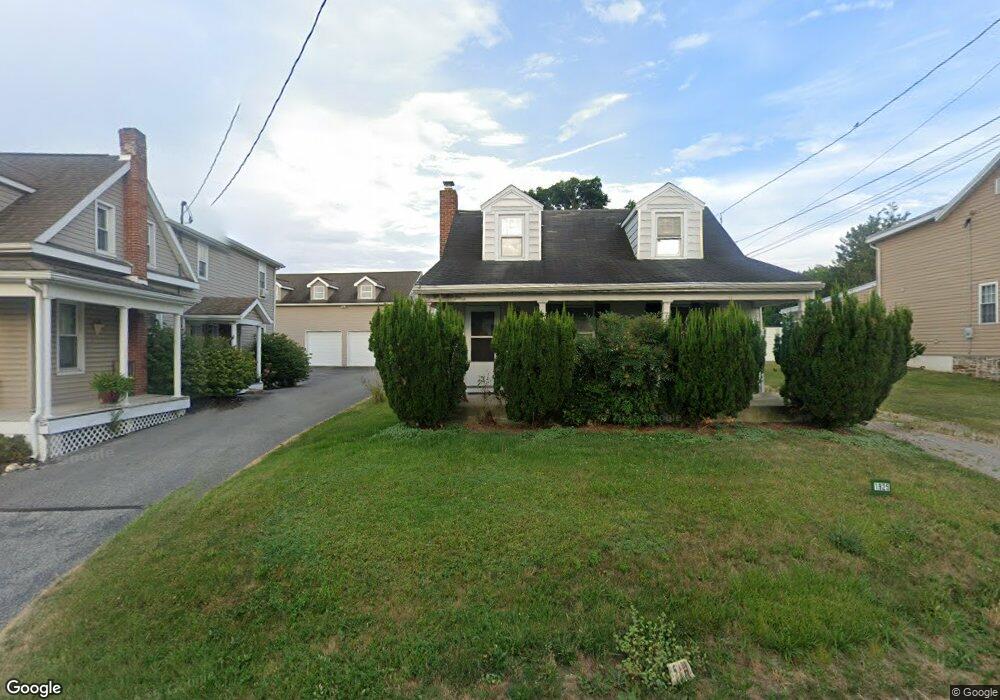
1925 Stoverstown Rd Spring Grove, PA 17362
Estimated Value: $204,000 - $266,930
3
Beds
1
Bath
1,364
Sq Ft
$172/Sq Ft
Est. Value
About This Home
This home is located at 1925 Stoverstown Rd, Spring Grove, PA 17362 and is currently estimated at $234,983, approximately $172 per square foot. 1925 Stoverstown Rd is a home located in York County with nearby schools including Spring Grove Area Middle School and Spring Grove Area High School.
Ownership History
Date
Name
Owned For
Owner Type
Purchase Details
Closed on
Sep 21, 2022
Sold by
Collins Jr Quinton R
Bought by
Senft Randy L and Collins Quinton R
Current Estimated Value
Purchase Details
Closed on
Apr 22, 2009
Sold by
Senft Randy L and Senft Dale
Bought by
Senft Dale and Collins Quinton R
Home Financials for this Owner
Home Financials are based on the most recent Mortgage that was taken out on this home.
Original Mortgage
$131,000
Interest Rate
4.86%
Mortgage Type
Purchase Money Mortgage
Create a Home Valuation Report for This Property
The Home Valuation Report is an in-depth analysis detailing your home's value as well as a comparison with similar homes in the area
Home Values in the Area
Average Home Value in this Area
Purchase History
| Date | Buyer | Sale Price | Title Company |
|---|---|---|---|
| Senft Randy L | -- | -- | |
| Senft Randy L | -- | None Listed On Document | |
| Senft Dale | $73,399 | None Available |
Source: Public Records
Mortgage History
| Date | Status | Borrower | Loan Amount |
|---|---|---|---|
| Previous Owner | Senft Dale | $131,000 |
Source: Public Records
Tax History Compared to Growth
Tax History
| Year | Tax Paid | Tax Assessment Tax Assessment Total Assessment is a certain percentage of the fair market value that is determined by local assessors to be the total taxable value of land and additions on the property. | Land | Improvement |
|---|---|---|---|---|
| 2025 | $4,436 | $133,010 | $21,800 | $111,210 |
| 2024 | $4,388 | $133,010 | $21,800 | $111,210 |
| 2023 | $4,388 | $133,010 | $21,800 | $111,210 |
| 2022 | $4,388 | $133,010 | $21,800 | $111,210 |
| 2021 | $4,199 | $133,010 | $21,800 | $111,210 |
| 2020 | $4,199 | $133,010 | $21,800 | $111,210 |
| 2019 | $4,168 | $133,010 | $21,800 | $111,210 |
| 2018 | $4,114 | $133,010 | $21,800 | $111,210 |
| 2017 | $4,020 | $133,010 | $21,800 | $111,210 |
| 2016 | $0 | $133,010 | $21,800 | $111,210 |
| 2015 | -- | $133,010 | $21,800 | $111,210 |
| 2014 | -- | $133,010 | $21,800 | $111,210 |
Source: Public Records
Map
Nearby Homes
- 2060 Paperback Way
- 1776 Country Manor Dr
- 2025 Paperback Way
- Penwell Plan at Strawberry Field Estates
- Henley Plan at Strawberry Field Estates
- Galen Plan at Strawberry Field Estates
- Neuville Plan at Strawberry Field Estates
- 2022 Paperback Way
- 2013 Paperback Way
- 2010 Paperback Way
- 2009 Paperback Way
- 2008 Paperback Way
- 2004 Paperback Way
- 2005 Paperback Way
- 2015 Paperback Way
- 1709 Country Manor Dr
- 1832 Buck Hill Dr
- 1870 Buck Hill Dr
- 1844 Buck Hill Dr
- 1941 Cedar Dr
- 1919 Stoverstown Rd
- 1929 Stoverstown Rd
- 1922 Stoverstown Rd
- 1928 Stoverstown Rd
- 1918 Stoverstown Rd
- 1931 Stoverstown Rd
- 1914 Stoverstown Rd
- 1932 Stoverstown Rd
- Lot 4 Sunnyside Rd
- 1936 Stoverstown Rd
- 1910 Stoverstown Rd
- 1940 Stoverstown Rd
- 1902 Stoverstown Rd
- 1907 Stoverstown Rd
- 1943 Stoverstown Rd
- 1944 Stoverstown Rd
- 1470 Sunnyside Rd
- 1950 Stoverstown Rd
- 1901 Stoverstown Rd
- 1949 Stoverstown Rd