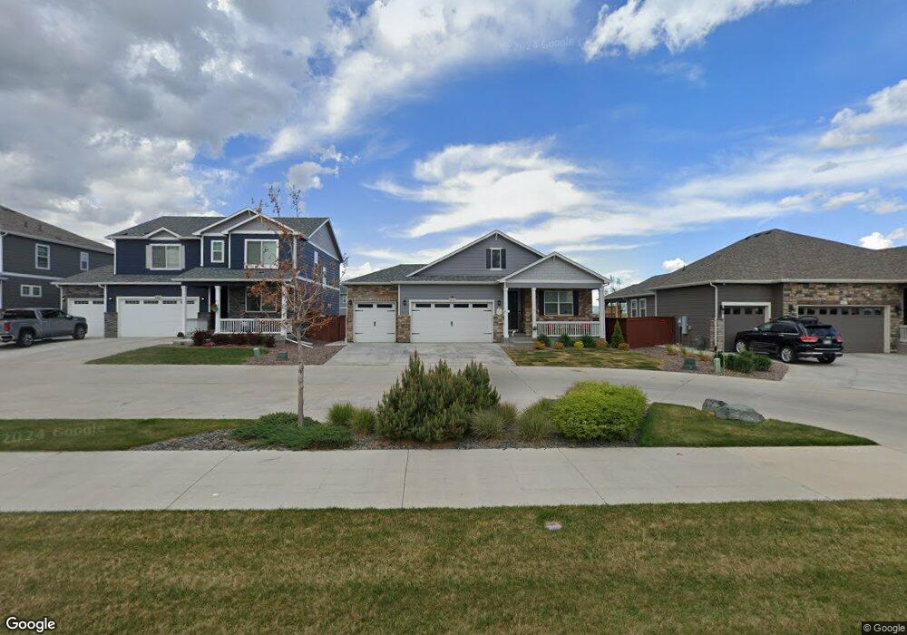
1926 Covered Bridge Pkwy Windsor, CO 80550
Estimated Value: $602,000 - $676,000
4
Beds
4
Baths
1,767
Sq Ft
$364/Sq Ft
Est. Value
About This Home
This home is located at 1926 Covered Bridge Pkwy, Windsor, CO 80550 and is currently estimated at $642,418, approximately $363 per square foot. 1926 Covered Bridge Pkwy is a home with nearby schools including Windsor Middle School, Windsor High School, and Resurrection Christian School.
Ownership History
Date
Name
Owned For
Owner Type
Purchase Details
Closed on
Nov 21, 2023
Sold by
Thibert Paul Francis and Thibert Heidi Peggy
Bought by
Paul And Heidi Thibert Revocable Trust
Current Estimated Value
Purchase Details
Closed on
Apr 16, 2021
Sold by
Melody Homes Inc
Bought by
Thibert Heidi P and Thibert Paul F
Home Financials for this Owner
Home Financials are based on the most recent Mortgage that was taken out on this home.
Original Mortgage
$442,370
Interest Rate
3%
Mortgage Type
New Conventional
Create a Home Valuation Report for This Property
The Home Valuation Report is an in-depth analysis detailing your home's value as well as a comparison with similar homes in the area
Home Values in the Area
Average Home Value in this Area
Purchase History
| Date | Buyer | Sale Price | Title Company |
|---|---|---|---|
| Paul And Heidi Thibert Revocable Trust | -- | None Listed On Document | |
| Thibert Heidi P | $492,070 | Dhi Title Agency |
Source: Public Records
Mortgage History
| Date | Status | Borrower | Loan Amount |
|---|---|---|---|
| Previous Owner | Thibert Heidi P | $442,370 |
Source: Public Records
Tax History Compared to Growth
Tax History
| Year | Tax Paid | Tax Assessment Tax Assessment Total Assessment is a certain percentage of the fair market value that is determined by local assessors to be the total taxable value of land and additions on the property. | Land | Improvement |
|---|---|---|---|---|
| 2025 | $5,628 | $38,610 | $6,250 | $32,360 |
| 2024 | $5,628 | $38,610 | $6,250 | $32,360 |
| 2023 | $5,446 | $43,900 | $7,100 | $36,800 |
| 2022 | $4,168 | $29,400 | $6,260 | $23,140 |
| 2021 | $1,091 | $8,350 | $6,440 | $1,910 |
| 2020 | $727 | $5,600 | $5,600 | $0 |
| 2019 | $235 | $1,820 | $1,820 | $0 |
| 2018 | $1 | $10 | $10 | $0 |
Source: Public Records
Map
Nearby Homes
- 1934 Covered Bridge Pkwy
- 1922 Covered Bridge Pkwy
- 1961 Rose Petal Dr
- 1932 Thundercloud Dr
- 1954 Covered Bridge Pkwy
- 1960 Thundercloud Dr
- 1903 Rolling Wind Dr
- 1773 Nightfall Dr
- 1678 Winter Glow Dr
- 1867 Abundance Dr
- 1675 Sundown Run Dr
- 1963 Golden Horizon Dr
- 1649 Winter Glow Dr
- 1726 Bounty Dr
- 1637 Winter Glow Dr
- 1781 Summer Bloom Dr
- 1633 Winter Glow Dr
- 1827 Wind Fall Dr
- 1845 Sunset Vista Dr
- 1837 Crisp Air Dr
- 1930 Covered Bridge Pkwy
- 1969 Floret Dr
- 1938 Covered Bridge Pkwy
- 1965 Floret Dr
- 1971 Floret Dr
- 1942 Covered Bridge Pkwy
- 1963 Floret Dr
- 1975 Floret Dr
- 1917 Covered Bridge Pkwy
- 1921 Covered Bridge Pkwy
- 1925 Covered Bridge Pkwy
- 1946 Covered Bridge Pkwy
- 1929 Covered Bridge Pkwy
- 1957 Floret Dr
- 1977 Floret Dr
- 1933 Covered Bridge Pkwy
- 1966 Floret Dr
- 1950 Covered Bridge Pkwy
- 1937 Covered Bridge Pkwy
- 1968 Floret Dr