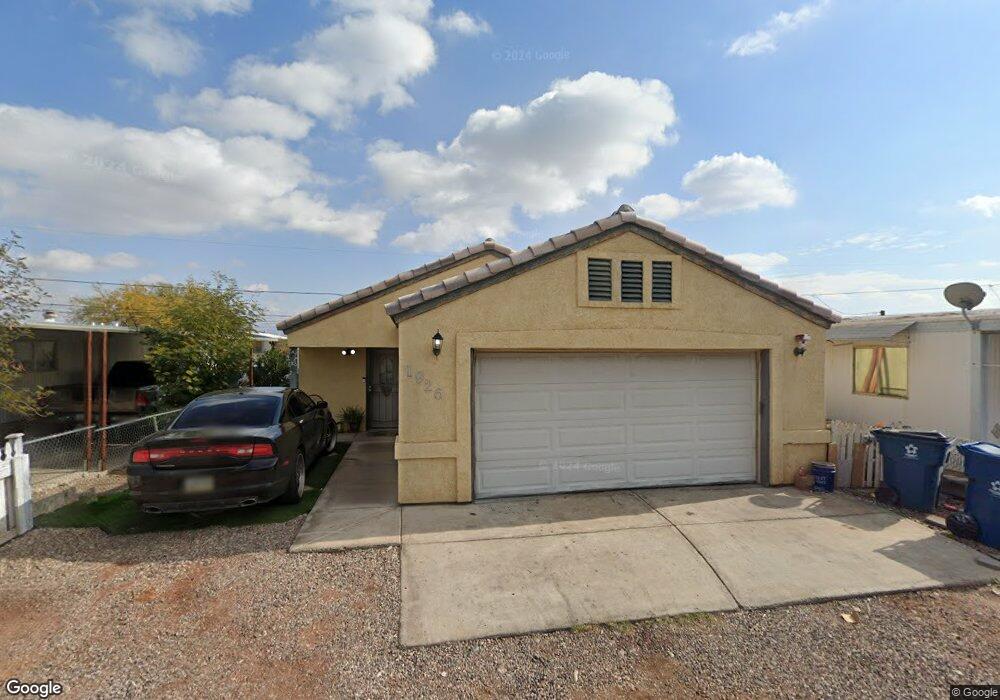
1926 Monterey Dr Bullhead City, AZ 86442
Riviera NeighborhoodEstimated Value: $220,000 - $231,000
3
Beds
2
Baths
1,204
Sq Ft
$187/Sq Ft
Est. Value
About This Home
This home is located at 1926 Monterey Dr, Bullhead City, AZ 86442 and is currently estimated at $225,689, approximately $187 per square foot. 1926 Monterey Dr is a home located in Mohave County with nearby schools including Desert Valley School, Bullhead City Junior High School, and Mohave High School.
Ownership History
Date
Name
Owned For
Owner Type
Purchase Details
Closed on
Oct 29, 2019
Sold by
Moreno Norma and Moreno Jose G
Bought by
Moreno Jose G
Current Estimated Value
Home Financials for this Owner
Home Financials are based on the most recent Mortgage that was taken out on this home.
Original Mortgage
$128,627
Outstanding Balance
$113,494
Interest Rate
3.75%
Mortgage Type
FHA
Estimated Equity
$112,195
Purchase Details
Closed on
Sep 10, 2008
Sold by
Lopez Jorge
Bought by
Tejera Luis and Tejera Angie
Purchase Details
Closed on
Apr 11, 2006
Sold by
Bravo Robert A and Ramirez Rosemary Bravo
Bought by
Lopez Jorge
Create a Home Valuation Report for This Property
The Home Valuation Report is an in-depth analysis detailing your home's value as well as a comparison with similar homes in the area
Home Values in the Area
Average Home Value in this Area
Purchase History
| Date | Buyer | Sale Price | Title Company |
|---|---|---|---|
| Moreno Jose G | -- | Pioneer Title Agency Inc | |
| Moreno Jose G | $131,000 | Pioneer Title Agency Inc | |
| Tejera Luis | -- | First American Title Company | |
| Lopez Jorge | $25,900 | Chicago Title Insurance Co |
Source: Public Records
Mortgage History
| Date | Status | Borrower | Loan Amount |
|---|---|---|---|
| Open | Moreno Jose G | $128,627 |
Source: Public Records
Tax History Compared to Growth
Tax History
| Year | Tax Paid | Tax Assessment Tax Assessment Total Assessment is a certain percentage of the fair market value that is determined by local assessors to be the total taxable value of land and additions on the property. | Land | Improvement |
|---|---|---|---|---|
| 2026 | $417 | -- | -- | -- |
| 2025 | $788 | $16,616 | $0 | $0 |
| 2024 | $788 | $17,482 | $0 | $0 |
| 2023 | $788 | $14,347 | $0 | $0 |
| 2022 | $756 | $12,268 | $0 | $0 |
| 2021 | $772 | $11,223 | $0 | $0 |
| 2019 | $842 | $9,143 | $0 | $0 |
| 2018 | $819 | $9,431 | $0 | $0 |
| 2017 | $798 | $8,617 | $0 | $0 |
| 2016 | $724 | $8,665 | $0 | $0 |
| 2015 | $677 | $6,843 | $0 | $0 |
Source: Public Records
Map
Nearby Homes
- 1955 Monterey Dr
- 1970 Monterey Dr
- 1967 Montclair Dr
- 1968 Montclair Dr
- 1965 Artesia Dr
- 1866 El Dorado Dr
- 1822 Del Norte Dr
- 1864 El Dorado Dr
- 1861 Monterey Dr
- 472 Harbor Dr
- 356 Meander Dr
- 1891 Artesia Dr
- 1867 Montclair Dr
- 1853 Monterey Dr
- 1863 Del Norte Dr
- 1960 Granada Dr
- 1862 Montclair Dr
- 1941 Merced Dr
- 372 Meander Dr
- 347 Meander Dr
- 1926 Monterey Dr
- 1918 Monterey Dr
- 1934 Monterey Dr
- 1935 Montclair Dr
- 1940 Monterey Dr
- 1935 Montclair Dr
- 1910 Monterey Dr
- 1939 Montclair Dr
- 1927 Montclair Dr
- 1927 Montclair Dr
- 1946 Monterey Dr
- 1904 Monterey Dr
- 1929 Monterey Dr
- 1954 Monterey Dr
- 1947 Montclair Dr
- 1919 Montclair Dr
- 1943 Monterey Dr
- 1919 Montclair Dr
- 1909 Monterey Dr
- 1949 Monterey Dr