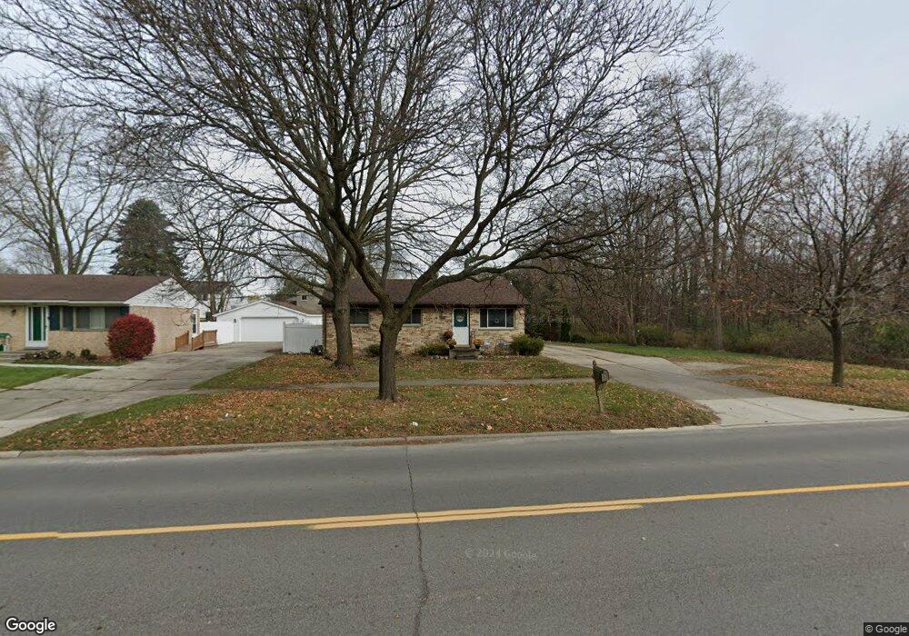
1926 N Sheldon Rd Canton, MI 48187
Estimated Value: $245,829 - $300,000
Studio
1
Bath
1,059
Sq Ft
$253/Sq Ft
Est. Value
About This Home
This home is located at 1926 N Sheldon Rd, Canton, MI 48187 and is currently estimated at $268,207, approximately $253 per square foot. 1926 N Sheldon Rd is a home located in Wayne County with nearby schools including Canton High School, Discovery Middle School, and Salem High School.
Ownership History
Date
Name
Owned For
Owner Type
Purchase Details
Closed on
Sep 22, 2016
Sold by
Kincade Gary
Bought by
Stamper Thomas B
Current Estimated Value
Home Financials for this Owner
Home Financials are based on the most recent Mortgage that was taken out on this home.
Original Mortgage
$106,000
Interest Rate
3.42%
Mortgage Type
New Conventional
Purchase Details
Closed on
Feb 19, 2008
Sold by
Kincade James Orr and Kincade Wilbur
Bought by
Kincade Gary
Create a Home Valuation Report for This Property
The Home Valuation Report is an in-depth analysis detailing your home's value as well as a comparison with similar homes in the area
Home Values in the Area
Average Home Value in this Area
Purchase History
| Date | Buyer | Sale Price | Title Company |
|---|---|---|---|
| Stamper Thomas B | $121,000 | None Available | |
| Kincade Gary | $77,500 | 1St Security Title Agency In |
Source: Public Records
Mortgage History
| Date | Status | Borrower | Loan Amount |
|---|---|---|---|
| Previous Owner | Stamper Thomas B | $106,000 |
Source: Public Records
Tax History
| Year | Tax Paid | Tax Assessment Tax Assessment Total Assessment is a certain percentage of the fair market value that is determined by local assessors to be the total taxable value of land and additions on the property. | Land | Improvement |
|---|---|---|---|---|
| 2025 | $1,562 | $120,200 | $0 | $0 |
| 2024 | $1,518 | $113,100 | $0 | $0 |
| 2023 | $1,447 | $96,100 | $0 | $0 |
| 2022 | $3,220 | $85,700 | $0 | $0 |
| 2021 | $3,125 | $80,300 | $0 | $0 |
| 2020 | $3,084 | $79,500 | $0 | $0 |
| 2019 | $3,031 | $75,790 | $0 | $0 |
| 2018 | $1,230 | $69,830 | $0 | $0 |
| 2017 | $3,181 | $68,600 | $0 | $0 |
| 2016 | $3,102 | $66,000 | $0 | $0 |
| 2015 | $5,191 | $60,770 | $0 | $0 |
| 2013 | $5,029 | $53,880 | $0 | $0 |
| 2010 | -- | $57,760 | $21,594 | $36,166 |
Source: Public Records
Map
Nearby Homes
- 44447 Savery Dr Unit 126
- 44497 Savery Dr Unit 103
- 44528 Whitman Ave
- 1822 N Sheldon Rd
- 1995 Peerce Ct Unit 2
- 58560 Stuart Dr
- 1567 Marlowe St
- 1399 Elmhurst St
- 44035 Westminister Way
- 45005 Saltz Rd
- 0000 Ford
- 1584 Commodore Cir Unit 33
- 49772 Shoreline Dr
- 45645 Graystone Ln Unit 100
- 45874 S Stonewood Rd Unit 221
- 835 Coldrose Way
- 45678 Aragon Ln
- 1276 W Crystal Cir Unit 202
- 1244 W Crystal Cir
- 859 Wellington Ct
- 1944 N Sheldon Rd
- 1964 N Sheldon Rd
- 1921 Brookline St
- 1945 Brookline St
- 1841 Brookline St
- 1986 N Sheldon Rd
- 1957 Brookline St
- 44403 Savery Dr Unit 140
- 1981 Brookline St
- 2016 N Sheldon Rd
- 2050 N Sheldon Rd
- 44437 Savery Dr Unit 127
- 2040 N Sheldon Rd
- 1993 Brookline St
- 1804 N Sheldon Rd
- 1920 Brookline St
- 1944 Brookline St
- 2017 Brookline St
- 1960 Brookline St
- 1762 Whittier Dr
Your Personal Tour Guide
Ask me questions while you tour the home.