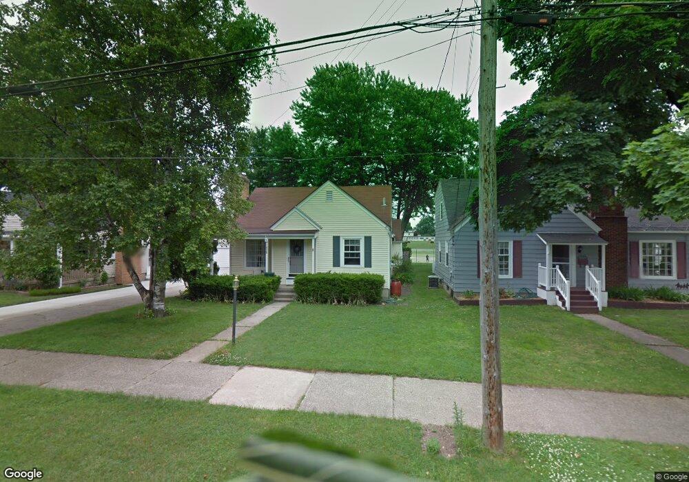
1926 Sylvan Ave SE Grand Rapids, MI 49506
South East End NeighborhoodEstimated Value: $275,318 - $324,000
3
Beds
1
Bath
1,218
Sq Ft
$249/Sq Ft
Est. Value
About This Home
This home is located at 1926 Sylvan Ave SE, Grand Rapids, MI 49506 and is currently estimated at $303,080, approximately $248 per square foot. 1926 Sylvan Ave SE is a home located in Kent County with nearby schools including Mulick Park Elementary School, Alger Middle School, and Ottawa Hills High School.
Ownership History
Date
Name
Owned For
Owner Type
Purchase Details
Closed on
Jun 26, 1998
Sold by
Hrpst Hrpst T T and Hrpst Denning R
Bought by
Denning Denning R and Denning B
Current Estimated Value
Purchase Details
Closed on
Aug 19, 1994
Sold by
Oostendorp Oostendorp M M and Harpst Oostendorp
Bought by
Denning Rodney L Barbara P
Purchase Details
Closed on
Apr 19, 1984
Bought by
Denning Rodney L Barbara P
Purchase Details
Closed on
Nov 16, 1981
Bought by
Denning Rodney L Barbara P
Create a Home Valuation Report for This Property
The Home Valuation Report is an in-depth analysis detailing your home's value as well as a comparison with similar homes in the area
Home Values in the Area
Average Home Value in this Area
Purchase History
| Date | Buyer | Sale Price | Title Company |
|---|---|---|---|
| Denning Denning R | $86,900 | -- | |
| Denning Rodney L Barbara P | $68,900 | -- | |
| Denning Rodney L Barbara P | $47,300 | -- | |
| Denning Rodney L Barbara P | $42,900 | -- |
Source: Public Records
Tax History Compared to Growth
Tax History
| Year | Tax Paid | Tax Assessment Tax Assessment Total Assessment is a certain percentage of the fair market value that is determined by local assessors to be the total taxable value of land and additions on the property. | Land | Improvement |
|---|---|---|---|---|
| 2025 | $1,853 | $123,500 | $0 | $0 |
| 2024 | $1,853 | $119,600 | $0 | $0 |
| 2023 | $1,880 | $107,000 | $0 | $0 |
| 2022 | $1,785 | $92,200 | $0 | $0 |
| 2021 | $1,745 | $79,700 | $0 | $0 |
| 2020 | $1,668 | $75,700 | $0 | $0 |
| 2019 | $1,747 | $71,900 | $0 | $0 |
| 2018 | $1,687 | $66,900 | $0 | $0 |
| 2017 | $1,642 | $57,800 | $0 | $0 |
| 2016 | $1,662 | $55,100 | $0 | $0 |
| 2015 | $1,546 | $55,100 | $0 | $0 |
| 2013 | -- | $47,300 | $0 | $0 |
Source: Public Records
Map
Nearby Homes
- 1819 Sylvan Ave SE
- 1458 Hazen St SE
- 1801 Sylvan Ave SE
- 1335 Burton St SE
- 1745 Margaret Ave SE
- 1413 Linwood St SE
- 1863 Kalamazoo Ave SE
- 2158 Cambridge Dr SE
- 1821 Woodward Ave SE
- 1619 Margaret Ave SE
- 1613 Margaret Ave SE
- 1910 Chamberlain Ave SE
- 1654 Lotus Ave SE
- 1548 Gladstone Dr SE
- 2324 Rosewood Ave SE
- 1533 Sylvan Ave SE
- 1680 Kalamazoo Ave SE
- 1513 Sylvan Ave SE
- 1315 Boston St SE
- 1177 Edna St SE
- 1930 Sylvan Ave SE
- 1920 Sylvan Ave SE
- 1936 Sylvan Ave SE
- 1916 Sylvan Ave SE
- 1910 Sylvan Ave SE
- 1940 Sylvan Ave SE
- 1929 Sylvan Ave SE
- 1923 Sylvan Ave SE
- 1946 Sylvan Ave SE
- 1933 Sylvan Ave SE
- 1917 Sylvan Ave SE
- 1911 Sylvan Ave SE
- 1900 Sylvan Ave SE
- 1945 Sylvan Ave SE
- 1617 Burton St SE
- 1907 Sylvan Ave SE
- 1601 Burton St SE
- 1609 Burton St SE
- 1862 Sylvan Ave SE
- 1959 Sylvan Ave SE