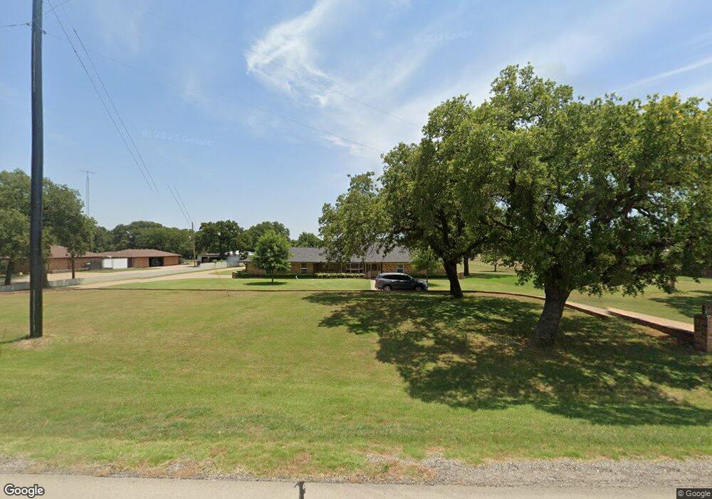
1926 Us Highway 380 E Graham, TX 76450
Estimated Value: $255,000 - $412,000
3
Beds
2
Baths
2,131
Sq Ft
$153/Sq Ft
Est. Value
About This Home
This home is located at 1926 Us Highway 380 E, Graham, TX 76450 and is currently estimated at $325,199, approximately $152 per square foot. 1926 Us Highway 380 E is a home located in Young County with nearby schools including Pioneer Elementary School, Woodland Elementary School, and Crestview Elementary School.
Ownership History
Date
Name
Owned For
Owner Type
Purchase Details
Closed on
Oct 1, 2007
Sold by
Horne Martin R and Horne Carol L
Bought by
Queen James M and Queen Carolyn S
Current Estimated Value
Home Financials for this Owner
Home Financials are based on the most recent Mortgage that was taken out on this home.
Original Mortgage
$130,000
Outstanding Balance
$81,324
Interest Rate
6.25%
Mortgage Type
Adjustable Rate Mortgage/ARM
Estimated Equity
$243,875
Create a Home Valuation Report for This Property
The Home Valuation Report is an in-depth analysis detailing your home's value as well as a comparison with similar homes in the area
Home Values in the Area
Average Home Value in this Area
Purchase History
| Date | Buyer | Sale Price | Title Company |
|---|---|---|---|
| Queen James M | -- | None Available |
Source: Public Records
Mortgage History
| Date | Status | Borrower | Loan Amount |
|---|---|---|---|
| Open | Queen James M | $130,000 |
Source: Public Records
Tax History Compared to Growth
Tax History
| Year | Tax Paid | Tax Assessment Tax Assessment Total Assessment is a certain percentage of the fair market value that is determined by local assessors to be the total taxable value of land and additions on the property. | Land | Improvement |
|---|---|---|---|---|
| 2024 | $4,779 | $275,630 | $40,000 | $235,630 |
| 2023 | $4,423 | $262,830 | $40,800 | $222,030 |
| 2022 | $4,477 | $235,520 | $28,560 | $206,960 |
| 2021 | $4,476 | $189,910 | $15,300 | $174,610 |
| 2020 | $4,183 | $182,570 | $11,220 | $171,350 |
| 2019 | $4,710 | $184,340 | $11,220 | $173,120 |
| 2018 | $4,694 | $187,860 | $10,440 | $177,420 |
| 2017 | $4,251 | $187,110 | $10,440 | $176,670 |
| 2016 | $3,788 | $173,760 | $10,440 | $163,320 |
| 2015 | -- | $139,010 | $6,120 | $132,890 |
| 2014 | -- | $138,450 | $6,000 | $132,450 |
Source: Public Records
Map
Nearby Homes
- 215 Cedar Ct
- 1134 Us Highway 380 E
- 1685 Rocky Mound Rd
- 000 Rocky Mound Rd
- 120 Dianna Dr
- 320 Rocky Mound Rd
- 520 Us Hwy 380 E
- 0000 Rocky Mound Rd
- TBD Farm To Market Road 2075
- 00 Mountain Top Loop
- 179 Oakland St
- 183 Oakland St
- 5030 Finis Rd
- TBD Finis Rd
- 6840id Mountain Top Estates Rd
- 572 Farm To Market Road 2652
- 3090 Us Hwy 16 N
- 0 Tbd Red Top Rd
- 1311 Loving Hwy
- 304 Ohio Ave
- 1934 Us Highway 380 E
- 1918 Us Highway 380 E
- 1940 Us Highway 380 E
- 1910 Us Highway 380 E
- 330 Centeridge Ln
- 283 Centeridge Ln
- 1946 U S 380
- 267 Centeridge Ln
- 423 Cedar Ct
- 205 Centeridge Ln
- 257 Centeridge Ln
- 337 Centeridge Ln
- 1950 Us Highway 380 E
- 310 Centeridge Ln
- 179 Centeridge Ln
- 294 Centeridge Ln
- 258 Centeridge Ln
- 178 Centeridge Ln
- 163 Centeridge Ln
- 1960 Us Highway 380 E