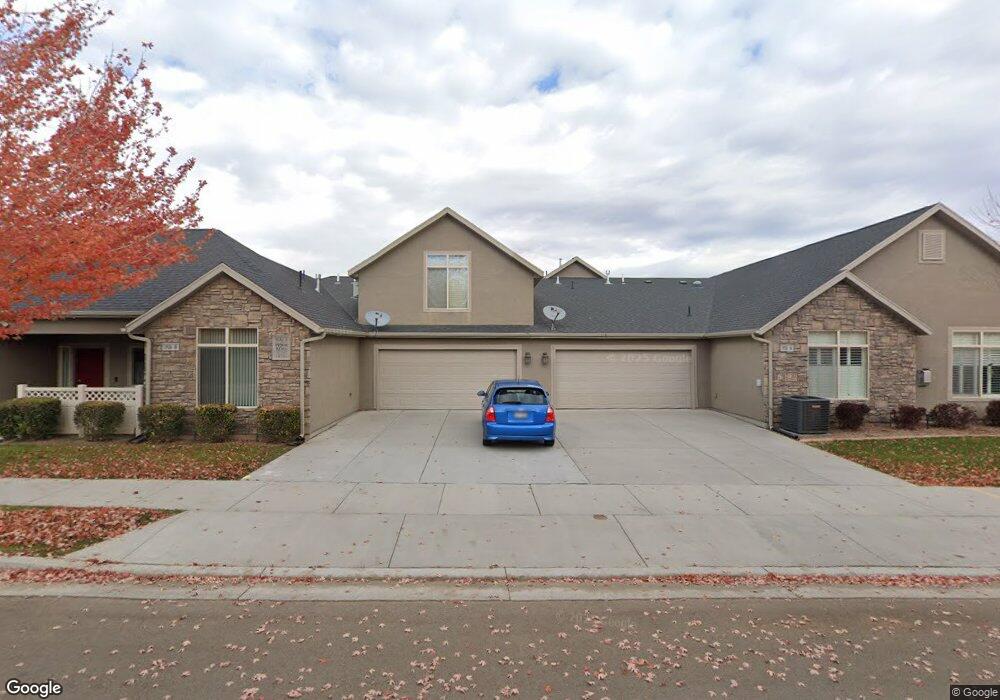
1926 W 9270 S Unit B West Jordan, UT 84088
Estimated Value: $622,000 - $627,000
4
Beds
3
Baths
2,561
Sq Ft
$244/Sq Ft
Est. Value
About This Home
This home is located at 1926 W 9270 S Unit B, West Jordan, UT 84088 and is currently estimated at $624,063, approximately $243 per square foot. 1926 W 9270 S Unit B is a home located in Salt Lake County with nearby schools including Westvale Elementary School, West Jordan Middle School, and West Jordan High School.
Ownership History
Date
Name
Owned For
Owner Type
Purchase Details
Closed on
Apr 30, 2019
Sold by
Ferrell Nellissa C
Bought by
Ferrell Nellissa Crowley and Ferrell Family Trust
Current Estimated Value
Purchase Details
Closed on
Apr 25, 2019
Sold by
Ray Suzanne Chadwick
Bought by
Ferrell Nellissa C
Purchase Details
Closed on
Oct 17, 2018
Sold by
Ray Suzanne C
Bought by
Ray Suzanne Chadwick and The Suzanne Chadwick Ray Revocable Trust
Purchase Details
Closed on
Jun 29, 2018
Sold by
Weaver Joann M
Bought by
Ray Suzanne C
Purchase Details
Closed on
Mar 24, 2014
Sold by
Weaver Joann M
Bought by
Weaver Joann M and Joann M Weaver Revocable Trust
Purchase Details
Closed on
Apr 3, 2012
Sold by
Bridlewood Villas Inc
Bought by
Weaver Joann M
Create a Home Valuation Report for This Property
The Home Valuation Report is an in-depth analysis detailing your home's value as well as a comparison with similar homes in the area
Home Values in the Area
Average Home Value in this Area
Purchase History
| Date | Buyer | Sale Price | Title Company |
|---|---|---|---|
| Ferrell Nellissa Crowley | -- | None Available | |
| Ferrell Nellissa C | -- | First American Title | |
| Ray Suzanne Chadwick | -- | None Available | |
| Ray Suzanne C | -- | Integrated Title Ins Svcs | |
| Weaver Joann M | -- | None Available | |
| Weaver Joann M | -- | Metro National Title |
Source: Public Records
Tax History Compared to Growth
Tax History
| Year | Tax Paid | Tax Assessment Tax Assessment Total Assessment is a certain percentage of the fair market value that is determined by local assessors to be the total taxable value of land and additions on the property. | Land | Improvement |
|---|---|---|---|---|
| 2025 | $3,339 | $674,300 | $139,700 | $534,600 |
| 2024 | $3,339 | $642,500 | $133,100 | $509,400 |
| 2023 | $3,157 | $572,500 | $123,200 | $449,300 |
| 2022 | $3,370 | $601,100 | $120,800 | $480,300 |
| 2021 | $2,994 | $486,200 | $96,600 | $389,600 |
| 2020 | $3,037 | $462,800 | $96,600 | $366,200 |
| 2019 | $2,833 | $423,400 | $96,600 | $326,800 |
| 2018 | $0 | $385,600 | $94,100 | $291,500 |
| 2017 | $2,479 | $365,800 | $94,100 | $271,700 |
| 2016 | $2,285 | $316,800 | $94,100 | $222,700 |
| 2015 | $2,243 | $303,300 | $125,400 | $177,900 |
| 2014 | $2,150 | $286,200 | $120,900 | $165,300 |
Source: Public Records
Map
Nearby Homes
- 1968 W 9270 S Unit C
- 9252 S 2040 W Unit D
- 2116 W Abbey View Rd
- 9414 S 1980 W
- 2097 Jordan Villa Dr
- 2177 W 9240 S
- 1753 Rylie Ann Cir
- 9496 S 1930 W
- 2223 W Williamsburg Cir
- 9511 S Tirado Cove Unit 204
- Brook Haven Plan at Jordan Woods
- Maple Plan at Jordan Woods
- The Maple Basement Plan at Jordan Woods
- The Evergreen Basement Plan at Jordan Woods
- 9503 S Tirado Cove Unit 203
- 2286 Williamsburg Cir
- 1719 W Brocious Way Unit 301
- 1673 Peaceful Cir
- 1741 W Nikos Ln
- 8859 S Long Dr
- 1926 W 9270 S Unit B
- 1926 W 9270 S Unit A
- 9237 S Covered Wagon Cir Unit A
- 9237 S Covered Wagon Cir Unit B
- 9237 S Covered Wagon Cir Unit B
- 1947 W 9270 S Unit C
- 1947 W 9270 S Unit B
- 1923 W 9270 S Unit A
- 1973 W 9270 S Unit A
- 9216 S 1870 W Unit C
- 1994 W 9270 S
- 1897 W 9270 S Unit D
- 1897 W 9270 S Unit A
- 1897 W 9270 S Unit B
- 9232 S 1870 W Unit D
- 9232 S 1870 W Unit A
- 9234 S Covered Wagon Cir Unit B
- 9217 S Covered Wagon Cir Unit D
- 9214 S Covered Wagon Cir Unit B
- 9214 S Covered Wagon Cir Unit D