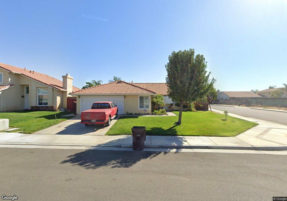
19262 Spring Rock Ct Perris, CA 92570
Estimated Value: $534,089 - $575,000
3
Beds
2
Baths
1,541
Sq Ft
$363/Sq Ft
Est. Value
About This Home
This home is located at 19262 Spring Rock Ct, Perris, CA 92570 and is currently estimated at $559,022, approximately $362 per square foot. 19262 Spring Rock Ct is a home located in Riverside County with nearby schools including Manuel L. Real Elementary School, Tomas Rivera Middle School, and Citrus Hill High School.
Ownership History
Date
Name
Owned For
Owner Type
Purchase Details
Closed on
Oct 2, 2011
Sold by
The Bank Of New York Mellon
Bought by
Llamas Francisco Arciniega and Arciniega Guadalupe
Current Estimated Value
Home Financials for this Owner
Home Financials are based on the most recent Mortgage that was taken out on this home.
Original Mortgage
$136,451
Interest Rate
4.25%
Mortgage Type
FHA
Purchase Details
Closed on
Jul 13, 2011
Sold by
Artavia Victor H and Artavia Evelyn D
Bought by
The Bank Of New York Mellon and The Bank Of New York
Purchase Details
Closed on
Feb 23, 2007
Sold by
Stonewood Housing Partners Lp
Bought by
Artavia Victor H and Artavia Evelyn D
Home Financials for this Owner
Home Financials are based on the most recent Mortgage that was taken out on this home.
Original Mortgage
$327,510
Interest Rate
9%
Mortgage Type
Purchase Money Mortgage
Create a Home Valuation Report for This Property
The Home Valuation Report is an in-depth analysis detailing your home's value as well as a comparison with similar homes in the area
Home Values in the Area
Average Home Value in this Area
Purchase History
| Date | Buyer | Sale Price | Title Company |
|---|---|---|---|
| Llamas Francisco Arciniega | $140,000 | Stewart Title Riverside | |
| The Bank Of New York Mellon | $119,250 | Landsafe Title | |
| Artavia Victor H | $364,000 | Chicago Title |
Source: Public Records
Mortgage History
| Date | Status | Borrower | Loan Amount |
|---|---|---|---|
| Previous Owner | Llamas Francisco Arciniega | $136,451 | |
| Previous Owner | Artavia Victor H | $327,510 |
Source: Public Records
Tax History
| Year | Tax Paid | Tax Assessment Tax Assessment Total Assessment is a certain percentage of the fair market value that is determined by local assessors to be the total taxable value of land and additions on the property. | Land | Improvement |
|---|---|---|---|---|
| 2025 | $2,075 | $175,833 | $75,355 | $100,478 |
| 2023 | $2,075 | $169,007 | $72,430 | $96,577 |
| 2022 | $2,009 | $165,694 | $71,010 | $94,684 |
| 2021 | $1,969 | $162,446 | $69,618 | $92,828 |
| 2020 | $1,947 | $160,782 | $68,905 | $91,877 |
| 2019 | $1,838 | $157,630 | $67,554 | $90,076 |
| 2018 | $1,811 | $154,540 | $66,231 | $88,309 |
| 2017 | $1,769 | $151,511 | $64,933 | $86,578 |
| 2016 | $1,746 | $148,541 | $63,660 | $84,881 |
| 2015 | $1,720 | $146,311 | $62,704 | $83,607 |
| 2014 | $1,697 | $143,447 | $61,477 | $81,970 |
Source: Public Records
Map
Nearby Homes
- 0 Marquez Rd
- 21321 Cajalco Rd
- 21274 Cajalco Rd
- 21701 Perry St
- 21131 Martin St
- 21725 Pinewood St
- 0 Old Elsinore Rd Unit DW25247795
- 20785 Burns St
- 22647 Cajalco Rd
- 20243 Lee Rd
- 21881 Smoketree St
- 22761 Cajalco Rd
- 20553 Hunter St
- 20541 Hunter St
- 20521 Hunter St
- 20646 Markham St
- 20540 Verta St
- 20434 Myron St
- 22738 Redwood Dr
- 18583 Seaton Ave
- 19252 Spring Rock Ct
- 19242 Spring Rock Ct
- 19269 Summerwind Trail
- 19259 Summerwind Trail
- 19249 Summerwind Trail
- 21661 Dawes St
- 21651 Dawes St
- 19267 Spring Rock Ct
- 19232 Spring Rock Ct
- 19257 Spring Rock Ct
- 19289 Summerwind Trail
- 21641 Dawes St
- 19239 Summerwind Trail
- 19247 Spring Rock Ct
- 21631 Dawes St
- 19222 Spring Rock Ct
- 19299 Summerwind Trail
- 19229 Summerwind Trail
- 19237 Spring Rock Ct
- 21621 Dawes St
Your Personal Tour Guide
Ask me questions while you tour the home.