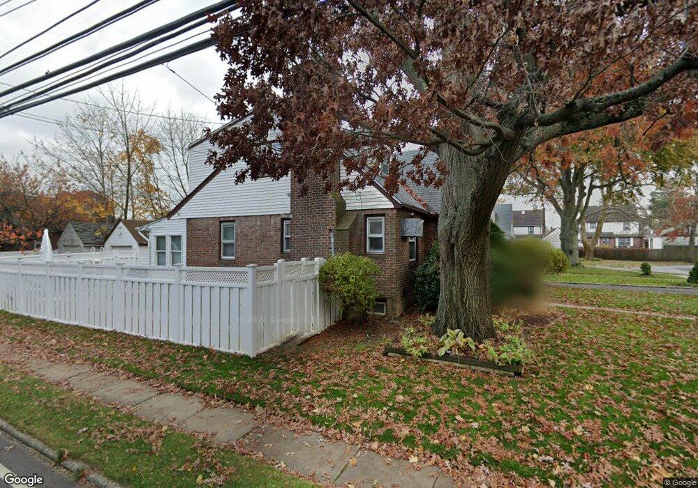
1927 Anita Ct North Baldwin, NY 11510
Estimated Value: $723,000 - $780,933
5
Beds
2
Baths
1,593
Sq Ft
$472/Sq Ft
Est. Value
About This Home
This home is located at 1927 Anita Ct, North Baldwin, NY 11510 and is currently estimated at $751,967, approximately $472 per square foot. 1927 Anita Ct is a home located in Nassau County with nearby schools including Baldwin Senior High School.
Ownership History
Date
Name
Owned For
Owner Type
Purchase Details
Closed on
Dec 30, 2022
Sold by
Josephs Merrick and Josephs Jennifer D
Bought by
Metelus Joudy and Metelus Yveline Marcelus
Current Estimated Value
Home Financials for this Owner
Home Financials are based on the most recent Mortgage that was taken out on this home.
Original Mortgage
$617,607
Outstanding Balance
$597,873
Interest Rate
6.42%
Mortgage Type
FHA
Estimated Equity
$154,094
Purchase Details
Closed on
Apr 15, 2003
Sold by
Josephs Merrick
Purchase Details
Closed on
Aug 5, 1998
Sold by
Prope S and Prope K
Bought by
Merrick Joseph
Purchase Details
Closed on
Jan 30, 1998
Sold by
Michael Mirotzuik
Bought by
S & K Properties
Create a Home Valuation Report for This Property
The Home Valuation Report is an in-depth analysis detailing your home's value as well as a comparison with similar homes in the area
Home Values in the Area
Average Home Value in this Area
Purchase History
| Date | Buyer | Sale Price | Title Company |
|---|---|---|---|
| Metelus Joudy | $629,000 | Westcor Land Title Ins Co | |
| -- | -- | -- | |
| Merrick Joseph | $170,000 | -- | |
| S & K Properties | $118,988 | -- |
Source: Public Records
Mortgage History
| Date | Status | Borrower | Loan Amount |
|---|---|---|---|
| Open | Metelus Joudy | $617,607 |
Source: Public Records
Tax History Compared to Growth
Tax History
| Year | Tax Paid | Tax Assessment Tax Assessment Total Assessment is a certain percentage of the fair market value that is determined by local assessors to be the total taxable value of land and additions on the property. | Land | Improvement |
|---|---|---|---|---|
| 2025 | $12,706 | $412 | $146 | $266 |
| 2024 | $3,337 | $429 | $152 | $277 |
| 2023 | $10,765 | $429 | $152 | $277 |
| 2022 | $10,765 | $429 | $152 | $277 |
| 2021 | $14,347 | $417 | $148 | $269 |
| 2020 | $10,345 | $575 | $471 | $104 |
| 2019 | $9,711 | $575 | $471 | $104 |
| 2018 | $9,093 | $575 | $0 | $0 |
| 2017 | $5,423 | $575 | $407 | $168 |
| 2016 | $8,194 | $575 | $407 | $168 |
| 2015 | $3,042 | $665 | $471 | $194 |
| 2014 | $3,042 | $665 | $471 | $194 |
| 2013 | $2,848 | $665 | $471 | $194 |
Source: Public Records
Map
Nearby Homes
- 345 W Seaman Ave
- 215 N Brookside Ave
- 858 Seaman Ave E
- 1850 Voshage St
- 15 Mckenna Ave
- 154 California Ave
- 142 Maryland Ave
- 2 Twain St
- 89 Delaware Ave
- 2100 Ambrose Ct
- 1 Willowbrook Ln
- 107 California Ave
- 2 Florence St
- 669 Seaman Ave
- 254 Lena Ave
- 174 Delaware Ave
- 139 New York Ave
- 86 N Bayview Ave
- 1690 Grand Ave Unit A16
- 1690 Grand Ave Unit B14
- 1933 Anita Ct
- 1928 Brookwood Dr
- 1934 Brookwood Dr
- 1939 Anita Ct
- 1940 Brookwood Dr
- 1928 Anita Ct
- 1932 Anita Ct
- 1946 Brookwood Dr
- 1940 Anita Ct
- 923 Newton Ave
- 919 Newton Ave
- 927 Newton Ave
- 915 Newton Ave
- 902 Seaman Ave E
- 933 Newton Ave
- 909 Newton Ave
- 939 Newton Ave
- 1935 Brookwood Dr
- 6 Brookwood Dr
- 1909 Voshage St