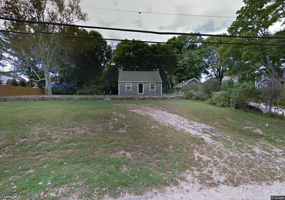
1927 Drift Rd Westport, MA 02790
Westport Point NeighborhoodEstimated Value: $617,000 - $788,111
About This Home
This home is located at 1927 Drift Rd, Westport, MA 02790 and is currently estimated at $712,528, approximately $659 per square foot. 1927 Drift Rd is a home located in Bristol County with nearby schools including Alice A. Macomber Primary School, Westport Elementary School, and Westport Middle-High School.
Ownership History
We collect this data history from publicly available records. To have your information removed, we recommend requesting removal directly through your county’s website.
Purchase Details
Home Values in the Area
Average Home Value in this Area
Purchase History
We collect this data history from publicly available records. To have your information removed, we recommend requesting removal directly through your county’s website.
| Date | Buyer | Sale Price | Title Company |
|---|---|---|---|
| $300,000 | -- |
Mortgage History
We collect this data history from publicly available records. To have your information removed, we recommend requesting removal directly through your county’s website.
| Date | Status | Borrower | Loan Amount |
|---|---|---|---|
| Open | $350,000 | ||
| Closed | $230,000 |
Tax History
We collect this data history from publicly available records. To have your information removed, we recommend requesting removal directly through your county’s website.
| Year | Tax Paid | Tax Assessment Tax Assessment Total Assessment is a certain percentage of the fair market value that is determined by local assessors to be the total taxable value of land and additions on the property. | Land | Improvement |
|---|---|---|---|---|
| 2025 | $4,381 | $588,100 | $432,000 | $156,100 |
| 2024 | $4,275 | $553,100 | $400,300 | $152,800 |
| 2023 | $4,052 | $496,600 | $351,000 | $145,600 |
| 2022 | $3,790 | $446,900 | $338,900 | $108,000 |
| 2021 | $3,410 | $394,100 | $286,100 | $108,000 |
| 2020 | $3,225 | $382,600 | $274,600 | $108,000 |
| 2019 | $3,180 | $378,300 | $274,600 | $103,700 |
| 2018 | $2,892 | $249,700 | $161,100 | $88,600 |
| 2017 | $2,001 | $251,100 | $161,100 | $90,000 |
| 2016 | $1,957 | $247,400 | $161,100 | $86,300 |
| 2015 | $1,936 | $244,100 | $161,100 | $83,000 |
Map
- 8 Juniper Rd
- 1775 Drift Rd
- 2037 Main Rd
- 2 Olin Howland Way
- 1746 Drift Rd
- 1680H Drift Rd Unit H
- 1680 Drift Rd Unit L
- 512 River Rd
- 1 Puddingstone Cir
- 1455 Main Rd
- 24 David Rd
- 169 Atlantic Ave
- 129 Cross Rd
- 94 Howland Rd
- 99 Sylvia Ln
- 536 Horseneck Rd
- 19 Seabury Ln
- 115 Howland Rd
- 185 Howland Rd
- 246 Howland Rd
- 1927 Drift Rd Unit 1
- 1923 Drift Rd
- 1886 Main Rd
- 1919 Drift Rd
- 1892 Main Rd
- 1919 Drift Rd
- 1878 Main Rd
- 1898 Main Rd
- 1913 Drift Rd
- 1900 Main Rd
- 1874 Main Rd
- 1942 Drift Rd
- 1943 Drift Rd
- 0 Cherry & Webb Ln Unit 70852953
- 0 Cherry & Webb Ln Unit 859061
- 1904 Main Rd
- 1904 Main Rd
- 1875 Main Rd
- 1907 Drift Rd
- 1871 Main Rd
Ask me questions while you tour the home.