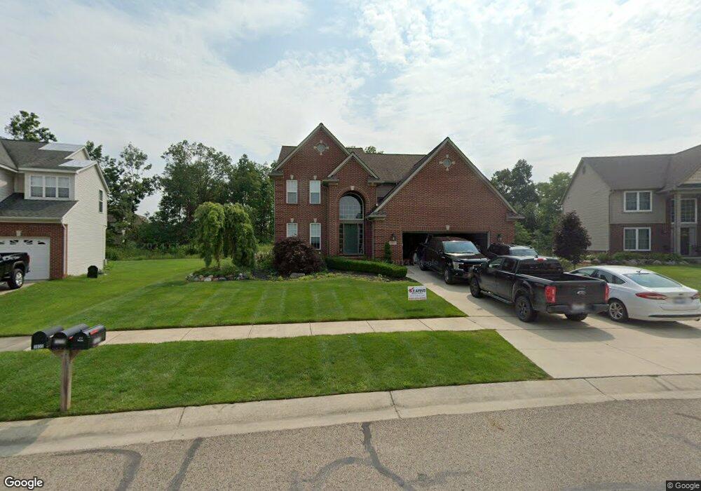
1927 Howland Blvd Unit 152 White Lake, MI 48386
Estimated Value: $462,000 - $556,000
4
Beds
4
Baths
2,347
Sq Ft
$213/Sq Ft
Est. Value
About This Home
This home is located at 1927 Howland Blvd Unit 152, White Lake, MI 48386 and is currently estimated at $499,121, approximately $212 per square foot. 1927 Howland Blvd Unit 152 is a home located in Oakland County with nearby schools including St. Patrick School and Lakecrest Baptist School.
Ownership History
Date
Name
Owned For
Owner Type
Purchase Details
Closed on
Jun 30, 2016
Sold by
Mccarthy Bruce and Mccarthy Nancy
Bought by
Greene David and Greene Wendy A
Current Estimated Value
Purchase Details
Closed on
Nov 29, 2011
Sold by
Greene David and Greene Wendy
Bought by
Newbury Place Reo Ii Llc
Purchase Details
Closed on
Aug 13, 2009
Sold by
Chase Home Finance Llc
Bought by
Federal National Mortgage Association
Purchase Details
Closed on
Aug 11, 2009
Sold by
Greene David and Greene Wendy
Bought by
Chase Home Finance Llc
Purchase Details
Closed on
Nov 26, 2003
Sold by
Willis Lumbercraft Construction Llc
Bought by
Greene David and Greene Wendy
Purchase Details
Closed on
Sep 12, 2003
Sold by
T S Development Llc
Bought by
Willis Lumbercraft Construction Llc
Create a Home Valuation Report for This Property
The Home Valuation Report is an in-depth analysis detailing your home's value as well as a comparison with similar homes in the area
Home Values in the Area
Average Home Value in this Area
Purchase History
| Date | Buyer | Sale Price | Title Company |
|---|---|---|---|
| Greene David | -- | None Listed On Document | |
| Newbury Place Reo Ii Llc | $160,000 | None Available | |
| Federal National Mortgage Association | -- | None Available | |
| Chase Home Finance Llc | $311,951 | None Available | |
| Greene David | $76,000 | Philip R Seaver Title Co Inc | |
| Willis Lumbercraft Construction Llc | $70,000 | Philip R Seaver Title Co Inc |
Source: Public Records
Tax History Compared to Growth
Tax History
| Year | Tax Paid | Tax Assessment Tax Assessment Total Assessment is a certain percentage of the fair market value that is determined by local assessors to be the total taxable value of land and additions on the property. | Land | Improvement |
|---|---|---|---|---|
| 2024 | $3,206 | $220,620 | $0 | $0 |
| 2023 | $3,059 | $189,260 | $0 | $0 |
| 2022 | $5,461 | $180,810 | $0 | $0 |
| 2021 | $5,559 | $179,760 | $0 | $0 |
| 2020 | $4,957 | $176,650 | $0 | $0 |
| 2019 | $7,547 | $165,810 | $0 | $0 |
| 2018 | $7,320 | $150,330 | $0 | $0 |
| 2017 | $7,108 | $150,330 | $0 | $0 |
| 2016 | $7,105 | $145,740 | $0 | $0 |
| 2015 | -- | $139,200 | $0 | $0 |
| 2014 | -- | $120,230 | $0 | $0 |
| 2011 | -- | $111,000 | $0 | $0 |
Source: Public Records
Map
Nearby Homes
- 9470 Pontiac Lake Rd
- 1940 Laflamme Ct
- 1965 Laflamme Ct
- 181 Highland Terrace
- 1925 Laflamme Ct
- 21 Highland Terrace
- 228 Greenhill Dr
- 1800 Teggerdine Rd
- 9910 Highland Rd
- 010770 Highland Rd
- 1052 Maple Heights Dr
- 820 Hilltop Dr
- 00000 Teggerdine Rd
- 694 Robar Cir
- 9136 Buckingham St
- 2019 Kingston St
- Vacant Land Tackles Dr
- 9058 Rhyan Rd
- 9056 Rhyan Rd
- 9055 Gale Rd
- 1935 Howland Blvd Unit 151
- 1919 Howland Blvd
- 1928 Howland Blvd
- 1943 Howland Blvd
- 1911 Howland Blvd Unit 154
- 1926 Margie Dr Unit 8
- 1934 Margie Dr Unit 9
- 1936 Howland Blvd
- 1918 Margie Dr
- 1920 Howland Blvd
- 1942 Margie Dr Unit 10
- 1951 Howland Blvd Unit 149
- 1910 Margie Dr Unit 6
- 1944 Howland Blvd Unit 159
- 9680 David Ln
- 1912 Howland Blvd Unit Bldg-Unit
- 1912 Howland Blvd
- 9690 David Ln Unit 80
- 9670 David Ln Unit 78
- 1950 Margie Dr