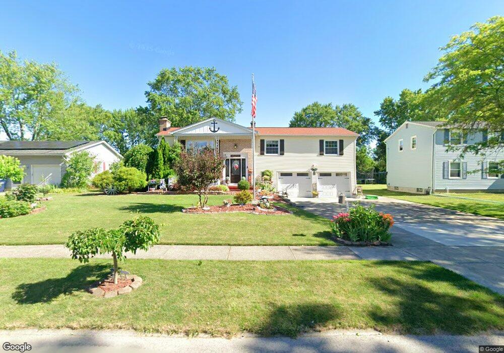
1927 Marjorie Rd Grand Island, NY 14072
Estimated Value: $324,000 - $389,000
3
Beds
2
Baths
2,125
Sq Ft
$167/Sq Ft
Est. Value
About This Home
This home is located at 1927 Marjorie Rd, Grand Island, NY 14072 and is currently estimated at $354,771, approximately $166 per square foot. 1927 Marjorie Rd is a home located in Erie County with nearby schools including Charlotte Sidway School, Veronica E. Connor Middle School, and Grand Island Senior High School.
Ownership History
Date
Name
Owned For
Owner Type
Purchase Details
Closed on
Jan 19, 2023
Sold by
Graf Patti A and Dommell Patti A
Bought by
Graf Patti A
Current Estimated Value
Create a Home Valuation Report for This Property
The Home Valuation Report is an in-depth analysis detailing your home's value as well as a comparison with similar homes in the area
Home Values in the Area
Average Home Value in this Area
Purchase History
| Date | Buyer | Sale Price | Title Company |
|---|---|---|---|
| Graf Patti A | -- | Priority Title & Escrow |
Source: Public Records
Tax History Compared to Growth
Tax History
| Year | Tax Paid | Tax Assessment Tax Assessment Total Assessment is a certain percentage of the fair market value that is determined by local assessors to be the total taxable value of land and additions on the property. | Land | Improvement |
|---|---|---|---|---|
| 2024 | $6,385 | $230,000 | $26,000 | $204,000 |
| 2023 | $6,282 | $230,000 | $26,000 | $204,000 |
| 2022 | $6,058 | $230,000 | $26,000 | $204,000 |
| 2021 | $5,883 | $230,000 | $26,000 | $204,000 |
| 2020 | $5,185 | $170,000 | $24,000 | $146,000 |
| 2019 | $4,690 | $170,000 | $24,000 | $146,000 |
| 2018 | $4,649 | $170,000 | $24,000 | $146,000 |
| 2017 | $2,017 | $170,000 | $24,000 | $146,000 |
| 2016 | $5,052 | $170,000 | $24,000 | $146,000 |
| 2015 | -- | $144,000 | $24,000 | $120,000 |
| 2014 | -- | $144,000 | $24,000 | $120,000 |
Source: Public Records
Map
Nearby Homes
- 1959 Marjorie Rd
- 108 Jenell Dr
- 44 Woodlee Ln
- 18 Woodlee Ln
- 287 Waterford Park
- 43 Riverview Ct
- 68 Dolphin Dr
- 81 Hidden Oaks Ct
- 88 Elsie Ln
- 1687 Fix Rd
- 891 E River Rd
- 1206 Stony Point Rd
- 49 Melrose Rd
- 1498 Red Jacket Rd
- 6 Towerwood Rd
- 1552 E Park Rd
- 646 Alt Blvd
- 2382 W Oakfield Rd
- 578 Alt Blvd
- 1552 Cox Rd
- 1933 Marjorie Rd
- 1921 Marjorie Rd
- 1913 Marjorie Rd
- 1939 Marjorie Rd
- 1926 Bruce Ln
- 1932 Bruce Ln
- 1920 Bruce Ln
- 1938 Bruce Ln
- 1907 Marjorie Rd
- 1930 Marjorie Rd
- 1945 Marjorie Rd
- 1914 Bruce Ln
- 1924 Marjorie Rd
- 1942 Marjorie Rd
- 1944 Bruce Ln
- 1906 Bruce Ln
- 1918 Marjorie Rd
- 1948 Marjorie Rd
- 1901 Marjorie Rd
- 1950 Bruce Ln