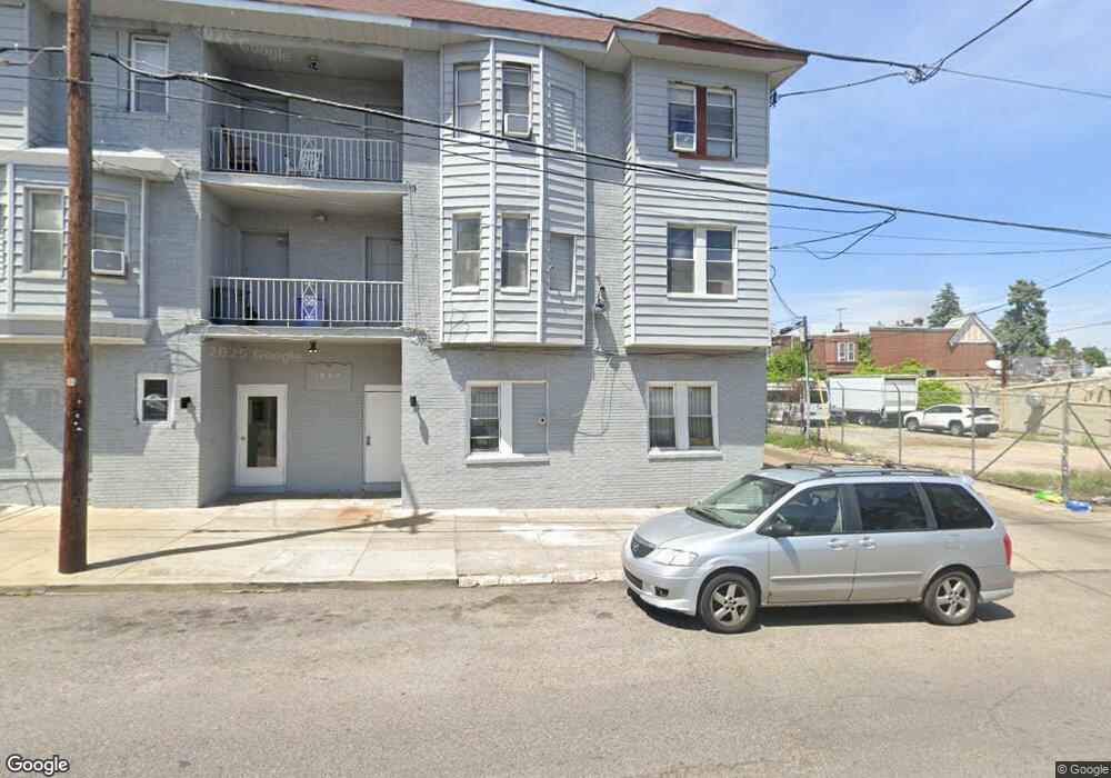
1927 Middleton St Philadelphia, PA 19138
West Oak Lane NeighborhoodEstimated Value: $480,000 - $573,347
1
Bed
1
Bath
4,200
Sq Ft
$122/Sq Ft
Est. Value
About This Home
This home is located at 1927 Middleton St, Philadelphia, PA 19138 and is currently estimated at $513,116, approximately $122 per square foot. 1927 Middleton St is a home located in Philadelphia County with nearby schools including William Rowen School, Gen. Louis Wagner Middle School, and Martin Luther King High School.
Ownership History
Date
Name
Owned For
Owner Type
Purchase Details
Closed on
Sep 22, 2010
Sold by
Brown Ruth M and Morris Bernard
Bought by
Gwacg Llc
Current Estimated Value
Home Financials for this Owner
Home Financials are based on the most recent Mortgage that was taken out on this home.
Original Mortgage
$195,000
Outstanding Balance
$127,800
Interest Rate
4.37%
Mortgage Type
Future Advance Clause Open End Mortgage
Estimated Equity
$385,316
Purchase Details
Closed on
Oct 8, 1993
Sold by
Brown Ella V and Brown Charles C
Bought by
Brown Ruth M
Create a Home Valuation Report for This Property
The Home Valuation Report is an in-depth analysis detailing your home's value as well as a comparison with similar homes in the area
Home Values in the Area
Average Home Value in this Area
Purchase History
| Date | Buyer | Sale Price | Title Company |
|---|---|---|---|
| Gwacg Llc | $260,000 | Title Insurance Company | |
| Brown Ruth M | -- | -- |
Source: Public Records
Mortgage History
| Date | Status | Borrower | Loan Amount |
|---|---|---|---|
| Open | Gwacg Llc | $195,000 |
Source: Public Records
Tax History Compared to Growth
Tax History
| Year | Tax Paid | Tax Assessment Tax Assessment Total Assessment is a certain percentage of the fair market value that is determined by local assessors to be the total taxable value of land and additions on the property. | Land | Improvement |
|---|---|---|---|---|
| 2026 | $5,143 | $382,200 | $76,440 | $305,760 |
| 2025 | $5,143 | $382,200 | $76,440 | $305,760 |
| 2024 | $5,143 | $382,200 | $76,440 | $305,760 |
| 2023 | $5,143 | $367,400 | $73,480 | $293,920 |
| 2022 | $5,388 | $367,400 | $73,480 | $293,920 |
| 2021 | $5,388 | $0 | $0 | $0 |
| 2020 | $5,388 | $0 | $0 | $0 |
| 2019 | $5,315 | $0 | $0 | $0 |
| 2018 | $2,795 | $0 | $0 | $0 |
| 2017 | $2,795 | $0 | $0 | $0 |
| 2016 | $2,795 | $0 | $0 | $0 |
| 2015 | $19,513 | $0 | $0 | $0 |
| 2014 | -- | $199,700 | $20,253 | $179,447 |
| 2012 | -- | $17,600 | $2,945 | $14,655 |
Source: Public Records
Map
Nearby Homes
- 7001 Limekiln Pike
- 7092 Forrest Ave
- 6944 Cedar Park Ave
- 7016 Andrews Ave
- 6908 Ogontz Ave
- 6905 Forrest Ave
- 7206 Forrest Ave
- 7349 E Walnut Ln
- 7159 N 20th St
- 7188 N Uber St
- 6838 Ogontz Ave
- 6869 Forrest Ave
- 1839 E Pastorius St
- 7245 Ogontz Ave
- 1623 Middleton St
- 2070 E Haines St
- 6943 N 19th St
- 1821 E Tulpehocken St
- 7313 Limekiln Pike
- 1911 72nd Ave
- 7051 Forrest Ave
- 7055 Forrest Ave
- 7057 Forrest Ave
- 7039 Forrest Ave
- 7037 Forrest Ave
- 7059 Forrest Ave
- 7061 Forrest Ave
- 7035 Forrest Ave
- 7033 Forrest Ave
- 7063 Forrest Ave
- 7065 Forrest Ave
- 7031 Forrest Ave
- 7067 Forrest Ave
- 7029 Forrest Ave
- 7112 Ogontz Ave
- 2001 Middleton St
- 7050 Forrest Ave
- 7052 Forrest Ave
- 7054 Forrest Ave Unit 1
- 7054 Forrest Ave