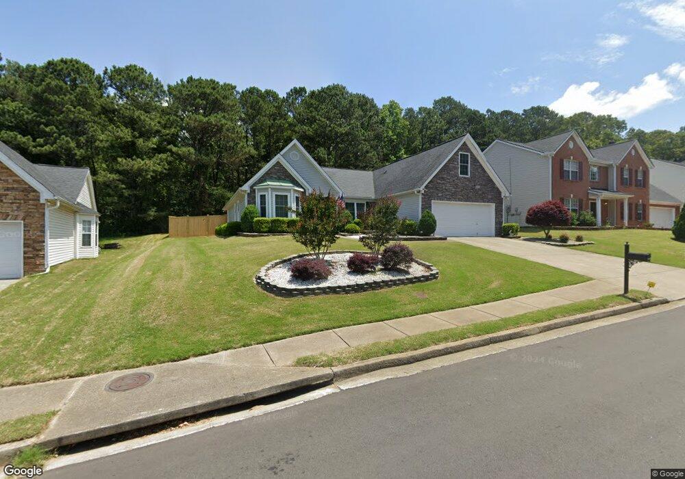
1927 Pierce Way Unit 1 Buford, GA 30519
Estimated Value: $402,937 - $439,000
4
Beds
3
Baths
2,349
Sq Ft
$178/Sq Ft
Est. Value
About This Home
This home is located at 1927 Pierce Way Unit 1, Buford, GA 30519 and is currently estimated at $419,234, approximately $178 per square foot. 1927 Pierce Way Unit 1 is a home located in Gwinnett County with nearby schools including Freeman's Mill Elementary School, Twin Rivers Middle School, and Mountain View High School.
Ownership History
Date
Name
Owned For
Owner Type
Purchase Details
Closed on
Feb 22, 2011
Sold by
Saucier Gloria M
Bought by
Saucier Ralph E
Current Estimated Value
Purchase Details
Closed on
Jun 9, 2010
Sold by
Saucier Ralph E and Saucier Gloria M
Bought by
Saucier Gloria M
Purchase Details
Closed on
Dec 20, 2002
Sold by
Winmark Homes Inc
Bought by
Saucier Gloria M
Home Financials for this Owner
Home Financials are based on the most recent Mortgage that was taken out on this home.
Original Mortgage
$173,000
Interest Rate
5.92%
Mortgage Type
FHA
Create a Home Valuation Report for This Property
The Home Valuation Report is an in-depth analysis detailing your home's value as well as a comparison with similar homes in the area
Home Values in the Area
Average Home Value in this Area
Purchase History
| Date | Buyer | Sale Price | Title Company |
|---|---|---|---|
| Saucier Ralph E | -- | -- | |
| Saucier Gloria M | -- | -- | |
| Saucier Gloria M | $175,800 | -- |
Source: Public Records
Mortgage History
| Date | Status | Borrower | Loan Amount |
|---|---|---|---|
| Previous Owner | Saucier Gloria M | $173,000 |
Source: Public Records
Tax History Compared to Growth
Tax History
| Year | Tax Paid | Tax Assessment Tax Assessment Total Assessment is a certain percentage of the fair market value that is determined by local assessors to be the total taxable value of land and additions on the property. | Land | Improvement |
|---|---|---|---|---|
| 2025 | $1,213 | $159,440 | $26,000 | $133,440 |
| 2024 | $1,206 | $152,760 | $30,000 | $122,760 |
| 2023 | $1,206 | $152,760 | $30,000 | $122,760 |
| 2022 | $1,163 | $132,240 | $28,000 | $104,240 |
| 2021 | $1,149 | $86,000 | $20,000 | $66,000 |
| 2020 | $1,147 | $86,000 | $20,000 | $66,000 |
| 2019 | $1,062 | $90,280 | $20,000 | $70,280 |
| 2018 | $1,044 | $82,360 | $16,800 | $65,560 |
| 2016 | $1,072 | $66,000 | $12,800 | $53,200 |
| 2015 | $1,029 | $61,360 | $11,200 | $50,160 |
| 2014 | $1,037 | $61,360 | $11,200 | $50,160 |
Source: Public Records
Map
Nearby Homes
- 2439 Canter Brook Ct Unit 1
- 2585 Braselton Hwy
- 2431 Lance Ridge Way
- 2045 Amber Creek Dr
- 2346 Hampton Park Dr Unit I
- 2375 Matlin Way
- 2228 Lakeview Bend Way
- 0 Hog Mountain Church Road and Auburn Rd
- 2032 Shin Ct NE
- 2305 Braselton Hwy
- 1603 Fort Perry Way
- 2425 Fort Daniels Dr Unit 3A
- 1720 Fort Daniels Trail
- 1827 Scouts Walk
- 2706 Captain Ct
- 1717 Willoughby Dr
- 2144 Beacon Crest Dr
- 1655 Brisbane Dr
- 1917 Pierce Way
- 1937 Pierce Way Unit 1
- 1907 Pierce Way
- 1924 Pierce Way
- 1947 Pierce Way
- 1947 Pierce Way NE
- 1914 Pierce Way
- 1944 Pierce Way Unit 1
- 1897 Pierce Way
- 1904 Pierce Way
- 1959 Johns Place Ct
- 1964 Pierce Way
- 1887 Pierce Way
- 1959 Johns Pl Ct NE
- 1894 Pierce Way Unit 1
- 1984 Pierce Way Unit 1
- 1958 Johns Place Ct Unit 1
- 0 Betty Dr NE Unit 7559819
- 0 Betty Dr NE
- 1969 Johns Place Ct