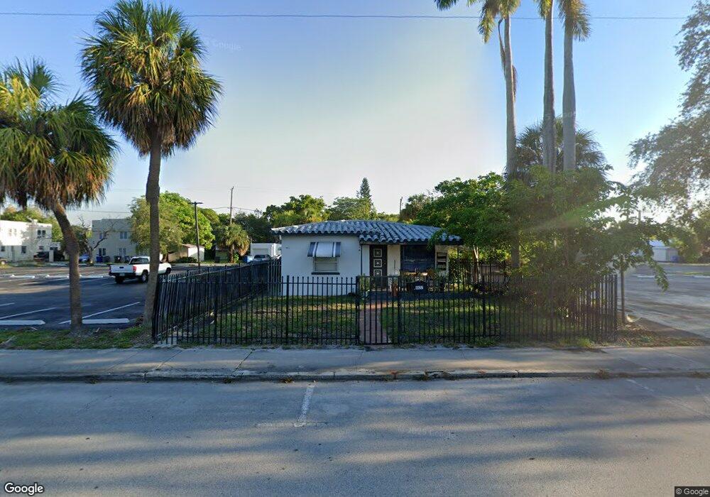
1927 Polk St Hollywood, FL 33020
Royal Poinciana NeighborhoodEstimated Value: $543,000 - $1,190,000
2
Beds
--
Bath
1,826
Sq Ft
$396/Sq Ft
Est. Value
About This Home
This home is located at 1927 Polk St, Hollywood, FL 33020 and is currently estimated at $723,747, approximately $396 per square foot. 1927 Polk St is a home with nearby schools including Dania Elementary School, Olsen Middle School, and South Broward High School.
Ownership History
Date
Name
Owned For
Owner Type
Purchase Details
Closed on
Jul 1, 2002
Sold by
Castoro Michael W and Castoro Lillian
Bought by
Betesh Joseph and Whale Pond Land Trust #1
Current Estimated Value
Purchase Details
Closed on
Jul 6, 1996
Sold by
Rudolph Don M
Bought by
Castoro Michael W and Castoro Lillian
Home Financials for this Owner
Home Financials are based on the most recent Mortgage that was taken out on this home.
Original Mortgage
$30,000
Interest Rate
7.99%
Mortgage Type
Commercial
Purchase Details
Closed on
Dec 1, 1992
Sold by
Available Not
Bought by
Available Not
Create a Home Valuation Report for This Property
The Home Valuation Report is an in-depth analysis detailing your home's value as well as a comparison with similar homes in the area
Home Values in the Area
Average Home Value in this Area
Purchase History
| Date | Buyer | Sale Price | Title Company |
|---|---|---|---|
| Betesh Joseph | $180,000 | -- | |
| Castoro Michael W | $72,000 | -- | |
| Available Not | $60,000 | -- |
Source: Public Records
Mortgage History
| Date | Status | Borrower | Loan Amount |
|---|---|---|---|
| Previous Owner | Castoro Michael W | $30,000 |
Source: Public Records
Tax History Compared to Growth
Tax History
| Year | Tax Paid | Tax Assessment Tax Assessment Total Assessment is a certain percentage of the fair market value that is determined by local assessors to be the total taxable value of land and additions on the property. | Land | Improvement |
|---|---|---|---|---|
| 2025 | $6,636 | $246,230 | -- | -- |
| 2024 | $6,480 | $246,230 | -- | -- |
| 2023 | $6,480 | $211,220 | $0 | $0 |
| 2022 | $5,529 | $192,020 | $0 | $0 |
| 2021 | $4,914 | $174,570 | $0 | $0 |
| 2020 | $4,543 | $257,690 | $37,660 | $220,030 |
| 2019 | $4,134 | $217,970 | $37,660 | $180,310 |
| 2018 | $3,839 | $217,050 | $37,660 | $179,390 |
| 2017 | $3,487 | $119,250 | $0 | $0 |
| 2016 | $3,131 | $108,410 | $0 | $0 |
| 2015 | $2,740 | $98,560 | $0 | $0 |
| 2014 | $2,478 | $89,600 | $0 | $0 |
| 2013 | -- | $86,240 | $34,970 | $51,270 |
Source: Public Records
Map
Nearby Homes
- 2010 Fillmore St Unit 303
- 2010 Fillmore St Unit 202
- 504 N 20th Ave
- 1930 Pierce St
- 2000 Polk St
- 1817 Taylor St Unit 1614
- 1817 Taylor St Unit 1211
- 1817 Taylor St Unit 1503
- 1817 Taylor St Unit 1207
- 1817 Taylor St Unit 1109
- 1817 Taylor St Unit 1812
- 1817 Taylor St Unit 1806
- 1817 Taylor St Unit 1615
- 1817 Taylor St Unit 1204
- 1817 Taylor St Unit 1602
- 1817 Taylor St Unit 1101
- 1830 Radius Dr Unit 810
- 1830 Radius Dr Unit 516
- 1830 Radius Dr Unit 1301
- 1830 Radius Dr Unit 609
- 1941 Polk St
- 1953 Polk St Unit B
- 1953 Polk St Unit "A"
- 1922 Taylor St
- 1932 Taylor St
- 1939 Tyler St
- 1947 Polk St Unit F
- 1947 Polk St
- 1906-1908 1906-1908 Taylor Unit 1908A
- 1906 1908 Taylor
- 1906-1908 Taylor St Unit 1908A
- 1906-1908 Taylor St Unit 1908B
- 1906 Taylor St Unit 1906
- 1906 Taylor St Unit 1908B
- 1906 Taylor St Unit 1908A
- 1942 Taylor St Unit B1
- 1942 Taylor St
- 1951 Polk St Unit main
- 1951 Polk St Unit "B"