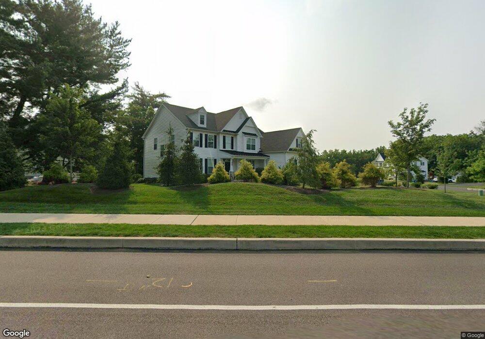
1927 S Broad St Lansdale, PA 19446
Estimated Value: $905,000 - $963,000
4
Beds
4
Baths
3,888
Sq Ft
$241/Sq Ft
Est. Value
About This Home
This home is located at 1927 S Broad St, Lansdale, PA 19446 and is currently estimated at $935,428, approximately $240 per square foot. 1927 S Broad St is a home located in Montgomery County with nearby schools including Gwynedd Square Elementary School, Penndale Middle School, and North Penn Senior High School.
Ownership History
Date
Name
Owned For
Owner Type
Purchase Details
Closed on
Jun 16, 2020
Sold by
Maple Green Llc
Bought by
Poyser Thomas P and Poyser Kathleen P
Current Estimated Value
Home Financials for this Owner
Home Financials are based on the most recent Mortgage that was taken out on this home.
Original Mortgage
$580,000
Outstanding Balance
$514,126
Interest Rate
3.2%
Mortgage Type
New Conventional
Estimated Equity
$421,302
Create a Home Valuation Report for This Property
The Home Valuation Report is an in-depth analysis detailing your home's value as well as a comparison with similar homes in the area
Home Values in the Area
Average Home Value in this Area
Purchase History
| Date | Buyer | Sale Price | Title Company |
|---|---|---|---|
| Poyser Thomas P | $725,000 | None Available |
Source: Public Records
Mortgage History
| Date | Status | Borrower | Loan Amount |
|---|---|---|---|
| Open | Poyser Thomas P | $580,000 |
Source: Public Records
Tax History Compared to Growth
Tax History
| Year | Tax Paid | Tax Assessment Tax Assessment Total Assessment is a certain percentage of the fair market value that is determined by local assessors to be the total taxable value of land and additions on the property. | Land | Improvement |
|---|---|---|---|---|
| 2025 | $10,029 | $283,340 | -- | -- |
| 2024 | $10,029 | $273,340 | -- | -- |
| 2023 | $9,559 | $273,340 | $0 | $0 |
| 2022 | $9,218 | $273,340 | $0 | $0 |
| 2021 | $8,976 | $273,340 | $0 | $0 |
| 2020 | $1,631 | $51,000 | $0 | $0 |
| 2019 | $1,631 | $0 | $0 | $0 |
Source: Public Records
Map
Nearby Homes
- 2806 Morris Rd
- 4 Anglesey
- 641 Jones Ave
- 643 Jones Ave
- 937 General Nash Dr
- 645 Jones Ave
- 1939 Penngrove Terrace
- 2203 Weber Rd
- 1401 Oak Cir
- 3106 Lilac Ct
- 4103 Lilac Ct
- 4204 Lilac Ct
- 4104 Lilac Ct
- 10 Wheatley Walk
- 6206 Lilac Ct
- 6103 Lilac Ct
- 5403 Lilac Ct
- 1307 Lilac Ct
- 1625 Clearbrook Rd
- 426 Primrose Dr
- 1927 Enclave
- 1931 S Broad St
- 1939 S Broad St
- 800 Maxwell Place
- 1919 S Broad St
- 1928 S Broad St
- 1932 S Broad St
- 780 Park Rd
- 1943 S Broad St
- 1935 S Broad St
- 801 Maxwell Place
- 806 Maxwell Place
- 1936 S Broad St
- 796 Park Rd
- 790 Park Rd
- 805 Maxwell Place
- 1900 Muhlenberg Dr
- 784 Park Rd
- 1912 S Broad St
- 814 Maxwell Place