Estimated Value: $212,000 - $543,000
3
Beds
2
Baths
1,056
Sq Ft
$302/Sq Ft
Est. Value
About This Home
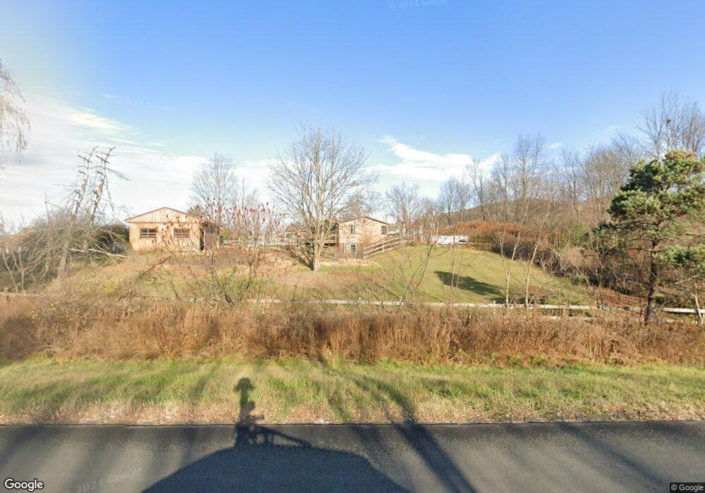
This home is located at 1927 State Highway 7, Troy, NY 12180 and is currently estimated at $318,713, approximately $301 per square foot. 1927 State Highway 7 is a home located in Rensselaer County with nearby schools including Tamarac Elementary School and Tamarac Middle School High School.
Ownership History
Date
Name
Owned For
Owner Type
Purchase Details
Closed on
Oct 23, 2007
Sold by
Wilson James J
Bought by
White David
Current Estimated Value
Home Financials for this Owner
Home Financials are based on the most recent Mortgage that was taken out on this home.
Original Mortgage
$154,230
Outstanding Balance
$64,203
Interest Rate
6.47%
Mortgage Type
Purchase Money Mortgage
Estimated Equity
$254,510
Purchase Details
Closed on
Sep 7, 2000
Sold by
Valenti Mary K
Bought by
Beneficial Mortgage
Purchase Details
Closed on
Aug 21, 2000
Sold by
Beneficial Mortgage Corp
Bought by
Berney Delorres
Purchase Details
Closed on
Aug 11, 2000
Purchase Details
Closed on
Oct 2, 1995
Sold by
Kilburn Frederick and Kilburn Katherine
Bought by
Valenti Mary K
Create a Home Valuation Report for This Property
The Home Valuation Report is an in-depth analysis detailing your home's value as well as a comparison with similar homes in the area
Home Values in the Area
Average Home Value in this Area
Purchase History
| Date | Buyer | Sale Price | Title Company |
|---|---|---|---|
| White David | $159,000 | Sudchetti | |
| Beneficial Mortgage | -- | -- | |
| Berney Delorres | $69,900 | Jennifer Taylor | |
| -- | -- | -- | |
| Valenti Mary K | $90,000 | -- |
Source: Public Records
Mortgage History
| Date | Status | Borrower | Loan Amount |
|---|---|---|---|
| Open | White David | $154,230 |
Source: Public Records
Tax History Compared to Growth
Tax History
| Year | Tax Paid | Tax Assessment Tax Assessment Total Assessment is a certain percentage of the fair market value that is determined by local assessors to be the total taxable value of land and additions on the property. | Land | Improvement |
|---|---|---|---|---|
| 2024 | $4,501 | $38,000 | $4,000 | $34,000 |
| 2023 | $4,464 | $38,000 | $4,000 | $34,000 |
| 2022 | $4,464 | $38,000 | $4,000 | $34,000 |
| 2021 | $4,420 | $38,000 | $4,000 | $34,000 |
| 2020 | $3,927 | $38,000 | $4,000 | $34,000 |
| 2019 | $3,751 | $38,000 | $4,000 | $34,000 |
| 2018 | $3,751 | $38,000 | $4,000 | $34,000 |
| 2017 | $3,616 | $38,000 | $4,000 | $34,000 |
| 2016 | $3,677 | $38,000 | $4,000 | $34,000 |
| 2015 | -- | $35,000 | $4,000 | $31,000 |
| 2014 | -- | $35,000 | $4,000 | $31,000 |
Source: Public Records
Map
Nearby Homes
- 71 Cooksboro Rd
- 1789 New York 7
- 34 Ford Rd
- 65 Deepkill Rd
- 87 Le Loup Rd
- 17 Johnny Cake Hollow Rd
- 214 N Pole Rd
- 13 Camel Hill Rd
- 1346 State Highway 7
- 2 Ribbon Candy Ln
- 13 Ribbon Candy Ln
- 343 Sweetmilk Creek Rd
- 85 Stuffle St
- 87 Bulson Rd
- 1232 State Highway 7
- 274 Bald Mountain Rd
- 233 Keefe Rd
- 42 Ashcroft Rd
- 10 Springbrook Rd
- 4048 New York 2
- 1927 New York 7
- 1925 State Highway 7
- 1944 State Highway 7
- 19 Cooksboro Rd
- 55 Cooksboro Rd
- 1950 New York 7
- 1950 State Highway 7
- 1925 New York 7
- 1920 State Highway 7
- 1928 State Highway 7
- 1906 State Highway 7
- 36 Cooksboro Rd
- 1962 State Highway 7
- 14 Cooksboro Rd
- 1892 State Highway 7
- 85 Cooksboro Rd
- 12 Cooksboro Rd
- 97 Cooksboro Rd
- 0 Cooksboro Rd Unit 201022234
- 1872 New York 7