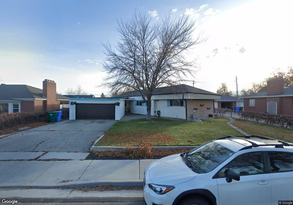
1927 W 12960 S Riverton, UT 84065
Estimated Value: $542,000 - $578,000
4
Beds
3
Baths
2,968
Sq Ft
$189/Sq Ft
Est. Value
About This Home
This home is located at 1927 W 12960 S, Riverton, UT 84065 and is currently estimated at $561,338, approximately $189 per square foot. 1927 W 12960 S is a home located in Salt Lake County with nearby schools including Riverton School, Hidden Valley Middle School, and Riverton High School.
Ownership History
Date
Name
Owned For
Owner Type
Purchase Details
Closed on
Jul 20, 2017
Sold by
Steck Cody
Bought by
Taylor Taunya
Current Estimated Value
Home Financials for this Owner
Home Financials are based on the most recent Mortgage that was taken out on this home.
Original Mortgage
$281,675
Outstanding Balance
$234,024
Interest Rate
3.89%
Mortgage Type
New Conventional
Estimated Equity
$327,314
Purchase Details
Closed on
Jun 16, 2017
Sold by
Landeen Brett J and Landeen Janell K
Bought by
Steck Cody
Home Financials for this Owner
Home Financials are based on the most recent Mortgage that was taken out on this home.
Original Mortgage
$281,675
Outstanding Balance
$234,024
Interest Rate
3.89%
Mortgage Type
New Conventional
Estimated Equity
$327,314
Purchase Details
Closed on
Mar 28, 2013
Sold by
Bodell Kevin W and Bodell Jessi
Bought by
Landeen Brett J and Landeen Janeeen K
Home Financials for this Owner
Home Financials are based on the most recent Mortgage that was taken out on this home.
Original Mortgage
$220,924
Interest Rate
3.25%
Mortgage Type
FHA
Purchase Details
Closed on
Mar 10, 2005
Sold by
Stringham Talon
Bought by
Bodell Kevin W and Bodell Jessi
Home Financials for this Owner
Home Financials are based on the most recent Mortgage that was taken out on this home.
Original Mortgage
$9,676
Interest Rate
5.65%
Mortgage Type
Stand Alone Second
Purchase Details
Closed on
Apr 16, 2004
Sold by
Fairbanks Capital Corp
Bought by
Stringham Talon
Purchase Details
Closed on
Mar 26, 2004
Sold by
Washington Mutual Bank Fsb
Bought by
Fairbanks Capital Corp
Purchase Details
Closed on
Nov 4, 2003
Sold by
Adair Ira G and Adair Debra Ann
Bought by
Washington Mutual Bank Fsb
Purchase Details
Closed on
Jan 12, 1998
Sold by
Adair Leonard W and Adair Dora B
Bought by
Adair Ira G and Adair Debra Ann
Home Financials for this Owner
Home Financials are based on the most recent Mortgage that was taken out on this home.
Original Mortgage
$105,000
Interest Rate
7.16%
Create a Home Valuation Report for This Property
The Home Valuation Report is an in-depth analysis detailing your home's value as well as a comparison with similar homes in the area
Home Values in the Area
Average Home Value in this Area
Purchase History
| Date | Buyer | Sale Price | Title Company |
|---|---|---|---|
| Taylor Taunya | -- | Charger Title Ins Agcy | |
| Steck Cody | -- | Charger Title Insurance Agcy | |
| Landeen Brett J | -- | Integrated Title Ins Service | |
| Bodell Kevin W | -- | Sutherland Title | |
| Stringham Talon | -- | First American Title | |
| Fairbanks Capital Corp | -- | First American Title | |
| Washington Mutual Bank Fsb | $117,000 | First Southwestern Title | |
| Adair Ira G | -- | -- | |
| Adair Leonard W | -- | -- |
Source: Public Records
Mortgage History
| Date | Status | Borrower | Loan Amount |
|---|---|---|---|
| Open | Taylor Taunya | $281,675 | |
| Closed | Steck Cody | $201,502 | |
| Previous Owner | Landeen Brett J | $220,924 | |
| Previous Owner | Bodell Kevin W | $9,676 | |
| Previous Owner | Bodell Kevin W | $161,269 | |
| Previous Owner | Adair Ira G | $105,000 |
Source: Public Records
Tax History Compared to Growth
Tax History
| Year | Tax Paid | Tax Assessment Tax Assessment Total Assessment is a certain percentage of the fair market value that is determined by local assessors to be the total taxable value of land and additions on the property. | Land | Improvement |
|---|---|---|---|---|
| 2025 | $2,837 | $505,400 | $202,600 | $302,800 |
| 2024 | $2,837 | $491,100 | $192,900 | $298,200 |
| 2023 | $2,837 | $469,400 | $189,100 | $280,300 |
| 2022 | $2,994 | $479,300 | $185,400 | $293,900 |
| 2021 | $2,577 | $367,200 | $112,300 | $254,900 |
| 2020 | $2,427 | $322,500 | $112,300 | $210,200 |
| 2019 | $2,483 | $317,200 | $105,900 | $211,300 |
| 2018 | $2,284 | $293,800 | $105,900 | $187,900 |
| 2017 | $1,981 | $248,300 | $105,900 | $142,400 |
| 2016 | $1,921 | $231,000 | $105,900 | $125,100 |
| 2015 | $1,855 | $216,300 | $107,900 | $108,400 |
| 2014 | $1,778 | $203,200 | $102,900 | $100,300 |
Source: Public Records
Map
Nearby Homes
- 2048 W 12920 S
- 2249 W 13035 S
- 2106 W 13220 S
- 1560 W 12730 S
- 12952 S Croix Cir
- 2356 W Montcalm Dr
- 1056 W Kate Springs Ln S Unit 10
- 12345 S Redwood Rd
- 13053 S 1300 W
- 12325 S Redwood Rd
- 12317 S Redwood Rd
- 1373 W Stewart Falls Dr
- 12501 Falls Creek Rd
- 1259 W Moon Way
- 1273 W Hendrix St Unit 145
- 1269 W Hendrix St Unit 146
- 13596 S 2260 W
- 12294 S 1490 W
- 1792 W Dalmeny Way
- 12392 S 1300 W
- 1917 W 12960 S
- 1941 W 12960 S
- 1906 Bingham Ridge Ln
- 1906 Bingham Ridge Ln Unit 1
- 1944 W 12960 S
- 1901 W 12960 S
- 1894 Bingham Ridge Ln
- 1894 Bingham Ridge Ln Unit 3
- 1961 W 12974 S
- 1971 W 12974 S
- 1930 W 12960 S
- 1914 W 12960 S
- 1847 W 12960 S
- 1906 W 13035 S
- 1890 W 13035 S
- 1920 W 13035 S
- 1977 W 12974 S
- 1876 W 13035 S
- 1841 W 12960 S
- 1979 W 12920 S