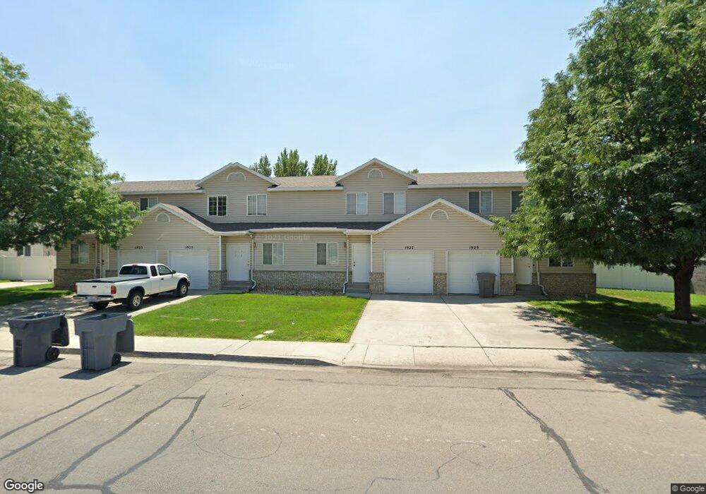
1927 W 680 N Unit 7 Pleasant Grove, UT 84062
Estimated Value: $337,955 - $364,000
3
Beds
2
Baths
1,250
Sq Ft
$280/Sq Ft
Est. Value
About This Home
This home is located at 1927 W 680 N Unit 7, Pleasant Grove, UT 84062 and is currently estimated at $350,239, approximately $280 per square foot. 1927 W 680 N Unit 7 is a home located in Utah County with nearby schools including Mount Mahogany School, Pleasant Grove Junior High School, and Pleasant Grove High School.
Ownership History
Date
Name
Owned For
Owner Type
Purchase Details
Closed on
Sep 14, 2005
Sold by
Butler Nicolette and Christensen Casey
Bought by
Shumway Lisa
Current Estimated Value
Home Financials for this Owner
Home Financials are based on the most recent Mortgage that was taken out on this home.
Original Mortgage
$108,000
Outstanding Balance
$57,307
Interest Rate
5.72%
Mortgage Type
FHA
Estimated Equity
$292,932
Purchase Details
Closed on
Mar 23, 2004
Sold by
Butler Nicolette
Bought by
Butler Nicolette and Christensen Casey
Home Financials for this Owner
Home Financials are based on the most recent Mortgage that was taken out on this home.
Original Mortgage
$103,367
Interest Rate
5.64%
Mortgage Type
FHA
Purchase Details
Closed on
Oct 18, 2002
Sold by
Federal Home Loan Mortgage Corporation
Bought by
Butler Nicolette
Home Financials for this Owner
Home Financials are based on the most recent Mortgage that was taken out on this home.
Original Mortgage
$103,367
Interest Rate
5.99%
Mortgage Type
FHA
Purchase Details
Closed on
May 8, 2002
Sold by
Aguilar Bertha and Old Kent Mtg Co
Bought by
Federal Loan Mtg Corp
Purchase Details
Closed on
Jan 30, 2002
Sold by
Aguilar Bertha
Bought by
Atlas Properties Llc
Purchase Details
Closed on
Dec 20, 1999
Sold by
Brownlee Matthew S and Brownlee Kelli F
Bought by
Aguilar Bertha
Home Financials for this Owner
Home Financials are based on the most recent Mortgage that was taken out on this home.
Original Mortgage
$95,050
Interest Rate
7.69%
Purchase Details
Closed on
Dec 28, 1998
Sold by
Brownlee Matthew S and Brownlee Kerri F
Bought by
Brownlee Matthew S and Brownlee Kelli F
Purchase Details
Closed on
Jun 24, 1998
Sold by
Westlake Homes
Bought by
Brownlee Matthew S and Brownlee Kerri F
Home Financials for this Owner
Home Financials are based on the most recent Mortgage that was taken out on this home.
Original Mortgage
$94,900
Interest Rate
7.17%
Purchase Details
Closed on
Jun 23, 1998
Sold by
Covington Alden L and Covington Joanna K
Bought by
Westlake Homes
Home Financials for this Owner
Home Financials are based on the most recent Mortgage that was taken out on this home.
Original Mortgage
$94,900
Interest Rate
7.17%
Create a Home Valuation Report for This Property
The Home Valuation Report is an in-depth analysis detailing your home's value as well as a comparison with similar homes in the area
Home Values in the Area
Average Home Value in this Area
Purchase History
| Date | Buyer | Sale Price | Title Company |
|---|---|---|---|
| Shumway Lisa | -- | First American Title Agency | |
| Butler Nicolette | -- | Inwest Title Services Inc | |
| Butler Nicolette | -- | First American Title Co | |
| Federal Loan Mtg Corp | $96,900 | Backman Stewart Title Servic | |
| Atlas Properties Llc | -- | -- | |
| Aguilar Bertha | -- | Title West Title Co | |
| Brownlee Matthew S | -- | Timp Title Insurance Agency | |
| Brownlee Matthew S | -- | Timp Title | |
| Westlake Homes | -- | Timp Title |
Source: Public Records
Mortgage History
| Date | Status | Borrower | Loan Amount |
|---|---|---|---|
| Open | Shumway Lisa | $108,000 | |
| Previous Owner | Butler Nicolette | $103,367 | |
| Previous Owner | Butler Nicolette | $103,367 | |
| Previous Owner | Aguilar Bertha | $95,050 | |
| Previous Owner | Brownlee Matthew S | $94,900 |
Source: Public Records
Tax History Compared to Growth
Tax History
| Year | Tax Paid | Tax Assessment Tax Assessment Total Assessment is a certain percentage of the fair market value that is determined by local assessors to be the total taxable value of land and additions on the property. | Land | Improvement |
|---|---|---|---|---|
| 2025 | $1,377 | $172,755 | $46,200 | $267,900 |
| 2024 | $1,377 | $164,120 | $0 | $0 |
| 2023 | $1,268 | $154,935 | $0 | $0 |
| 2022 | $1,026 | $124,685 | $0 | $0 |
| 2021 | $901 | $166,700 | $20,000 | $146,700 |
| 2020 | $843 | $152,900 | $18,300 | $134,600 |
| 2019 | $741 | $139,000 | $16,700 | $122,300 |
| 2018 | $783 | $139,000 | $16,700 | $122,300 |
| 2017 | $734 | $69,300 | $0 | $0 |
| 2016 | $760 | $69,300 | $0 | $0 |
| 2015 | $802 | $69,300 | $0 | $0 |
| 2014 | $701 | $59,950 | $0 | $0 |
Source: Public Records
Map
Nearby Homes
- 1088 E 390 S
- 759 W 930 N Unit 502
- 708 W 930 N Unit 505
- 734 W 930 N Unit 506
- 1598 W 220 N
- 293 N 1630 W
- 1879 W 1100 N
- 295 N 1580 W
- 502 S 1040 E Unit 252
- 502 S 1040 E Unit 221
- 502 S 1040 E Unit 137
- 502 S 1040 E Unit 243
- 502 S 1040 E Unit 226
- 152 S 930 E
- 1515 W 1010 St N
- 1525 W 300 N
- 1491 W 1010 N
- 1541 W 1060 N
- 1541 W 250 N
- 1184 E 110 S