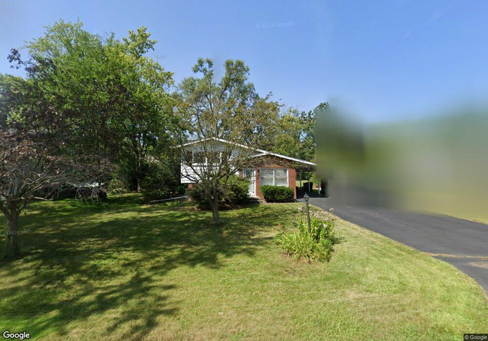
1928 Central Ave Northbrook, IL 60062
Estimated Value: $380,000 - $471,000
3
Beds
1
Bath
1,032
Sq Ft
$425/Sq Ft
Est. Value
About This Home
This home is located at 1928 Central Ave, Northbrook, IL 60062 and is currently estimated at $438,964, approximately $425 per square foot. 1928 Central Ave is a home located in Cook County with nearby schools including Henry Winkelman Elementary School, Field Middle School, and Glenbrook North High School.
Ownership History
Date
Name
Owned For
Owner Type
Purchase Details
Closed on
Jul 17, 2009
Sold by
Lasalle Bank National Association
Bought by
Chen Yang Chi and Chen Hai
Current Estimated Value
Home Financials for this Owner
Home Financials are based on the most recent Mortgage that was taken out on this home.
Original Mortgage
$160,000
Outstanding Balance
$104,320
Interest Rate
5.29%
Mortgage Type
Unknown
Estimated Equity
$334,644
Purchase Details
Closed on
Jan 15, 2009
Sold by
Leszkiewicz Arkadiusz
Bought by
Lasalle Bank National Association
Purchase Details
Closed on
Sep 1, 2006
Sold by
Vanalstine Arlene F
Bought by
Leszkiewicz Arkadiusz
Home Financials for this Owner
Home Financials are based on the most recent Mortgage that was taken out on this home.
Original Mortgage
$360,000
Interest Rate
10.42%
Mortgage Type
Unknown
Create a Home Valuation Report for This Property
The Home Valuation Report is an in-depth analysis detailing your home's value as well as a comparison with similar homes in the area
Home Values in the Area
Average Home Value in this Area
Purchase History
| Date | Buyer | Sale Price | Title Company |
|---|---|---|---|
| Chen Yang Chi | $200,000 | Fatic | |
| Lasalle Bank National Association | -- | None Available | |
| Leszkiewicz Arkadiusz | $400,000 | Lawyers |
Source: Public Records
Mortgage History
| Date | Status | Borrower | Loan Amount |
|---|---|---|---|
| Open | Chen Yang Chi | $160,000 | |
| Previous Owner | Leszkiewicz Arkadiusz | $360,000 |
Source: Public Records
Tax History Compared to Growth
Tax History
| Year | Tax Paid | Tax Assessment Tax Assessment Total Assessment is a certain percentage of the fair market value that is determined by local assessors to be the total taxable value of land and additions on the property. | Land | Improvement |
|---|---|---|---|---|
| 2024 | $5,700 | $31,597 | $10,131 | $21,466 |
| 2023 | $5,634 | $31,597 | $10,131 | $21,466 |
| 2022 | $5,634 | $31,597 | $10,131 | $21,466 |
| 2021 | $3,076 | $16,679 | $11,323 | $5,356 |
| 2020 | $2,976 | $16,679 | $11,323 | $5,356 |
| 2019 | $2,841 | $18,130 | $11,323 | $6,807 |
| 2018 | $3,495 | $19,965 | $9,833 | $10,132 |
| 2017 | $3,441 | $19,965 | $9,833 | $10,132 |
| 2016 | $3,428 | $19,965 | $9,833 | $10,132 |
| 2015 | $3,681 | $19,684 | $8,343 | $11,341 |
| 2014 | $3,607 | $19,684 | $8,343 | $11,341 |
| 2013 | $3,519 | $19,684 | $8,343 | $11,341 |
Source: Public Records
Map
Nearby Homes
- 3492 Whirlaway Dr
- 1696 Highland Ave
- 3741 Mission Hills Rd Unit 110
- 3741 Mission Hills Rd Unit 209
- 1620 Provenance Way
- 240 Violet Ln
- 3810 Mission Hills Rd Unit 502
- 1671 Mission Hills Rd Unit S
- 1671 Mission Hills Rd Unit 501
- 2250 White Oak Dr
- 3860 Mission Hills Rd Unit 417
- 3801 Mission Hills Rd Unit 204
- 3801 Mission Hills Rd Unit 304
- 3851 Mission Hills Rd Unit 409
- 3801 Mission Hills Rd Unit 510
- 1891 Mission Hills Ln Unit 4
- 3900 Mission Hills Rd Unit 407
- 1935 Mission Hills Ln Unit 6C
- 2410 White Oak Dr
- 3955 Mission Hills Rd Unit D
- 1918 Central Ave
- 1944 Central Ave
- 1932 Deercrest Ln
- 1934 Deercrest Ln
- 1912 Central Ave
- 1960 Central Ave
- 1937 Central Ave
- 1925 Central Ave
- 1928 Deercrest Ln
- 1949 Central Ave
- 1913 Central Ave
- 1972 Central Ave
- 1961 Central Ave
- 3495 Garden St
- 3511 Garden St
- 1901 Central Ave
- 1926 Deercrest Ln
- 1936 Highland Ave
- 1973 Central Ave
- 1924 Highland Ave