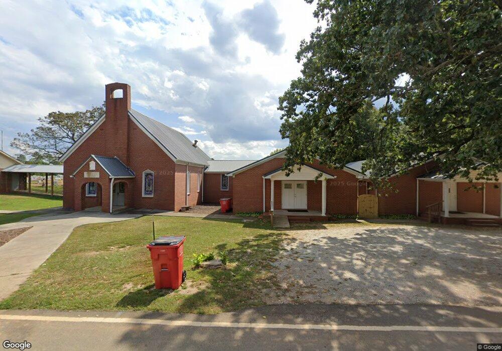
1928 High Point Rd Bowdon, GA 30108
Estimated Value: $1,008,000 - $1,626,258
Studio
2
Baths
13,767
Sq Ft
$96/Sq Ft
Est. Value
About This Home
This home is located at 1928 High Point Rd, Bowdon, GA 30108 and is currently estimated at $1,317,129, approximately $95 per square foot. 1928 High Point Rd is a home with nearby schools including Bowdon Elementary School, Bowdon Middle School, and Bowdon High School.
Ownership History
Date
Name
Owned For
Owner Type
Purchase Details
Closed on
Oct 22, 2014
Sold by
Missionary Baptist Church
Bought by
Mountain View Baptist Church O
Current Estimated Value
Home Financials for this Owner
Home Financials are based on the most recent Mortgage that was taken out on this home.
Original Mortgage
$113,000
Outstanding Balance
$86,643
Interest Rate
4.26%
Mortgage Type
New Conventional
Estimated Equity
$1,230,486
Purchase Details
Closed on
Dec 19, 2005
Sold by
Mt View Baptist Church
Bought by
Mt View Baptist Church
Purchase Details
Closed on
May 24, 1949
Bought by
Mt View Bpt Church
Create a Home Valuation Report for This Property
The Home Valuation Report is an in-depth analysis detailing your home's value as well as a comparison with similar homes in the area
Home Values in the Area
Average Home Value in this Area
Purchase History
| Date | Buyer | Sale Price | Title Company |
|---|---|---|---|
| Mountain View Baptist Church O | -- | -- | |
| Mt View Baptist Church | -- | -- | |
| Mt View Bpt Church | -- | -- |
Source: Public Records
Mortgage History
| Date | Status | Borrower | Loan Amount |
|---|---|---|---|
| Open | Mountain View Baptist Church O | $113,000 |
Source: Public Records
Tax History
| Year | Tax Paid | Tax Assessment Tax Assessment Total Assessment is a certain percentage of the fair market value that is determined by local assessors to be the total taxable value of land and additions on the property. | Land | Improvement |
|---|---|---|---|---|
| 2025 | -- | $771,120 | $130,784 | $640,336 |
| 2024 | -- | $771,120 | $130,784 | $640,336 |
| 2023 | $0 | $687,334 | $104,626 | $582,708 |
| 2022 | $13,478 | $537,419 | $69,750 | $467,669 |
| 2021 | $10,976 | $428,135 | $32,604 | $395,531 |
| 2020 | $10,238 | $385,902 | $32,604 | $353,298 |
| 2019 | $9,341 | $352,110 | $32,604 | $319,506 |
| 2018 | $8,095 | $307,199 | $32,604 | $274,595 |
| 2017 | $8,095 | $307,199 | $32,604 | $274,595 |
| 2016 | $8,095 | $307,199 | $32,604 | $274,595 |
| 2015 | -- | $213,130 | $32,604 | $180,526 |
| 2014 | -- | $109,192 | $32,604 | $76,588 |
Source: Public Records
Map
Nearby Homes
- 1121 Kansas-Jake Rd
- 339 Cavender Ln
- 369 Cavender Ln
- 1509 High Point Rd
- 695 Frost Rd
- 0 Turkey Ct Unit LOT 42 & 46
- 2908 N Highway 100
- 80 Hand Rd
- 0 N Highway 100 Unit TRACT 2 10571032
- 0 N Highway 100 Unit TRACT 3 10571036
- 0 N Highway 100 Unit TRACT 4 10571038
- 3920 County Road 48
- 0 Kansas Jake Rd Unit 26132658
- 0 Kansas Jake Rd Unit 10676294
- 0 Kansas Jake Rd Unit 10686699
- 0 Kansas Jake Rd Unit 26114165
- 0 Kansas Jake Rd Unit 26114173
- 0 Kansas Jake Rd Unit 26114180
- 211 Kelly Creek Rd
- 80 Beaver Run Rd
- 1953 High Point Rd
- 1857 High Point Rd
- 1801 High Point Rd
- 8235 Smithfield Rd
- 2038 High Point Rd
- 1824 High Point Rd
- 8109 Smithfield Rd
- 8099 Smithfield Rd
- 8155 Smithfield Rd
- 130 Adamson Rd
- 8155 Smithfield Rd
- 8170 Smithfield Rd
- 1669 High Point Rd
- 1669 High Point Rd
- 2130 High Point Rd
- 100 Adamson Rd
- 0 Adamson Rd Unit 33.39 AC 7308911
- 0 Adamson Rd Unit 3.11 AC 7308879
- 0 Adamson Rd Unit 36.50 AC 7308944
- 0 Adamson Rd
Your Personal Tour Guide
Ask me questions while you tour the home.