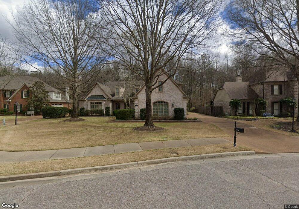
1928 McCool Forest Ln Collierville, TN 38017
Estimated Value: $676,668 - $780,000
4
Beds
5
Baths
4,886
Sq Ft
$148/Sq Ft
Est. Value
About This Home
This home is located at 1928 McCool Forest Ln, Collierville, TN 38017 and is currently estimated at $724,917, approximately $148 per square foot. 1928 McCool Forest Ln is a home located in Shelby County with nearby schools including Bailey Station Elementary School, West Collierville Middle School, and Collierville High School.
Ownership History
Date
Name
Owned For
Owner Type
Purchase Details
Closed on
Jul 20, 2022
Sold by
Herringshaw Michael J and Herringshaw Doris A
Bought by
Doris And Michael Herringshaw Living Trust
Current Estimated Value
Purchase Details
Closed on
Aug 17, 2001
Sold by
Sanvidge William J and Sanvidge Paula J
Bought by
Herringshaw Michael J and Herringshaw Doris A
Home Financials for this Owner
Home Financials are based on the most recent Mortgage that was taken out on this home.
Original Mortgage
$328,000
Interest Rate
6.12%
Purchase Details
Closed on
Sep 22, 1998
Sold by
Riverbirch Homes Llc
Bought by
Sanvidge William J and Sanvidge Paula J
Home Financials for this Owner
Home Financials are based on the most recent Mortgage that was taken out on this home.
Original Mortgage
$297,600
Interest Rate
6.95%
Create a Home Valuation Report for This Property
The Home Valuation Report is an in-depth analysis detailing your home's value as well as a comparison with similar homes in the area
Home Values in the Area
Average Home Value in this Area
Purchase History
| Date | Buyer | Sale Price | Title Company |
|---|---|---|---|
| Doris And Michael Herringshaw Living Trust | -- | Williams Mcdaniel Pllc | |
| Herringshaw Michael J | $410,000 | -- | |
| Herringshaw Michael J | $410,000 | -- | |
| Sanvidge William J | $372,000 | Southern Escrow Title Compan | |
| Sanvidge William J | $372,000 | Southern Escrow Title Compan |
Source: Public Records
Mortgage History
| Date | Status | Borrower | Loan Amount |
|---|---|---|---|
| Previous Owner | Herringshaw Michael J | $328,000 | |
| Previous Owner | Sanvidge William J | $297,600 | |
| Closed | Herringshaw Michael J | $40,500 |
Source: Public Records
Tax History
| Year | Tax Paid | Tax Assessment Tax Assessment Total Assessment is a certain percentage of the fair market value that is determined by local assessors to be the total taxable value of land and additions on the property. | Land | Improvement |
|---|---|---|---|---|
| 2025 | $4,745 | $186,575 | $21,275 | $165,300 |
| 2024 | -- | $139,975 | $21,275 | $118,700 |
| 2023 | $7,321 | $139,975 | $21,275 | $118,700 |
| 2022 | $7,153 | $139,975 | $21,275 | $118,700 |
| 2021 | $7,237 | $139,975 | $21,275 | $118,700 |
| 2020 | $7,130 | $121,250 | $21,275 | $99,975 |
| 2019 | $4,911 | $121,250 | $21,275 | $99,975 |
| 2018 | $4,911 | $121,250 | $21,275 | $99,975 |
| 2017 | $4,983 | $121,250 | $21,275 | $99,975 |
| 2016 | $4,871 | $111,475 | $0 | $0 |
| 2014 | $4,871 | $111,475 | $0 | $0 |
Source: Public Records
Map
Nearby Homes
- 2168 Neshoba Nook Cir
- 1923 Swynford Ln
- 1842 Swynford Ln
- 1842 Liles Ln
- 1887 Almadale Lake Dr
- 1813 Farish Downs Ct
- 2283 Shrewsbury Run E
- 2286 Lake Page Dr
- 10440 Ansley Cove
- 1784 Penshurst Dr
- 1854 Almadale Farms Pkwy
- 1941 Lonhill Dr
- 10094 Bushrod Cove
- 2069 Standing Rock Ave
- 2540 Halle Pkwy
- 2381 Logwood Briar Cove N
- 2590 Halle Pkwy
- 2151 Houston Pass
- 2195 Houston Pass
- 2410 Halle Pkwy
- 1918 McCool Forest Ln
- 1936 McCool Forest Ln
- 1925 McCool Forest Ln
- 1908 McCool Forest Ln
- 1913 McCool Forest Ln
- 1712 Napier Woods Dr
- 1896 McCool Forest Ln
- 1905 McCool Forest Ln
- 1729 Napier Woods Dr
- 1722 Napier Woods Dr
- 1738 Hartwell Manor Cove
- 1893 McCool Forest Ln
- 1732 Napier Woods Dr
- 1886 McCool Forest Ln
- 1735 Hartwell Manor Cove
- 1739 Napier Woods Dr
- 1742 Napier Woods Dr
- 1878 McCool Forest Ln
- 1883 McCool Forest Ln
- 1746 Hartwell Manor Cove
Your Personal Tour Guide
Ask me questions while you tour the home.