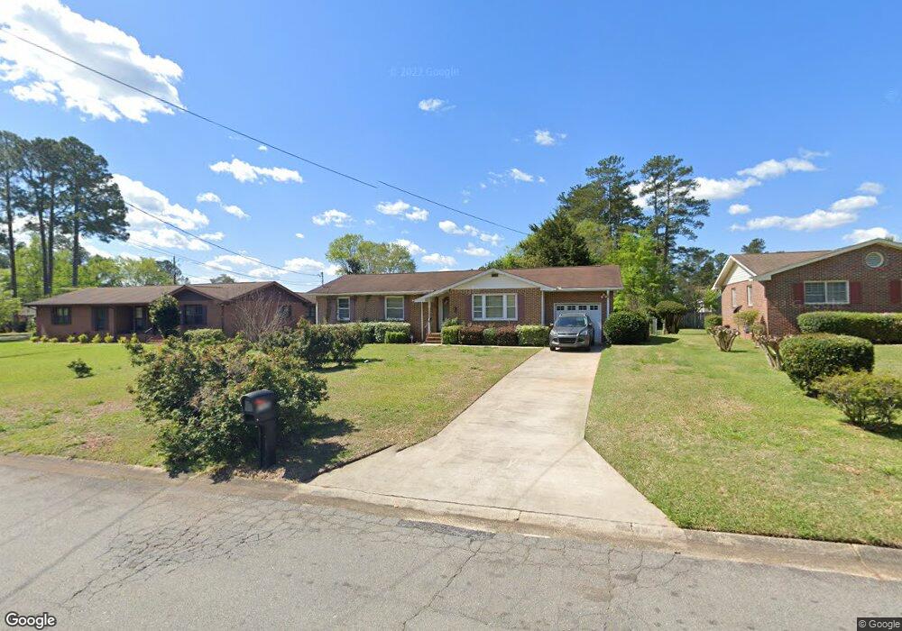
1928 Robin Cir Milledgeville, GA 31061
Estimated Value: $205,029 - $249,000
--
Bed
--
Bath
1,487
Sq Ft
$158/Sq Ft
Est. Value
About This Home
This home is located at 1928 Robin Cir, Milledgeville, GA 31061 and is currently estimated at $234,257, approximately $157 per square foot. 1928 Robin Cir is a home located in Baldwin County with nearby schools including Lakeview Primary, Lakeview Academy, and Oak Hill Middle School.
Ownership History
Date
Name
Owned For
Owner Type
Purchase Details
Closed on
Mar 17, 2017
Sold by
Spillars Etta T
Bought by
Benson Gloria F
Current Estimated Value
Home Financials for this Owner
Home Financials are based on the most recent Mortgage that was taken out on this home.
Original Mortgage
$105,000
Outstanding Balance
$87,023
Interest Rate
4.15%
Mortgage Type
VA
Estimated Equity
$147,234
Purchase Details
Closed on
Jan 11, 2002
Sold by
Fennell Derrick S
Bought by
Spillers Etta
Purchase Details
Closed on
Jan 29, 1996
Sold by
Collins Amelia
Bought by
Fennell Derrick S
Create a Home Valuation Report for This Property
The Home Valuation Report is an in-depth analysis detailing your home's value as well as a comparison with similar homes in the area
Home Values in the Area
Average Home Value in this Area
Purchase History
| Date | Buyer | Sale Price | Title Company |
|---|---|---|---|
| Benson Gloria F | $105,000 | -- | |
| Spillers Etta | $87,900 | -- | |
| Fennell Derrick S | $74,000 | -- |
Source: Public Records
Mortgage History
| Date | Status | Borrower | Loan Amount |
|---|---|---|---|
| Open | Benson Gloria F | $105,000 |
Source: Public Records
Tax History Compared to Growth
Tax History
| Year | Tax Paid | Tax Assessment Tax Assessment Total Assessment is a certain percentage of the fair market value that is determined by local assessors to be the total taxable value of land and additions on the property. | Land | Improvement |
|---|---|---|---|---|
| 2025 | $2,285 | $64,120 | $12,000 | $52,120 |
| 2024 | $2,285 | $64,120 | $12,000 | $52,120 |
| 2023 | $1,230 | $48,984 | $10,000 | $38,984 |
| 2022 | $1,231 | $49,472 | $10,000 | $39,472 |
| 2021 | $962 | $36,320 | $10,000 | $26,320 |
| 2020 | $949 | $36,320 | $10,000 | $26,320 |
| 2019 | $950 | $36,320 | $10,000 | $26,320 |
| 2018 | $959 | $36,320 | $10,000 | $26,320 |
| 2017 | $644 | $35,240 | $6,000 | $29,240 |
| 2016 | $552 | $30,500 | $3,680 | $26,820 |
| 2015 | $552 | $30,500 | $3,680 | $26,820 |
| 2014 | $551 | $30,500 | $3,680 | $26,820 |
Source: Public Records
Map
Nearby Homes
- 1954 Twin Oaks Dr
- 1863 Tanglewood Rd
- 2275 Leo Ct
- 1750 Elmwood Rd
- 1835 Audobon Rd
- 1745 Cedarwood Rd
- 1740 Holly Hill Rd
- 1784 Cedarwood Rd
- 1756 Stone Meadow Rd
- 1605 Stone Meadow Rd
- 1692 Pine Valley Rd
- 1985 Briarcliff Rd
- 1985 Briarcliff Rd Unit A1
- 1985 Briarcliff Rd Unit B1
- 240 Lakeside Dr
- 1647 Valley Rd
- 131 Carriage Ct NE
- 122 Ivey Weaver Rd NE
- 261 Linda Dr NE
- 1508 N Columbia St
- 1906 Robin Cir
- 1930 Robin Cir
- 1930 Redwood Rd
- 1908 Robin Cir
- 1934 Redwood Rd
- 1929 Robin Cir
- 1931 Robin Cir
- 1904 Robin Cir
- 1932 Robin Cir
- 1909 Robin Cir
- 1907 Robin Cir
- 1933 Robin Cir
- 1937 Redwood Rd Unit Carrington Woods
- 1925 Robin Ct
- 1946 Redwood Rd
- 1905 Robin Cir
- 1941 Redwood Rd
- 1934 Robin Cir
- 1935 Robin Cir
- 1902 Robin Cir