Estimated Value: $477,000 - $491,000
4
Beds
4
Baths
2,158
Sq Ft
$225/Sq Ft
Est. Value
About This Home
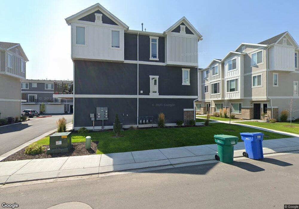
This home is located at 1928 S 1030 W Unit 429, Orem, UT 84058 and is currently estimated at $484,796, approximately $224 per square foot. 1928 S 1030 W Unit 429 is a home located in Utah County with nearby schools including Vineyard Elementary School, Lakeridge Jr High School, and Mountain View High School.
Ownership History
Date
Name
Owned For
Owner Type
Purchase Details
Closed on
Oct 2, 2023
Sold by
Brinkerhoff Family Trust
Bought by
Big Meadow Landings Llc
Current Estimated Value
Purchase Details
Closed on
Nov 14, 2022
Sold by
Brinkerhoff Walter A and Brinkerhoff Coni Jo
Bought by
Big Meadow Landings Llc
Purchase Details
Closed on
Apr 7, 2020
Sold by
Doyle Kirk and Doyle Loretta
Bought by
Brinkerhoff Coni Jo
Home Financials for this Owner
Home Financials are based on the most recent Mortgage that was taken out on this home.
Original Mortgage
$252,750
Interest Rate
3.4%
Mortgage Type
New Conventional
Purchase Details
Closed on
Apr 6, 2020
Sold by
Brinkerhoff Coni Jo
Bought by
Brinkerhoff Walter A and Brinkerhoff Coni Jo
Home Financials for this Owner
Home Financials are based on the most recent Mortgage that was taken out on this home.
Original Mortgage
$252,750
Interest Rate
3.4%
Mortgage Type
New Conventional
Create a Home Valuation Report for This Property
The Home Valuation Report is an in-depth analysis detailing your home's value as well as a comparison with similar homes in the area
Home Values in the Area
Average Home Value in this Area
Purchase History
| Date | Buyer | Sale Price | Title Company |
|---|---|---|---|
| Big Meadow Landings Llc | -- | None Listed On Document | |
| Big Meadow Landings Llc | -- | None Listed On Document | |
| Brinkerhoff Coni Jo | -- | Platinum Title Services | |
| Brinkerhoff Walter A | -- | Old Republic Title |
Source: Public Records
Mortgage History
| Date | Status | Borrower | Loan Amount |
|---|---|---|---|
| Previous Owner | Brinkerhoff Coni Jo | $252,750 |
Source: Public Records
Tax History Compared to Growth
Tax History
| Year | Tax Paid | Tax Assessment Tax Assessment Total Assessment is a certain percentage of the fair market value that is determined by local assessors to be the total taxable value of land and additions on the property. | Land | Improvement |
|---|---|---|---|---|
| 2025 | $1,980 | $248,050 | $66,300 | $384,700 |
| 2024 | $1,980 | $242,165 | $0 | $0 |
| 2023 | $1,780 | $233,915 | $0 | $0 |
| 2022 | $1,888 | $240,405 | $0 | $0 |
| 2021 | $1,704 | $328,600 | $49,300 | $279,300 |
| 2020 | $1,541 | $292,100 | $46,000 | $246,100 |
Source: Public Records
Map
Nearby Homes
- 1871 S 1030 W
- 1217 W 1860 S
- 1965 N 3050 W
- Kirkwood Scandia Plan at Broadview Shores - Cottages
- Kirkwood Farmhouse Plan at Broadview Shores - Cottages
- Sundance Ballpark Plan at Broadview Shores - Cottages
- Nyborg Plan at Broadview Shores - Cottages
- Goteborg Plan at Broadview Shores - Cottages
- Keystone Scandia Plan at Broadview Shores - Cottages
- 3157 W 1690 N
- 3206 W 1670 N
- 3191 W 1670 N
- 1501 N 3250 W
- 1458 N 3300 W
- 543 W 1770 S
- 537 W 1770 S
- 1418 N 3250 W
- 1415 N 3300 W
- 1825 Garden Plan at Broadview Shores
- 3182 W 1570 N
- 1932 S 1030 W Unit 428
- 1932 S 1030 W
- 1934 S 1030 W Unit 427
- 1946 S 1030 W Unit 430
- 1936 S 1030 W Unit 426
- 1926 S 1030 W Unit 420
- 1948 S 1030 W Unit 431
- 1922 S 1030 W Unit 422
- 1938 S 1030 W Unit 425
- 1918 S 1030 W Unit 423
- 1952 S 1030 W Unit 432
- 1022 W 1950 S
- 1916 S 1030 W Unit 424
- 1929 S 1030 W
- 1927 S 1030 W
- 1018 W 1950 S
- 1942 S 1030 W
- 1942 S 1030 W Unit 433
- 1923 S 1030 W
- 1914 S 1030 W Unit 419