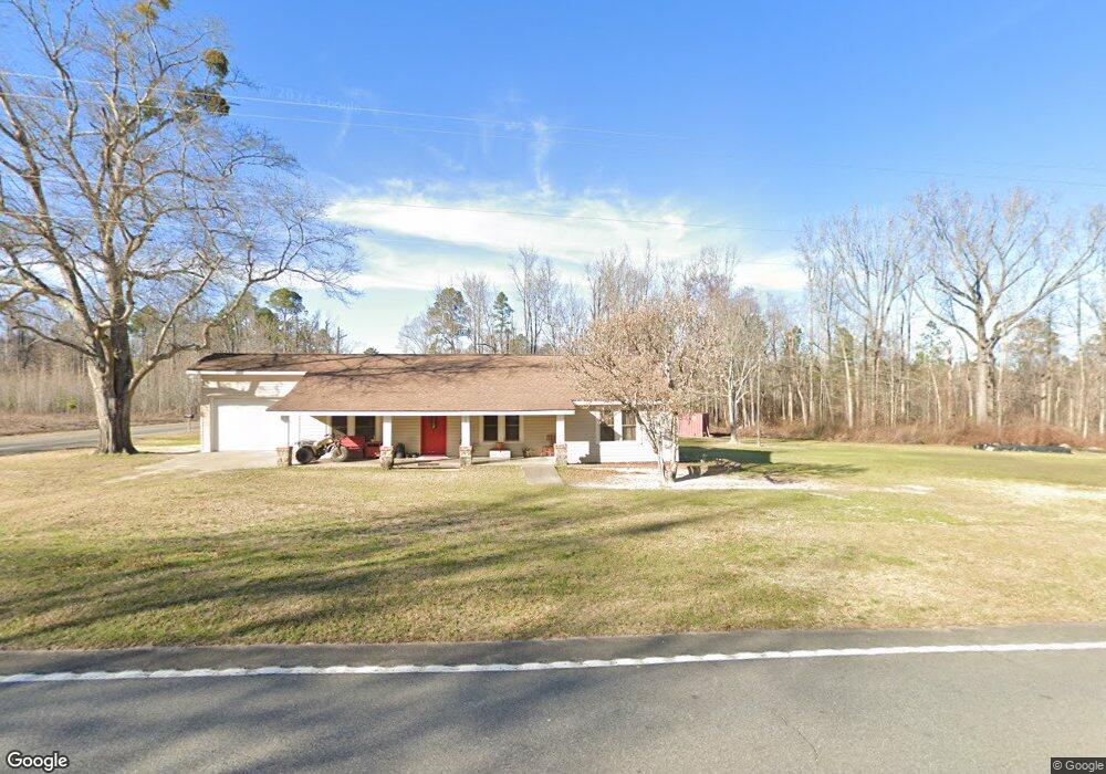
1928 Us Highway 80 E East Dublin, GA 31027
Estimated Value: $149,000 - $232,000
--
Bed
1
Bath
1,748
Sq Ft
$104/Sq Ft
Est. Value
About This Home
This home is located at 1928 Us Highway 80 E, East Dublin, GA 31027 and is currently estimated at $180,955, approximately $103 per square foot. 1928 Us Highway 80 E is a home located in Laurens County with nearby schools including Northwest Laurens Elementary School, Southwest Laurens Elementary School, and East Laurens Primary School.
Ownership History
Date
Name
Owned For
Owner Type
Purchase Details
Closed on
Jul 30, 2008
Sold by
Watson Lance
Bought by
Laurens County
Current Estimated Value
Purchase Details
Closed on
Jun 26, 2008
Sold by
Carter Ricky
Bought by
Watson Lance
Purchase Details
Closed on
Jul 14, 2006
Sold by
Wicker Jeffrey T
Bought by
Carter Ricky
Purchase Details
Closed on
May 23, 2000
Sold by
Wicker W M
Bought by
Wicker Jeffrey T
Purchase Details
Closed on
Jun 5, 1997
Sold by
Stevens Cecil
Bought by
Wicker W M
Purchase Details
Closed on
Sep 9, 1994
Bought by
Stevens Cecil Wayne
Create a Home Valuation Report for This Property
The Home Valuation Report is an in-depth analysis detailing your home's value as well as a comparison with similar homes in the area
Home Values in the Area
Average Home Value in this Area
Purchase History
| Date | Buyer | Sale Price | Title Company |
|---|---|---|---|
| Laurens County | -- | -- | |
| Watson Lance | $108,544 | -- | |
| Carter Ricky | $68,000 | -- | |
| Wicker Jeffrey T | $35,200 | -- | |
| Wicker W M | $35,200 | -- | |
| Stevens Cecil Wayne | -- | -- |
Source: Public Records
Tax History Compared to Growth
Tax History
| Year | Tax Paid | Tax Assessment Tax Assessment Total Assessment is a certain percentage of the fair market value that is determined by local assessors to be the total taxable value of land and additions on the property. | Land | Improvement |
|---|---|---|---|---|
| 2024 | $888 | $44,193 | $11,559 | $32,634 |
| 2023 | $887 | $43,756 | $11,559 | $32,197 |
| 2022 | $930 | $43,419 | $11,222 | $32,197 |
| 2021 | $956 | $43,569 | $9,819 | $33,750 |
| 2020 | $957 | $43,569 | $9,819 | $33,750 |
| 2019 | $958 | $43,569 | $9,819 | $33,750 |
| 2018 | $782 | $35,461 | $9,819 | $25,642 |
| 2017 | $781 | $35,461 | $9,819 | $25,642 |
| 2016 | $782 | $35,461 | $9,819 | $25,642 |
| 2015 | $782 | $35,461 | $9,819 | $25,642 |
| 2014 | $661 | $29,256 | $13,204 | $16,052 |
Source: Public Records
Map
Nearby Homes
- 509 Maddox Rd
- 1787 Buddy Johnson Rd
- 0 Hubert Fulford Rd Unit 22123639
- 0 Old Carter Rd
- NA Rd
- 117 Lovett Scott Rd
- 0 Ralph Keen Rd Unit 21905127
- 1739 Snellbridge Rd
- 0 Snellbridge Rd Unit 30130
- 00 Snellbridge Rd
- 0 Snellbridge Rd Unit 10569491
- 0 Snellbridge Rd Unit 10569490
- 859 Silver Rd
- Pendleton Rreek Rd
- 0 Pendleton Creek Rd Unit SA340356
- 437 Mccord Rd
- 3.5 ACRES Brewton Lovett Rd
- 12.37 ACRES- LO Perry Horton Rd
- 1613 Georgia 29
- 132 Shaddock Creek Cir
- 1899 Us Highway 80 E
- 1964 U S 80
- 519 Maddox Rd
- 1977 Us Highway 80 E
- 535 Maddox Rd
- 504 Maddox Rd
- 1981 Us Highway 80 E
- 1999 Us Highway 80 E
- 1999 Us Highway 80 E
- 467 Maddox Rd
- 0 Maddox Rd Unit 7605747
- 00 Lovett Scott Rd & Alyssa Ln
- 0 Saint Paul Rd
- 167 Keens Crossing Rd
- 1753 U S 80
- 1753 Hwy 80e
- 1753 Us Highway 80 E
- 2099 Us Highway 80 E