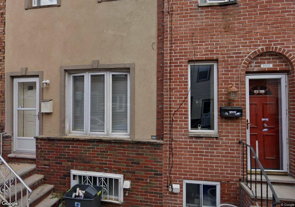
1929 Durfor St Philadelphia, PA 19145
South Philadelphia West NeighborhoodEstimated Value: $254,727 - $330,000
3
Beds
1
Bath
1,008
Sq Ft
$273/Sq Ft
Est. Value
About This Home
This home is located at 1929 Durfor St, Philadelphia, PA 19145 and is currently estimated at $274,932, approximately $272 per square foot. 1929 Durfor St is a home located in Philadelphia County with nearby schools including Stephen Girard School, Universal Vare Charter School, and Universal Audenried Charter High School.
Ownership History
Date
Name
Owned For
Owner Type
Purchase Details
Closed on
Jul 26, 2018
Sold by
Point Breeze Holding Llc
Bought by
Romans Matthew
Current Estimated Value
Home Financials for this Owner
Home Financials are based on the most recent Mortgage that was taken out on this home.
Original Mortgage
$241,775
Outstanding Balance
$209,095
Interest Rate
4.5%
Mortgage Type
New Conventional
Estimated Equity
$65,837
Purchase Details
Closed on
Mar 14, 2011
Sold by
Cortese Jo Anna
Bought by
Centeno Joseph L and Meoli Eva E
Home Financials for this Owner
Home Financials are based on the most recent Mortgage that was taken out on this home.
Original Mortgage
$170,563
Interest Rate
5.12%
Mortgage Type
FHA
Purchase Details
Closed on
Jun 25, 2009
Sold by
Arlington Loan Servicing Llc
Bought by
Cortese Jo Anna
Home Financials for this Owner
Home Financials are based on the most recent Mortgage that was taken out on this home.
Original Mortgage
$87,505
Interest Rate
4.86%
Mortgage Type
FHA
Purchase Details
Closed on
Apr 27, 2009
Sold by
Muraglia Melissa and Jpmorgan Chase Bank National A
Bought by
Arlington Loan Servicing Llc
Home Financials for this Owner
Home Financials are based on the most recent Mortgage that was taken out on this home.
Original Mortgage
$87,505
Interest Rate
4.86%
Mortgage Type
FHA
Purchase Details
Closed on
Sep 15, 2004
Sold by
Muraglia Robert and Muraglia Anna C
Bought by
Muraglia Melissa
Create a Home Valuation Report for This Property
The Home Valuation Report is an in-depth analysis detailing your home's value as well as a comparison with similar homes in the area
Home Values in the Area
Average Home Value in this Area
Purchase History
| Date | Buyer | Sale Price | Title Company |
|---|---|---|---|
| Romans Matthew | $254,500 | None Available | |
| Centeno Joseph L | $175,000 | None Available | |
| Cortese Jo Anna | $106,000 | None Available | |
| Arlington Loan Servicing Llc | $68,000 | None Available | |
| Muraglia Melissa | -- | -- |
Source: Public Records
Mortgage History
| Date | Status | Borrower | Loan Amount |
|---|---|---|---|
| Open | Romans Matthew | $241,775 | |
| Previous Owner | Centeno Joseph L | $170,563 | |
| Previous Owner | Cortese Jo Anna | $87,505 |
Source: Public Records
Tax History Compared to Growth
Tax History
| Year | Tax Paid | Tax Assessment Tax Assessment Total Assessment is a certain percentage of the fair market value that is determined by local assessors to be the total taxable value of land and additions on the property. | Land | Improvement |
|---|---|---|---|---|
| 2026 | $3,873 | $225,200 | $45,000 | $180,200 |
| 2025 | $3,873 | $225,200 | $45,000 | $180,200 |
| 2024 | $3,873 | $225,200 | $45,000 | $180,200 |
| 2023 | $3,873 | $276,700 | $55,340 | $221,360 |
| 2022 | $1,852 | $231,700 | $55,340 | $176,360 |
| 2021 | $2,482 | $0 | $0 | $0 |
| 2020 | $2,482 | $0 | $0 | $0 |
| 2019 | $2,307 | $0 | $0 | $0 |
| 2018 | $2,062 | $0 | $0 | $0 |
| 2017 | $2,062 | $0 | $0 | $0 |
| 2016 | $2,062 | $0 | $0 | $0 |
| 2015 | $1,974 | $0 | $0 | $0 |
| 2014 | -- | $147,300 | $12,067 | $135,233 |
| 2012 | -- | $12,992 | $1,029 | $11,963 |
Source: Public Records
Map
Nearby Homes
- 1841 Wolf St
- 1940 Wolf St
- 2223 S 20th St
- 2329 S Woodstock St
- 2415 S Opal St
- 2306 S Woodstock St
- 2151 S Opal St
- 1738 Wolf St
- 2344 S Woodstock St
- 2325 S Lambert St
- 1803 Gladstone St
- 2218 S Bouvier St
- 2235 S Bouvier St
- 1725 W Ritner St
- 1821 W Porter St
- 2106 S Garnet St
- 2446 S Woodstock St
- 2233 S Norwood St
- 2051 S Dorrance St
- 2051 S Cleveland St