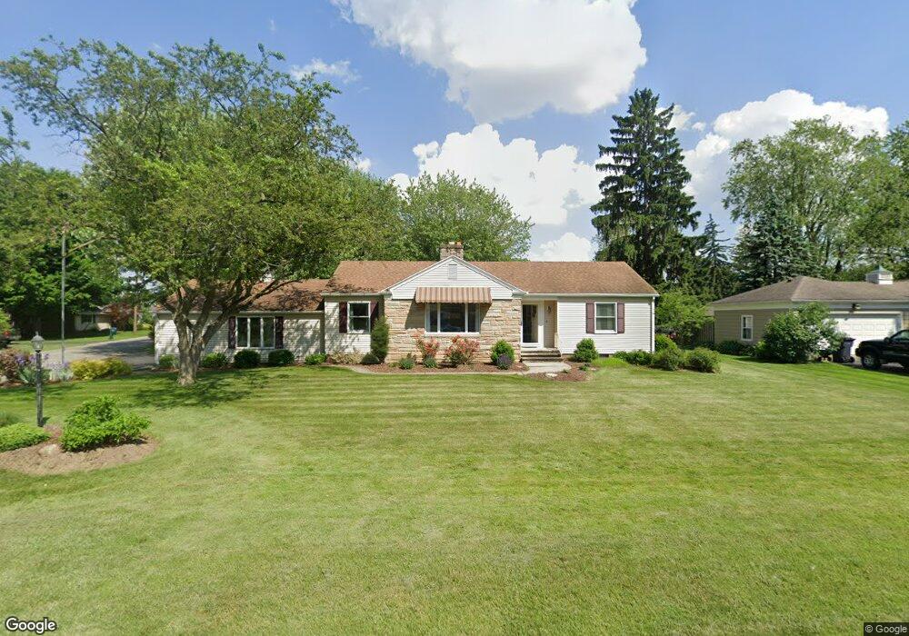
1929 Riverbend Pkwy Fremont, OH 43420
Estimated Value: $215,000 - $245,000
3
Beds
2
Baths
2,181
Sq Ft
$104/Sq Ft
Est. Value
About This Home
This home is located at 1929 Riverbend Pkwy, Fremont, OH 43420 and is currently estimated at $227,161, approximately $104 per square foot. 1929 Riverbend Pkwy is a home located in Sandusky County with nearby schools including Fremont Ross High School, St. Ann Catholic School, and Bishop Hoffman Catholic School - This is St Joe's School now.
Ownership History
Date
Name
Owned For
Owner Type
Purchase Details
Closed on
Jan 16, 2009
Sold by
Schepflin Richard C
Bought by
Zamora Louis T and Zamora Beth A
Current Estimated Value
Home Financials for this Owner
Home Financials are based on the most recent Mortgage that was taken out on this home.
Original Mortgage
$155,000
Outstanding Balance
$97,185
Interest Rate
5.03%
Mortgage Type
Purchase Money Mortgage
Estimated Equity
$129,976
Create a Home Valuation Report for This Property
The Home Valuation Report is an in-depth analysis detailing your home's value as well as a comparison with similar homes in the area
Home Values in the Area
Average Home Value in this Area
Purchase History
| Date | Buyer | Sale Price | Title Company |
|---|---|---|---|
| Zamora Louis T | $82,500 | First American | |
| Zamora Louis T | $82,500 | First American |
Source: Public Records
Mortgage History
| Date | Status | Borrower | Loan Amount |
|---|---|---|---|
| Open | Zamora Louis T | $155,000 | |
| Closed | Zamora Louis T | $155,000 |
Source: Public Records
Tax History Compared to Growth
Tax History
| Year | Tax Paid | Tax Assessment Tax Assessment Total Assessment is a certain percentage of the fair market value that is determined by local assessors to be the total taxable value of land and additions on the property. | Land | Improvement |
|---|---|---|---|---|
| 2024 | $2,369 | $62,970 | $10,470 | $52,500 |
| 2023 | $2,369 | $50,370 | $8,370 | $42,000 |
| 2022 | $2,014 | $50,370 | $8,370 | $42,000 |
| 2021 | $2,484 | $50,370 | $8,370 | $42,000 |
| 2020 | $2,268 | $44,390 | $8,370 | $36,020 |
| 2019 | $2,296 | $44,390 | $8,370 | $36,020 |
| 2018 | $2,299 | $44,390 | $8,370 | $36,020 |
| 2017 | $2,168 | $41,100 | $8,370 | $32,730 |
| 2016 | $1,962 | $41,100 | $8,370 | $32,730 |
| 2015 | $1,937 | $41,100 | $8,370 | $32,730 |
| 2014 | $2,022 | $41,370 | $7,770 | $33,600 |
| 2013 | $1,988 | $41,370 | $7,770 | $33,600 |
Source: Public Records
Map
Nearby Homes
- 1730 Port Clinton Rd Unit 41
- 1730 Port Clinton Rd
- 1730 Port Clinton Rd Unit 33
- 711 Bloom Rd
- 0 Sean Dr
- Outlot A Sean Dr
- 2100 Ohio 53
- 612 2nd St
- 533 Sandusky Ave Unit 535
- 900 Spring St
- 433 Sandusky Ave
- 711 Rawson Ave
- 1441 White Ave
- 340 340 Sandusky Ave
- 1227 White Ave
- 516 N Front St
- 322 4th St
- 224 Sandusky Ave Unit 226
- 427 N Clover St
- 818 Franklin Ave
- 1921 Riverbend Pkwy
- 1926 Riverbend Pkwy
- 224 Yacht Club Dr
- 214 Yacht Club Dr
- 1913 Riverbend Pkwy
- 1918 Riverbend Pkwy
- 210 Yacht Club Dr
- 236 Yacht Club Dr
- 1914 Riverbend Pkwy
- 1909 Riverbend Pkwy
- 1931 Whittaker Dr
- 1910 Riverbend Pkwy
- 1925 Burdick Dr
- 1923 Burdick Dr
- 1900 Riverbend Pkwy
- 1927 Burdick Dr
- 248 Yacht Club Dr
- 1915 Whittaker Dr
- 1939 Whittaker Dr
- 1905 Whittaker Dr