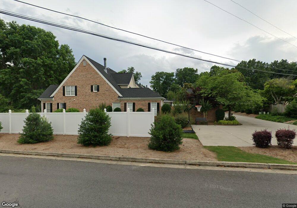
1929 Shields Rd Unit 12 Dalton, GA 30720
Estimated Value: $420,000 - $691,000
--
Bed
4
Baths
2,914
Sq Ft
$177/Sq Ft
Est. Value
About This Home
This home is located at 1929 Shields Rd Unit 12, Dalton, GA 30720 and is currently estimated at $514,383, approximately $176 per square foot. 1929 Shields Rd Unit 12 is a home located in Whitfield County with nearby schools including Brookwood Elementary School, Dalton Middle School, and Dalton High School.
Ownership History
Date
Name
Owned For
Owner Type
Purchase Details
Closed on
Mar 26, 2021
Sold by
Napali Business Solutions Llc
Bought by
Hubbs Robert
Current Estimated Value
Purchase Details
Closed on
Nov 18, 2016
Sold by
Allen James R and Allen Linda L
Bought by
Hubbs Robert Berry and Hubbs Mary F
Purchase Details
Closed on
Jan 7, 2003
Sold by
Lambert Sims Smith
Bought by
Allen James R and Allen Linda L
Purchase Details
Closed on
May 1, 2000
Sold by
Young William O
Bought by
Lambert Sims Smith
Purchase Details
Closed on
May 1, 1999
Bought by
Young William O
Create a Home Valuation Report for This Property
The Home Valuation Report is an in-depth analysis detailing your home's value as well as a comparison with similar homes in the area
Home Values in the Area
Average Home Value in this Area
Purchase History
| Date | Buyer | Sale Price | Title Company |
|---|---|---|---|
| Hubbs Robert | $105,000 | None Listed On Document | |
| Hubbs Robert Berry | $365,000 | -- | |
| Allen James R | $290,000 | -- | |
| Lambert Sims Smith | $250,000 | -- | |
| Young William O | $260,000 | -- |
Source: Public Records
Tax History Compared to Growth
Tax History
| Year | Tax Paid | Tax Assessment Tax Assessment Total Assessment is a certain percentage of the fair market value that is determined by local assessors to be the total taxable value of land and additions on the property. | Land | Improvement |
|---|---|---|---|---|
| 2024 | $825 | $180,656 | $0 | $180,656 |
| 2023 | $825 | $154,533 | $0 | $154,533 |
| 2022 | $2,337 | $125,960 | $0 | $125,960 |
| 2021 | $2,339 | $125,960 | $0 | $125,960 |
| 2020 | $2,445 | $125,960 | $0 | $125,960 |
| 2019 | $2,498 | $125,960 | $0 | $125,960 |
| 2018 | $2,536 | $125,484 | $12,600 | $112,884 |
| 2017 | $2,537 | $125,484 | $12,600 | $112,884 |
| 2016 | $1,006 | $99,593 | $12,600 | $86,993 |
| 2014 | $728 | $99,593 | $12,600 | $86,993 |
| 2013 | -- | $99,593 | $12,600 | $86,993 |
Source: Public Records
Map
Nearby Homes
- 1934 Spring Chase Way
- 1506 Summer Gate Way
- 1506 Summer Gate Way Unit 8
- 1482 Mineral Springs Rd
- 1922 Fairfield Dr
- 1498 Mineral Springs Rd
- 1704 Southmont Dr
- 00 Rio Vista Dr
- 1123 Ridgeleigh Cir
- 111 Broadview Terrace
- 1122 Ridgeleigh Cir
- 1709 Dug Gap Rd
- 1117 Lakemont Dr
- 1105 Desota Dr
- 1608 Ryman Ridge Rd
- 0 Lakemont Dr Unit 1524585
- 0 Lakemont Dr Unit 131479
- 1230 Valencia Dr
- 1230 W Lakeshore Dr W
- 1504 Belmont Dr
- 1929 Shields Rd Unit 11
- 1929 Shields Rd Unit 10
- 1929 Shields Rd Unit 9
- 1929 Shields Rd Unit 8
- 1929 Shields Rd Unit 7
- 1412 Dug Gap Rd
- 1910 Shields Rd
- 1906 Shields Rd Unit 9/14P8/13
- 1906 Shields Rd
- 706 Shields Rd
- 1414 Dug Gap Rd
- 1912 Shields Rd
- 1914 Spring Chase Way
- 1914 Shields Rd
- 1916 Spring Chase Way
- 1416 Dug Gap Rd
- 1918 Spring Chase Way
- 1920 Spring Chase Way
- 1904 Shields Rd Unit 15 & 16
- 1904 Shields Rd