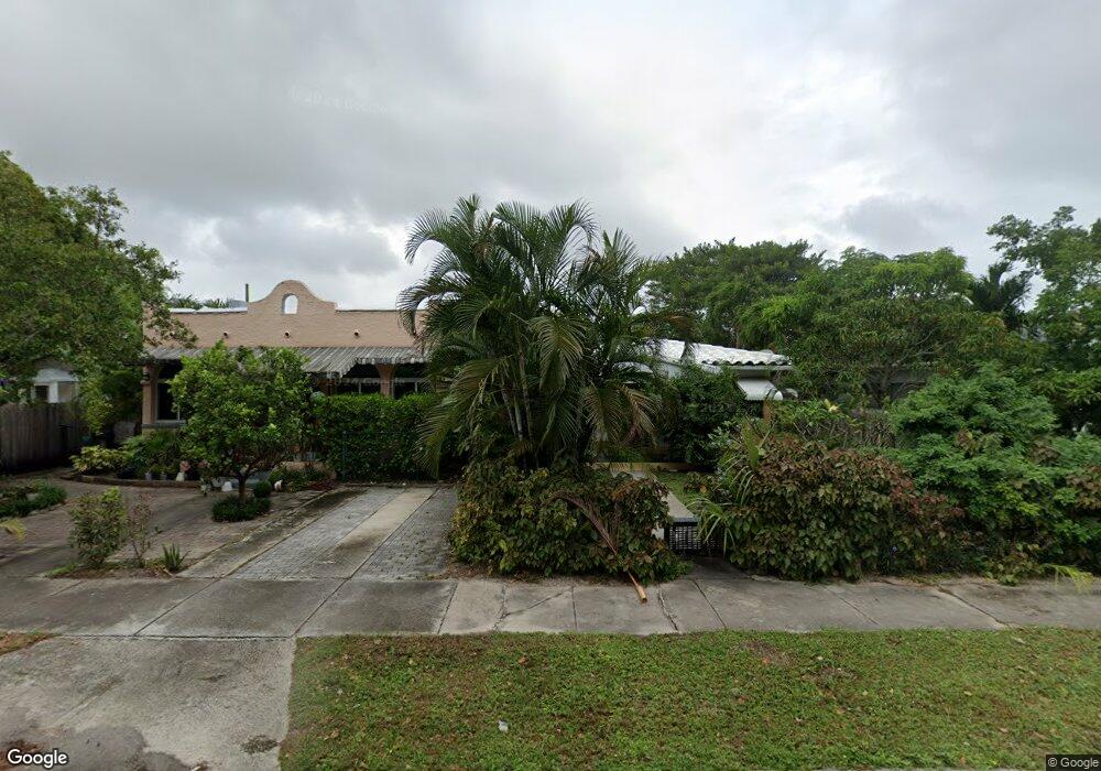
1929 Taylor St Hollywood, FL 33020
Royal Poinciana NeighborhoodEstimated Value: $469,674 - $662,000
2
Beds
--
Bath
1,581
Sq Ft
$362/Sq Ft
Est. Value
About This Home
This home is located at 1929 Taylor St, Hollywood, FL 33020 and is currently estimated at $572,669, approximately $362 per square foot. 1929 Taylor St is a home located in Broward County with nearby schools including Hollywood Central Elementary School, Olsen Middle School, and South Broward High School.
Ownership History
Date
Name
Owned For
Owner Type
Purchase Details
Closed on
Jul 15, 2011
Sold by
Borday Robert
Bought by
Fenimore Kenneth Albert and Gonzalez Carmen
Current Estimated Value
Purchase Details
Closed on
Sep 26, 2005
Sold by
Uquillas Luis I
Bought by
Borday Robert
Home Financials for this Owner
Home Financials are based on the most recent Mortgage that was taken out on this home.
Original Mortgage
$299,250
Interest Rate
6.5%
Mortgage Type
Purchase Money Mortgage
Purchase Details
Closed on
Aug 23, 2004
Sold by
Brow Marie
Bought by
Uquillas Luis I
Home Financials for this Owner
Home Financials are based on the most recent Mortgage that was taken out on this home.
Original Mortgage
$195,000
Interest Rate
7%
Mortgage Type
Commercial
Purchase Details
Closed on
Sep 5, 2003
Sold by
Korte Scott
Bought by
Brow Marie
Home Financials for this Owner
Home Financials are based on the most recent Mortgage that was taken out on this home.
Original Mortgage
$180,500
Interest Rate
7.25%
Mortgage Type
Commercial
Purchase Details
Closed on
Aug 31, 2001
Sold by
Alessi Daniel A
Bought by
Korte Scott A
Home Financials for this Owner
Home Financials are based on the most recent Mortgage that was taken out on this home.
Original Mortgage
$101,250
Interest Rate
10.99%
Mortgage Type
Commercial
Purchase Details
Closed on
Feb 28, 2001
Sold by
Available Not
Bought by
Available Not
Home Financials for this Owner
Home Financials are based on the most recent Mortgage that was taken out on this home.
Original Mortgage
$25,000
Interest Rate
7.11%
Mortgage Type
Commercial
Purchase Details
Closed on
Dec 29, 1997
Sold by
Ruth Mejia Tr
Bought by
Weaver Joanne M
Home Financials for this Owner
Home Financials are based on the most recent Mortgage that was taken out on this home.
Original Mortgage
$72,800
Interest Rate
7.23%
Mortgage Type
Commercial
Purchase Details
Closed on
Apr 12, 1996
Sold by
Opoka Olech
Bought by
Munoz Gloria
Create a Home Valuation Report for This Property
The Home Valuation Report is an in-depth analysis detailing your home's value as well as a comparison with similar homes in the area
Home Values in the Area
Average Home Value in this Area
Purchase History
| Date | Buyer | Sale Price | Title Company |
|---|---|---|---|
| Fenimore Kenneth Albert | $90,700 | Attorney | |
| Borday Robert | $399,000 | Boulevard Title | |
| Uquillas Luis I | $260,000 | Sunbelt Title Agency | |
| Brow Marie | $190,000 | -- | |
| Korte Scott A | $135,000 | Action Title Company | |
| Available Not | $100,000 | -- | |
| Weaver Joanne M | $91,000 | -- | |
| Mejia Ruth | $100 | -- | |
| Munoz Gloria | $84,000 | -- |
Source: Public Records
Mortgage History
| Date | Status | Borrower | Loan Amount |
|---|---|---|---|
| Previous Owner | Borday Robert | $299,250 | |
| Previous Owner | Uquillas Luis I | $195,000 | |
| Previous Owner | Brow Marie | $180,500 | |
| Previous Owner | Munoz Gloria | $27,000 | |
| Previous Owner | Korte Scott A | $101,250 | |
| Previous Owner | Munoz Gloria | $25,000 | |
| Previous Owner | Munoz Gloria | $72,800 |
Source: Public Records
Tax History Compared to Growth
Tax History
| Year | Tax Paid | Tax Assessment Tax Assessment Total Assessment is a certain percentage of the fair market value that is determined by local assessors to be the total taxable value of land and additions on the property. | Land | Improvement |
|---|---|---|---|---|
| 2025 | $6,599 | $238,150 | -- | -- |
| 2024 | $5,932 | $238,150 | -- | -- |
| 2023 | $5,932 | $196,820 | $0 | $0 |
| 2022 | $5,037 | $178,930 | $0 | $0 |
| 2021 | $4,460 | $162,670 | $0 | $0 |
| 2020 | $4,100 | $213,650 | $49,070 | $164,580 |
| 2019 | $3,931 | $209,050 | $49,070 | $159,980 |
| 2018 | $3,174 | $133,330 | $49,070 | $84,260 |
| 2017 | $2,832 | $111,120 | $0 | $0 |
| 2016 | $2,630 | $101,020 | $0 | $0 |
| 2015 | $2,421 | $91,840 | $0 | $0 |
| 2014 | $2,290 | $84,890 | $0 | $0 |
| 2013 | -- | $80,540 | $49,070 | $31,470 |
Source: Public Records
Map
Nearby Homes
- 2000 Polk St
- 1830 Radius Dr Unit 810
- 1830 Radius Dr Unit 516
- 1830 Radius Dr Unit 1301
- 1830 Radius Dr Unit 609
- 1830 Radius Dr Unit 308
- 1830 Radius Dr Unit 604
- 1830 Radius Dr Unit 1024
- 1830 Radius Dr Unit 909
- 1830 Radius Dr Unit 1317
- 1830 Radius Dr Unit 1123
- 1830 Radius Dr Unit 421
- 1830 Radius Dr Unit 314
- 1830 Radius Dr Unit 1017
- 1830 Radius Dr Unit 605
- 1830 Radius Dr Unit 807
- 1830 Radius Dr Unit 1203
- 1830 Radius Dr Unit 820
- 1830 Radius Dr Unit 405
- 1817 Taylor St Unit 1614
- 1927 Taylor St Unit 5
- 1927 Taylor St Unit 4
- 1927 Taylor St Unit 10
- 1927 Taylor St Unit 7
- 1927 Taylor St
- 1948 Tyler St
- 1938 Taylor St
- 1938 Taylor St
- 1920 Tyler St
- 1922 Tyler St
- 1924 Tyler St
- 1895 Tyler St
- 1895 Tyler St Unit 814
- 1895 Tyler St Unit 1207
- 1926 Tyler St
- 1953 Tyler St
- 1949 Taylor St Unit 11
- 1949 Taylor St Unit 12
- 1949 Taylor St Unit 8
- 1949 Taylor St Unit 10