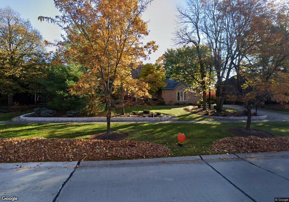
19299 Saratoga Trail Strongsville, OH 44136
Estimated Value: $480,000 - $567,000
4
Beds
3
Baths
3,258
Sq Ft
$157/Sq Ft
Est. Value
About This Home
This home is located at 19299 Saratoga Trail, Strongsville, OH 44136 and is currently estimated at $509,939, approximately $156 per square foot. 19299 Saratoga Trail is a home located in Cuyahoga County with nearby schools including Strongsville High School and Saint Ambrose Catholic School.
Ownership History
Date
Name
Owned For
Owner Type
Purchase Details
Closed on
Oct 30, 1996
Sold by
Knight Benjamin F
Bought by
Lisa C Elias Trustee
Current Estimated Value
Purchase Details
Closed on
Aug 27, 1993
Sold by
Derryberry Eddie W
Bought by
Knight Benjamin F
Purchase Details
Closed on
Jun 10, 1992
Bought by
Derryberry Eddie W
Purchase Details
Closed on
Oct 11, 1991
Bought by
Parkview Corp An Ohio Corp
Purchase Details
Closed on
Dec 19, 1990
Bought by
Kingswood Group , Inc An
Purchase Details
Closed on
Jan 1, 1984
Bought by
Planterra Corp
Create a Home Valuation Report for This Property
The Home Valuation Report is an in-depth analysis detailing your home's value as well as a comparison with similar homes in the area
Home Values in the Area
Average Home Value in this Area
Purchase History
| Date | Buyer | Sale Price | Title Company |
|---|---|---|---|
| Lisa C Elias Trustee | $266,750 | -- | |
| Knight Benjamin F | $304,000 | -- | |
| Derryberry Eddie W | $298,000 | -- | |
| Parkview Corp An Ohio Corp | -- | -- | |
| Kingswood Group , Inc An | -- | -- | |
| Planterra Corp | -- | -- |
Source: Public Records
Tax History Compared to Growth
Tax History
| Year | Tax Paid | Tax Assessment Tax Assessment Total Assessment is a certain percentage of the fair market value that is determined by local assessors to be the total taxable value of land and additions on the property. | Land | Improvement |
|---|---|---|---|---|
| 2024 | $6,990 | $148,890 | $37,240 | $111,650 |
| 2023 | $7,265 | $116,030 | $29,540 | $86,490 |
| 2022 | $7,212 | $116,030 | $29,540 | $86,490 |
| 2021 | $7,156 | $116,030 | $29,540 | $86,490 |
| 2020 | $7,352 | $105,460 | $26,850 | $78,610 |
| 2019 | $7,136 | $301,300 | $76,700 | $224,600 |
| 2018 | $6,260 | $105,460 | $26,850 | $78,610 |
| 2017 | $6,256 | $94,300 | $23,000 | $71,300 |
| 2016 | $6,205 | $92,790 | $23,000 | $69,790 |
| 2015 | $6,192 | $92,790 | $23,000 | $69,790 |
| 2014 | $6,192 | $92,790 | $23,000 | $69,790 |
Source: Public Records
Map
Nearby Homes
- 16711 Beech Cir
- 3550 Boston Rd
- 196 Pinnacle Dr
- 97 Weathervane Ln
- 18411 Yorktown Oval
- 18848 Pearl Rd
- 328 Crestway Oval
- 17934 Cambridge Oval
- 362 Brantley Ln
- 338 Delaware Dr
- 15604-REAR Boston Rd
- 16486 S Red Rock Dr
- 17682 Drake Rd
- 278 Sheri Dr
- 18294 Drake Rd
- 19694 Benbow Rd
- 19740 Benbow Rd
- 18229 Howe Rd
- 17130 Golden Star Dr
- 17159 Turkey Meadow Ln
- 19329 Saratoga Trail
- 19269 Saratoga Trail
- 17566 Pioneers Creek Cir
- 19241 Saratoga Trail
- 17514 Pioneers Creek Cir
- 19286 Saratoga Trail
- 19314 Saratoga Trail
- 19258 Saratoga Trail
- 19359 Saratoga Trail
- 17462 Pioneers Creek
- 17462 Pioneers Creek Cir
- 17573 Pioneers Creek Cir
- 19213 Saratoga Trail
- 19230 Saratoga Trail
- 17531 Pioneers Creek Cir
- 19342 Saratoga Trail
- 17553 Deer Ridge Cir
- 19383 Saratoga Trail
- 19370 Saratoga Trail
- 17410 Pioneers Creek Cir