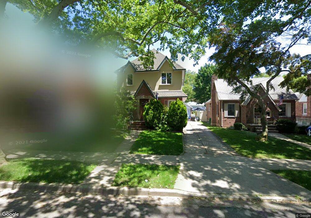
193 Bryant Ave Staten Island, NY 10306
New Dorp NeighborhoodEstimated Value: $771,000 - $946,000
3
Beds
2
Baths
1,350
Sq Ft
$660/Sq Ft
Est. Value
About This Home
This home is located at 193 Bryant Ave, Staten Island, NY 10306 and is currently estimated at $890,793, approximately $659 per square foot. 193 Bryant Ave is a home located in Richmond County with nearby schools including P.S. 41 The Stephanie a Vierno School, Is 2 George L Egbert, and New Dorp High School.
Ownership History
Date
Name
Owned For
Owner Type
Purchase Details
Closed on
Jun 28, 2000
Sold by
Rullo John and Rullo Marianne
Bought by
Syvanen Janne and Syvanen Hanna
Current Estimated Value
Home Financials for this Owner
Home Financials are based on the most recent Mortgage that was taken out on this home.
Original Mortgage
$202,000
Outstanding Balance
$72,026
Interest Rate
8.18%
Estimated Equity
$818,767
Create a Home Valuation Report for This Property
The Home Valuation Report is an in-depth analysis detailing your home's value as well as a comparison with similar homes in the area
Home Values in the Area
Average Home Value in this Area
Purchase History
| Date | Buyer | Sale Price | Title Company |
|---|---|---|---|
| Syvanen Janne | $253,000 | First American Title Ins Co |
Source: Public Records
Mortgage History
| Date | Status | Borrower | Loan Amount |
|---|---|---|---|
| Open | Syvanen Janne | $202,000 |
Source: Public Records
Tax History Compared to Growth
Tax History
| Year | Tax Paid | Tax Assessment Tax Assessment Total Assessment is a certain percentage of the fair market value that is determined by local assessors to be the total taxable value of land and additions on the property. | Land | Improvement |
|---|---|---|---|---|
| 2025 | $9,941 | $70,200 | $9,689 | $60,511 |
| 2024 | $9,941 | $60,060 | $10,977 | $49,083 |
| 2023 | $9,569 | $47,118 | $11,272 | $35,846 |
| 2022 | $9,156 | $54,960 | $13,320 | $41,640 |
| 2021 | $9,492 | $51,000 | $13,320 | $37,680 |
| 2020 | $9,007 | $43,980 | $13,320 | $30,660 |
| 2019 | $8,628 | $47,700 | $13,320 | $34,380 |
| 2018 | $8,004 | $39,265 | $9,600 | $29,665 |
| 2017 | $7,792 | $38,222 | $10,865 | $27,357 |
| 2016 | $7,514 | $37,587 | $10,456 | $27,131 |
| 2015 | $6,596 | $35,460 | $11,100 | $24,360 |
| 2014 | $6,596 | $34,372 | $11,059 | $23,313 |
Source: Public Records
Map
Nearby Homes
- 217 Bancroft Ave
- 157 Clawson St
- 240 Otis Ave
- 257 Locust Ave
- 297 Otis Ave
- 142 Fremont Ave
- 155 Burbank Ave
- 84 Bryant Ave
- 164 Burbank Ave
- 210 Lincoln Ave
- 86 Fremont Ave
- 75 Jacques Ave
- 145 Lincoln Ave Unit 2F
- 145 Lincoln Ave Unit 2K
- 145 Lincoln Ave Unit 6J
- 145 Lincoln Ave Unit 6X
- 145 Lincoln Ave Unit 3X
- 100 Colfax Ave Unit 3J
- 100 Colfax Ave Unit 4B
- 100 Colfax Ave Unit 6H
- 197 Bryant Ave
- 189 Bryant Ave
- 188 Bancroft Ave
- 194 Bancroft Ave
- 218 Edison St Unit 222
- 218-222 Edison St
- 211 Bryant Ave
- 184 Bancroft Ave
- 200 Bancroft Ave
- 180 Bancroft Ave
- 213 Bryant Ave
- 196 Bryant Ave
- 194 Bryant Ave
- 188 Bryant Ave
- 206 Bancroft Ave
- 204 Bryant Ave
- 215 Bryant Ave
- 184 Bryant Ave
- 210 Bancroft Ave
- 180 Bryant Ave