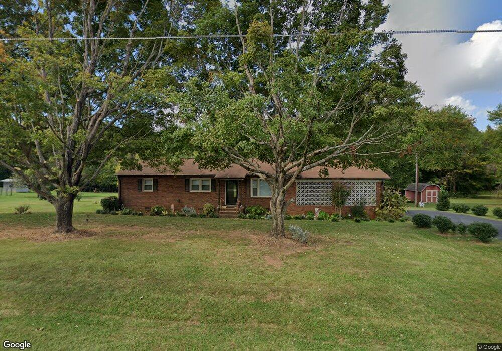
193 Carl Austin Rd Statesville, NC 28625
Estimated Value: $235,554 - $277,000
3
Beds
2
Baths
1,269
Sq Ft
$203/Sq Ft
Est. Value
About This Home
This home is located at 193 Carl Austin Rd, Statesville, NC 28625 and is currently estimated at $258,139, approximately $203 per square foot. 193 Carl Austin Rd is a home located in Iredell County with nearby schools including Cloverleaf Elementary School, East Iredell Middle School, and North Iredell High School.
Ownership History
Date
Name
Owned For
Owner Type
Purchase Details
Closed on
Jun 16, 2020
Sold by
Arnette Wendy and Arnette Casey
Bought by
Redfear Herbert B and Redfear Geneva F
Current Estimated Value
Home Financials for this Owner
Home Financials are based on the most recent Mortgage that was taken out on this home.
Original Mortgage
$156,900
Outstanding Balance
$124,871
Interest Rate
3.2%
Mortgage Type
New Conventional
Estimated Equity
$133,268
Purchase Details
Closed on
Feb 11, 2010
Sold by
Hayes William T and Allison Nancy Hayes
Bought by
Hayes William T and Payne Marith E
Home Financials for this Owner
Home Financials are based on the most recent Mortgage that was taken out on this home.
Original Mortgage
$92,000
Interest Rate
4.91%
Mortgage Type
New Conventional
Purchase Details
Closed on
Jul 1, 1993
Create a Home Valuation Report for This Property
The Home Valuation Report is an in-depth analysis detailing your home's value as well as a comparison with similar homes in the area
Home Values in the Area
Average Home Value in this Area
Purchase History
| Date | Buyer | Sale Price | Title Company |
|---|---|---|---|
| Redfear Herbert B | $157,000 | None Available | |
| Hayes William T | -- | None Available | |
| -- | -- | -- |
Source: Public Records
Mortgage History
| Date | Status | Borrower | Loan Amount |
|---|---|---|---|
| Open | Redfear Herbert B | $156,900 | |
| Previous Owner | Hayes William T | $92,000 |
Source: Public Records
Tax History Compared to Growth
Tax History
| Year | Tax Paid | Tax Assessment Tax Assessment Total Assessment is a certain percentage of the fair market value that is determined by local assessors to be the total taxable value of land and additions on the property. | Land | Improvement |
|---|---|---|---|---|
| 2024 | $1,045 | $166,890 | $50,720 | $116,170 |
| 2023 | $1,045 | $166,890 | $50,720 | $116,170 |
| 2022 | $933 | $139,110 | $50,720 | $88,390 |
| 2021 | $929 | $139,110 | $50,720 | $88,390 |
| 2020 | $741 | $109,230 | $61,070 | $48,160 |
| 2019 | $731 | $109,230 | $61,070 | $48,160 |
| 2018 | $701 | $108,650 | $63,830 | $44,820 |
| 2017 | $701 | $108,650 | $63,830 | $44,820 |
| 2016 | $701 | $108,650 | $63,830 | $44,820 |
| 2015 | $701 | $108,650 | $63,830 | $44,820 |
| 2014 | $685 | $114,000 | $63,830 | $50,170 |
Source: Public Records
Map
Nearby Homes
- 103 Oaklawn Rd
- 131 Little Forest Ln
- 155 Brookview Rd
- 116 Green Meadow Ln
- 678 Turnersburg Hwy
- 209 Brookview Rd
- 587 Jane Sowers Rd
- 160 Tarrington Dr
- 158 W Meadowview Dr
- 139 Valencia Ln
- 105 Rock Ave
- 141 Altondale Dr
- 201 Tarrington Dr
- 109 Oconee Trail
- Lawson Plan at Sullivan Farm
- Frost Plan at Sullivan Farm
- Dickenson Plan at Sullivan Farm
- Whitman Plan at Sullivan Farm
- Crane Plan at Sullivan Farm
- Emerson Plan at Sullivan Farm
- 193 Carl Austin Rd Unit 2
- 185 Carl Austin Rd
- 190 Carl Austin Rd
- 203 Carl Austin Rd
- 182 Carl Austin Rd
- 179 Carl Austin Rd
- 178 Carl Austin Rd
- 206 Carl Austin Rd
- 119 Foxfire Ct
- 174 Carl Austin Rd
- 174 Carl Austin Rd Unit 20
- 212 Carl Austin Rd
- 192 Carl Austin Rd
- 123 Foxfire Ct
- 168 Carl Austin Rd
- 113 Foxfire Ct
- 164 Carl Austin Rd
- 0 Carl Austin Rd
- 109 Foxfire Ct
- 165 Carl Austin Rd