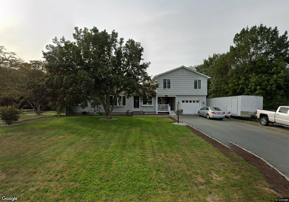
193 Main Rd Westport, MA 02790
Brownell/Giffords Corner NeighborhoodEstimated Value: $596,881 - $664,000
4
Beds
2
Baths
1,756
Sq Ft
$359/Sq Ft
Est. Value
About This Home
This home is located at 193 Main Rd, Westport, MA 02790 and is currently estimated at $630,220, approximately $358 per square foot. 193 Main Rd is a home located in Bristol County with nearby schools including Alice A. Macomber Primary School, Westport Elementary School, and Westport Middle-High School.
Ownership History
Date
Name
Owned For
Owner Type
Purchase Details
Closed on
Sep 13, 2021
Sold by
Samson Kenneth J and Samson Kimberly
Bought by
Samson Kenneth J and Samson Kimberly
Current Estimated Value
Home Financials for this Owner
Home Financials are based on the most recent Mortgage that was taken out on this home.
Original Mortgage
$372,000
Outstanding Balance
$337,987
Interest Rate
2.7%
Mortgage Type
Stand Alone Refi Refinance Of Original Loan
Estimated Equity
$292,233
Purchase Details
Closed on
Sep 23, 2009
Sold by
Costa Ann C
Bought by
Samson Kenneth J and Gardikis Kimberly
Home Financials for this Owner
Home Financials are based on the most recent Mortgage that was taken out on this home.
Original Mortgage
$284,747
Interest Rate
5.31%
Mortgage Type
Purchase Money Mortgage
Purchase Details
Closed on
May 10, 2007
Sold by
Proulx Michele M and Costa Robert G
Bought by
Costa Ann C
Create a Home Valuation Report for This Property
The Home Valuation Report is an in-depth analysis detailing your home's value as well as a comparison with similar homes in the area
Home Values in the Area
Average Home Value in this Area
Purchase History
| Date | Buyer | Sale Price | Title Company |
|---|---|---|---|
| Samson Kenneth J | -- | None Available | |
| Samson Kenneth J | -- | None Available | |
| Samson Kenneth J | $290,000 | -- | |
| Samson Kenneth J | $290,000 | -- | |
| Costa Ann C | -- | -- | |
| Costa Ann C | -- | -- |
Source: Public Records
Mortgage History
| Date | Status | Borrower | Loan Amount |
|---|---|---|---|
| Open | Samson Kenneth J | $372,000 | |
| Previous Owner | Costa Ann C | $286,930 | |
| Previous Owner | Costa Ann C | $284,747 |
Source: Public Records
Tax History Compared to Growth
Tax History
| Year | Tax Paid | Tax Assessment Tax Assessment Total Assessment is a certain percentage of the fair market value that is determined by local assessors to be the total taxable value of land and additions on the property. | Land | Improvement |
|---|---|---|---|---|
| 2025 | $3,522 | $472,700 | $161,800 | $310,900 |
| 2024 | $3,461 | $447,700 | $143,400 | $304,300 |
| 2023 | $3,392 | $415,700 | $124,200 | $291,500 |
| 2022 | $3,236 | $381,600 | $124,200 | $257,400 |
| 2021 | $3,143 | $364,600 | $107,200 | $257,400 |
| 2020 | $2,659 | $315,400 | $97,500 | $217,900 |
| 2019 | $2,421 | $292,700 | $97,500 | $195,200 |
| 2018 | $2,504 | $306,500 | $109,600 | $196,900 |
| 2017 | $2,386 | $299,400 | $106,100 | $193,300 |
| 2016 | $2,205 | $278,700 | $102,600 | $176,100 |
| 2015 | $2,088 | $263,300 | $104,900 | $158,400 |
Source: Public Records
Map
Nearby Homes
- 994 State
- 4 Main Rd
- 118 Charlotte White Rd
- 0 Hidden Glen Ln
- 118 Charlotte White Rd Extension
- 47 Fallon Dr
- 8 Strawberry Ln
- 6 Angel Ct
- 27 Dias Ave
- 978 Sodom Rd
- 380 Gifford Rd
- 15 Village Way
- 7 Village Way
- 8 Village Way
- 218 American Legion Hwy
- 771 Sanford Rd
- 2 Magnolia Ln
- 96 Forge Rd
- 47 Devol Ave
- 29 Union Ave
- 197 Main Rd
- 196 Main Rd
- 205 Main Rd
- 190 Main Rd
- 181 Main Rd
- 000 Confidential
- 000 Kettle Corn
- 0 Halesworth Ln Unit 71362487
- 0 Halesworth Ln Unit 71451304
- Lot 7 Rita Ln
- 0 Halesworth Ln Unit 71615362
- lot 41 R Berard Ct
- 442 & 0 River Rd
- Lot 1 Harvest Hill Rd
- LOT 7 Bentley Ln
- Lot 1 Rita Ln
- 204 Main Rd
- 204 Main Rd
- 178 Main Rd
- 213 Main Rd