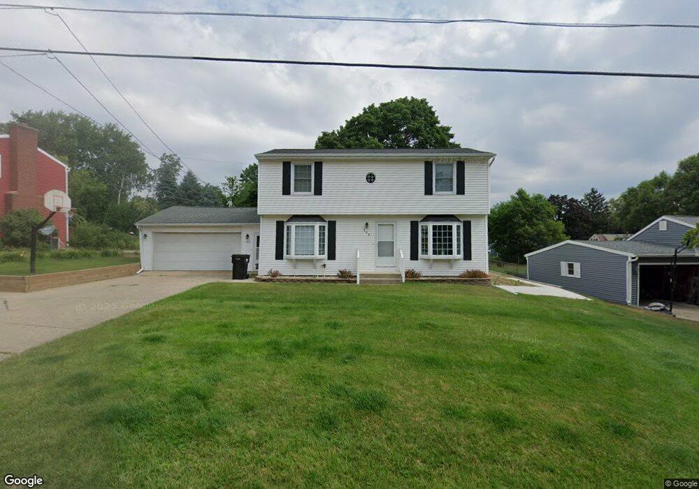
193 Netherfield St NW Unit A Comstock Park, MI 49321
Estimated Value: $273,000 - $377,000
3
Beds
2
Baths
1
Sq Ft
$331,051/Sq Ft
Est. Value
About This Home
This home is located at 193 Netherfield St NW Unit A, Comstock Park, MI 49321 and is currently estimated at $331,051, approximately $331,051 per square foot. 193 Netherfield St NW Unit A is a home located in Kent County with nearby schools including Stoney Creek Elementary School, Pine Island Elementary School, and Mill Creek Middle School.
Ownership History
Date
Name
Owned For
Owner Type
Purchase Details
Closed on
Feb 18, 2022
Sold by
Carpenter Brian R and Carpenter Brenda K
Bought by
Carpenter Brian R and Carpenter Brian R
Current Estimated Value
Purchase Details
Closed on
Mar 15, 1991
Bought by
Carpenter B and Carpenter Brian R
Purchase Details
Closed on
Oct 1, 1982
Bought by
Kharmai N and Carpenter Brian R
Purchase Details
Closed on
Jun 1, 1981
Purchase Details
Closed on
Oct 1, 1976
Create a Home Valuation Report for This Property
The Home Valuation Report is an in-depth analysis detailing your home's value as well as a comparison with similar homes in the area
Home Values in the Area
Average Home Value in this Area
Purchase History
| Date | Buyer | Sale Price | Title Company |
|---|---|---|---|
| Carpenter Brian R | -- | None Listed On Document | |
| Carpenter B | $76,000 | -- | |
| Kharmai N | $47,500 | -- | |
| -- | $47,000 | -- | |
| -- | $30,500 | -- |
Source: Public Records
Tax History Compared to Growth
Tax History
| Year | Tax Paid | Tax Assessment Tax Assessment Total Assessment is a certain percentage of the fair market value that is determined by local assessors to be the total taxable value of land and additions on the property. | Land | Improvement |
|---|---|---|---|---|
| 2025 | $2,642 | $164,700 | $0 | $0 |
| 2024 | $2,642 | $149,000 | $0 | $0 |
| 2023 | $2,525 | $138,800 | $0 | $0 |
| 2022 | $3,163 | $125,100 | $0 | $0 |
| 2021 | $3,086 | $118,800 | $0 | $0 |
| 2020 | $2,318 | $110,700 | $0 | $0 |
| 2019 | $2,767 | $87,300 | $0 | $0 |
| 2018 | $2,715 | $87,300 | $0 | $0 |
| 2017 | $2,639 | $82,900 | $0 | $0 |
| 2016 | $2,557 | $79,700 | $0 | $0 |
| 2015 | -- | $79,700 | $0 | $0 |
| 2013 | -- | $69,600 | $0 | $0 |
Source: Public Records
Map
Nearby Homes
- 4341 Laura Ave NW
- 550 Clark St NW
- 4404 Division Ave N
- Croswell Plan at The Range
- Ashton Plan at The Range
- Enclave Plan at The Range
- Carson Plan at The Range
- Remington Plan at The Range
- Cascade Plan at The Range
- Wilshire Plan at The Range
- Linden Plan at The Range
- Avery Plan at The Range
- Andover Plan at The Range
- 122 Blue Violet Ln NE Unit 99
- 4581 Westshire Dr NW
- 4791 Westgate Dr NW
- 4857 Division Ave N
- 134 Mabel St NW
- 211 York View Place NW
- 4575 Moffett Rd NW Unit 100
- 193 Netherfield St NW
- 181 Netherfield St NW
- 201 Netherfield St NW
- 174 Brandywyne Dr NW
- 184 Brandywyne Dr NW
- 169 Netherfield St NW
- 213 Netherfield St NW
- 194 Brandywyne Dr NW
- 200 Netherfield St NW
- 192 Netherfield St NW
- 180 Netherfield St NW
- 154 Brandywyne Dr NW
- 206 Brandywyne Dr NW
- 157 Netherfield St NW
- 214 Netherfield St NW
- 225 Netherfield St NW
- 218 Brandywyne Dr NW
- 166 Netherfield St NW
- 142 Brandywyne Dr NW
- 228 Netherfield St NW