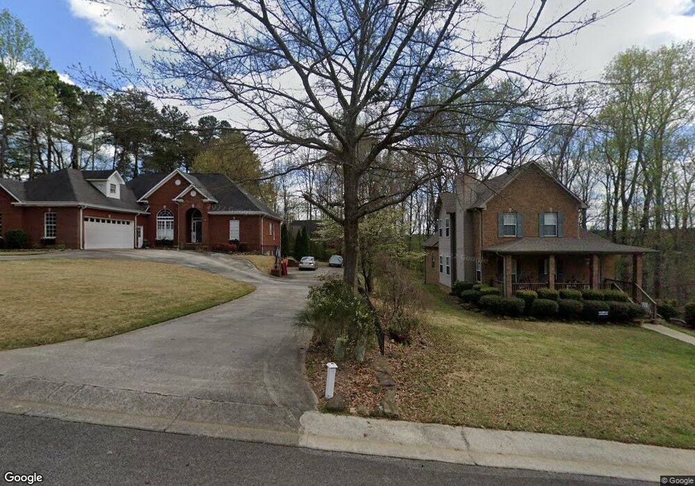
193 Patrick Ln Gardendale, AL 35071
Estimated Value: $564,000 - $726,000
6
Beds
5
Baths
4,650
Sq Ft
$144/Sq Ft
Est. Value
About This Home
This home is located at 193 Patrick Ln, Gardendale, AL 35071 and is currently estimated at $670,047, approximately $144 per square foot. 193 Patrick Ln is a home located in Jefferson County with nearby schools including Snow Rogers Elementary School, Bragg Middle School, and Gardendale High School.
Ownership History
Date
Name
Owned For
Owner Type
Purchase Details
Closed on
Feb 22, 2008
Sold by
Don Alexander Construction Inc
Bought by
Moon Michael L
Current Estimated Value
Home Financials for this Owner
Home Financials are based on the most recent Mortgage that was taken out on this home.
Original Mortgage
$188,000
Outstanding Balance
$34,945
Interest Rate
5.46%
Mortgage Type
Purchase Money Mortgage
Estimated Equity
$635,102
Purchase Details
Closed on
Jul 21, 2003
Sold by
Moon Michael L
Bought by
Tuggle Charles
Purchase Details
Closed on
May 17, 2000
Sold by
Cades Cove Development Inc
Bought by
Don Alexander Construction Inc
Create a Home Valuation Report for This Property
The Home Valuation Report is an in-depth analysis detailing your home's value as well as a comparison with similar homes in the area
Home Values in the Area
Average Home Value in this Area
Purchase History
| Date | Buyer | Sale Price | Title Company |
|---|---|---|---|
| Moon Michael L | -- | None Available | |
| Tuggle Charles | $36,000 | -- | |
| Don Alexander Construction Inc | $24,800 | Alabama Title Co Inc |
Source: Public Records
Mortgage History
| Date | Status | Borrower | Loan Amount |
|---|---|---|---|
| Open | Moon Michael L | $188,000 |
Source: Public Records
Tax History Compared to Growth
Tax History
| Year | Tax Paid | Tax Assessment Tax Assessment Total Assessment is a certain percentage of the fair market value that is determined by local assessors to be the total taxable value of land and additions on the property. | Land | Improvement |
|---|---|---|---|---|
| 2024 | $4,833 | $81,300 | -- | -- |
| 2022 | $4,560 | $76,750 | $9,000 | $67,750 |
| 2021 | $3,763 | $63,490 | $9,000 | $54,490 |
| 2020 | $3,335 | $56,380 | $9,000 | $47,380 |
| 2019 | $3,335 | $56,380 | $0 | $0 |
| 2018 | $2,400 | $40,820 | $0 | $0 |
| 2017 | $2,510 | $42,640 | $0 | $0 |
| 2016 | $2,334 | $39,720 | $0 | $0 |
| 2015 | $2,400 | $40,820 | $0 | $0 |
| 2014 | $1,765 | $36,180 | $0 | $0 |
| 2013 | $1,765 | $36,180 | $0 | $0 |
Source: Public Records
Map
Nearby Homes
- 1515 Clover Ave
- 1825 Harrison Dr
- 1767 Mount Olive Rd
- 608 Meadow Place
- 520 Parks Rd
- 716 Kerr Dr
- 420 Redmayne Rd
- 164 Summit Blvd
- 216 Howard Dr
- 313 Belcher Hill Rd Unit 1
- 5634 Hunter Brook Ct
- 304 Fieldstown Rd
- 0 Odum Rd
- 2263 Mount Olive Rd Unit 3-5
- 5253 Stevens Ct
- 5236 Stevens Ct
- 5301 Stevens Ct
- 1031 Mount Olive Ave Unit 17/18
- 1308 Colonial Ave
- 220 Payne Rd
- 185 Patrick Ln
- 189 Patrick Ln
- 1526 Clover Ave
- 1530 Clover Ave
- 181 Patrick Ln
- 1536 Clover Ave
- 1518 Clover Ave
- 179 Patrick Ln
- 192 Patrick Ln
- 1527 Clover Ave
- 1531 Clover Ave
- 1523 Clover Ave
- 184 Patrick Ln
- 1512 Clover Ave
- 1535 Clover Ave
- 180 Patrick Ln
- 1519 Clover Ave
- 1542 Shamrock Dr
- 1546 Shamrock Dr
- 1538 Shamrock Dr